
Tropical Storm Lorena forms in the eastern Pacific
Tropical Lorena formed in eastern Pacific on September 2, 2025, as the 12th named storm of the 2025 eastern Pacific hurricane season. The storm is forecast to reach hurricane strength before weakening and making landfall in Baja California.
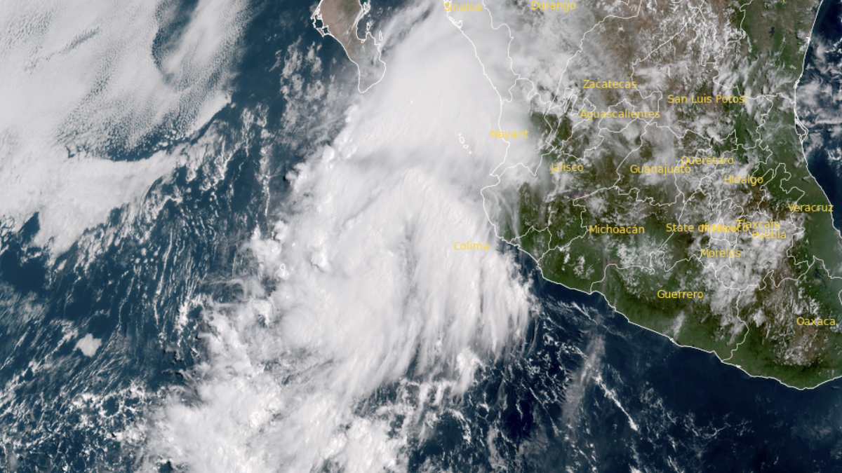
Satellite image of Tropical Storm Lorena as of 1540 UTC on September 1, 2025. Credit: GOES-19, RAMMB/CIRA, The Watchers
Tropical Depression Twelve-E strengthened into Tropical Storm Lorena on September 2 over the eastern Pacific. The system is moving northwestward well off the coast of Mexico but is forecast to strengthen and approach the Baja California Peninsula later this week.
At 15:00 UTC (08:00 MST) on September 2, the center of Tropical Storm Lorena was located near 18.3°N, 107.9°W — about 385 km (240 miles) west of Manzanillo, Mexico, and 550 km (345 miles) south-southeast of Cabo San Lucas, Mexico. The storm was moving northwest at 22 km/h (14 mph).
Maximum sustained winds reached 75 km/h (45 mph), with higher gusts, and the estimated minimum central pressure was 1 004 hPa. Tropical-storm-force winds extended outward up to 55 km (35 miles) from the center.
Satellite imagery from GOES-East showed improving organization, with banding features developing and overshooting convective tops near the core. Dvorak estimates from the Tropical Analysis and Forecast Branch (TAFB) and the Satellite Analysis Branch (SAB) ranged from T2.5 to T3.5, supporting the upgrade to tropical storm status.
Lorena is being steered northwestward along the southwestern periphery of a mid-level ridge. This motion is expected to continue for several days before a gradual slowdown and a turn north to northeast toward Baja California later this week.
The National Hurricane Center’s (NHC) forecast track shows possible landfall in central Baja California Sur at around 96 hours (September 6), although model guidance remains spread.
The Global Forecast System (GFS) favors a faster and more eastward track, while the European Centre for Medium-Range Weather Forecasts (ECMWF) keeps Lorena farther west and away from land. Forecast uncertainty is high, and residents of Baja California Sur are advised to monitor updates closely.

Environmental conditions, very warm sea surface temperatures, high ocean heat content, and abundant moisture, support further strengthening.
Lorena is forecast to reach hurricane strength within 24–48 hours, with steady intensification possible through mid-week. The cyclone may begin to weaken after 72 hours as it encounters cooler waters (below 26°C / 79°F) and increasing southwesterly vertical wind shear.
Rainfall and flooding Bands of heavy rainfall east and northeast of Lorena will continue affecting coastal states from Colima to Sinaloa on September 2, with isolated flash flooding possible in mountainous terrain.
Rainfall totals of 100–200 mm (4–8 inches), with local maxima up to 300 mm (12 inches), are forecast across Baja California Sur and southwestern Sonora through September 5, raising the risk of life-threatening flash floods and mudslides.

I am an Assistant Editor and Severe Weather & Science Journalist at The Watchers, specializing in real-time severe weather coverage, geophysical event reporting, and research-driven scientific analysis. You can reach me at rishav(at)watchers(.)news.
Commenting rules and guidelines
We value the thoughts and opinions of our readers and welcome healthy discussions on our website. In order to maintain a respectful and positive community, we ask that all commenters follow these rules.