
Heavy rains from Hurricane “Tammy” to impact Windward and Leeward Islands today, extend to Virgin Islands and Puerto Rico by Sunday
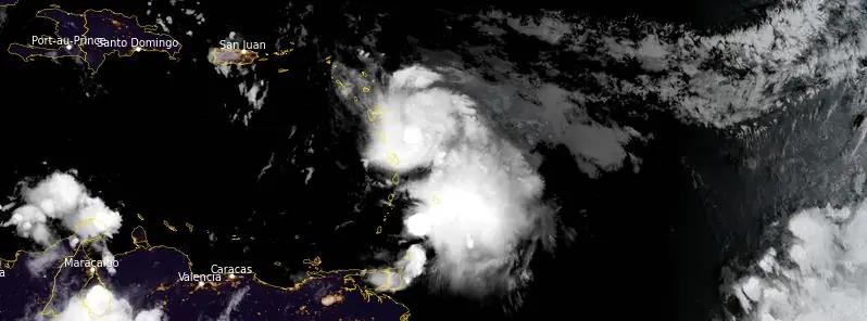
Featured image: Hurricane "Tammy" at 09:40 UTC on October 21, 2023. Credit: NOAA/GOES-East, RAMMB/CIRA, The Watchers
Tammy intensified into a hurricane at 14:00 UTC on Friday, October 20, 2023, some 150 km (90 miles) NE of Barbados and 275 km (170 miles) ESE of Martinique.
- Hurricane and tropical storm conditions are expected in portions of the Leeward and northern Windward Islands through Sunday.
- Heavy rains from Tammy will affect the Windward and Leeward Islands today, spreading into the British and U.S. Virgin Islands and eastern Puerto Rico as early as Sunday. This rainfall may produce isolated flash and urban flooding, along with isolated mudslides in areas of higher terrain.
- A storm surge could produce coastal flooding in areas of onshore winds as the center of Tammy moves near or over the Leeward Islands. Near the coast, the surge will be accompanied by large and dangerous waves.
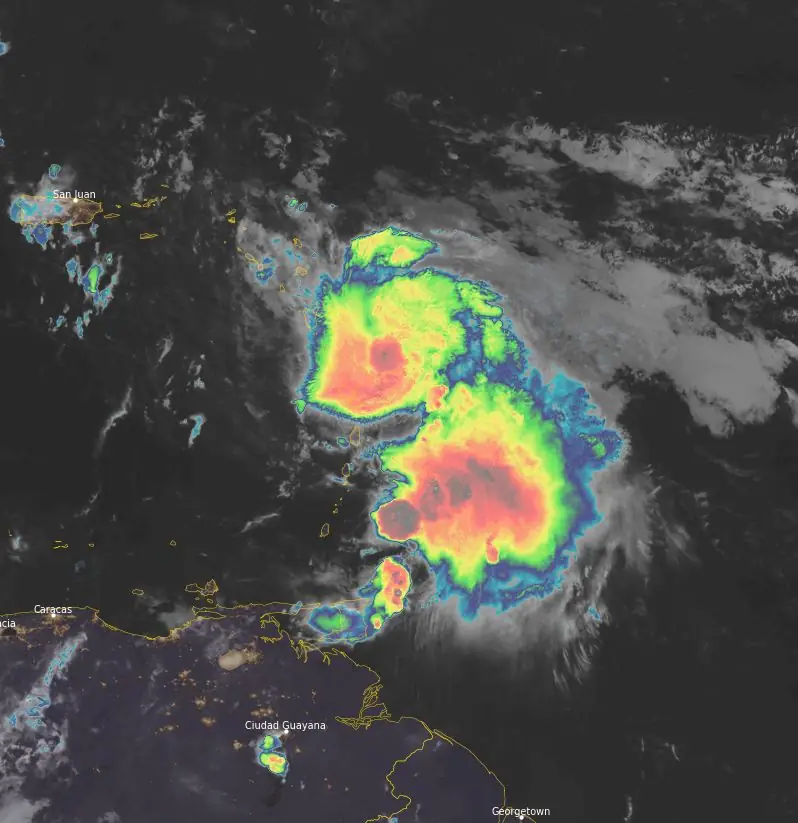
At 09:00 UTC on October 21, the center of Hurricane “Tammy” was located about 100 km (60 miles) ESE of Dominica and 160 km (100 miles) SE of Guadeloupe. It had maximum sustained winds of 130 km/h (80 mph) and a minimum central pressure of 991 hPa. It was moving at 15 km/h (9 mph).
A Hurricane Warning has been issued for several Caribbean islands, including Guadeloupe, Antigua, Barbuda, Montserrat, St. Kitts, Nevis, Anguilla, St. Maarten, St. Martin, and St. Barthelemy. This warning indicates that hurricane conditions are expected, requiring immediate and urgent preparations for the approaching storm. The warning underscores the need for residents in these areas to finalize their hurricane plans and take necessary precautions to safeguard life and property.
Concurrently, a Hurricane Watch is in effect for Dominica, Saba, and St. Eustatius, signaling that hurricane conditions are possible within the next 24 to 48 hours. In addition, a Tropical Storm Warning has been issued for Dominica, Saba, and St. Eustatius, indicating that tropical storm conditions are expected within 36 hours. A Tropical Storm Watch has been set for Martinique and the British Virgin Islands, suggesting that storm conditions are possible within the next 48 hours. Residents in these areas are advised to closely monitor weather updates and prepare for potential impacts.
Tammy is now moving toward the northwest near 15 km/h (9 mph), and this general motion is expected to continue through tonight. A turn toward the NNW is forecast on Sunday, followed by a turn toward the north on Monday.
On the forecast track, the center of Tammy will move near or over portions of the Leeward Islands through early Sunday, and then move north of the northern Leeward Islands by Sunday afternoon.
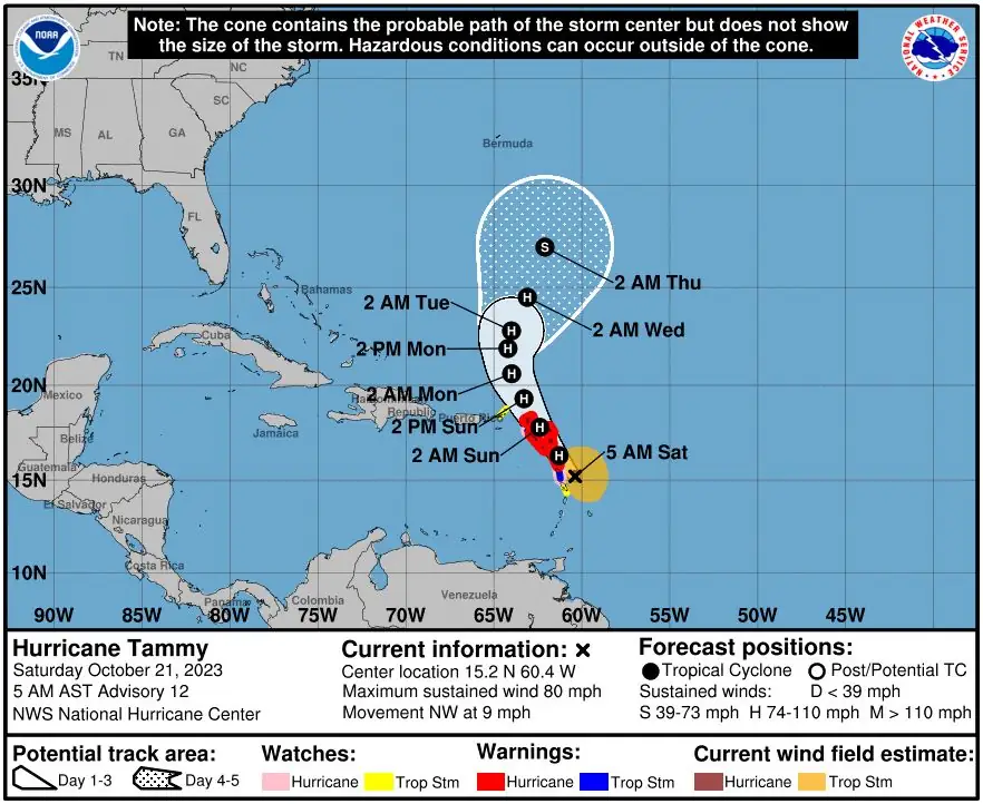
Fluctuations in intensity are possible during the next few days, but Tammy is expected to remain a hurricane while it passes near or over the Leeward Islands.
Hurricane conditions are anticipated to commence in the hurricane warning areas later this morning and extend northward across the Leeward Islands throughout today and tonight. In terms of wind speed, this entails conditions of at least 119 km/h (74 mph) or higher. Additionally, tropical storm conditions, featuring winds between 63 and 118 km/h (39 to 73 mph), are expected within the tropical storm warning areas today and tonight. Areas under hurricane watch could also experience hurricane conditions today and tonight. Tropical storm conditions are also possible in Martinique today and in the British Virgin Islands tonight and Sunday.
Tammy is forecasted to generate substantial rainfall across various regions. The Leeward Islands could receive between 102 and 203 mm (4 to 8 inches) of rain, with maximum amounts reaching up to 305 mm (12 inches). In portions of the Windward Islands, rainfall is expected to range from 51 to 102 mm (2 to 4 inches), with peaks up to 152 mm (6 inches). The British and U.S. Virgin Islands, as well as eastern Puerto Rico, may see rainfall amounts between 25 and 51 mm (1 to 2 inches), with maximums of 102 mm (4 inches). These rainfall levels carry the risk of isolated flash and urban flooding, along with the potential for mudslides in areas with higher terrain.
Storm surge may elevate water levels by approximately 0.3 to 0.9 m (1 to 3 feet) above normal tide levels in proximity to where the center of Tammy moves across the Leeward Islands. Coastal areas can expect this surge to be accompanied by large and hazardous waves.
Swells induced by Tammy will persistently affect parts of the Lesser Antilles over the coming days. These swells are expected to create life-threatening surf and rip current conditions. Residents and visitors in the affected areas are strongly advised to consult local weather advisories for updated information and safety guidelines.
References:
1 Hurricane Tammy – Advisory Number 12 NWS National Hurricane Center Miami FL AL202023 – 500 AM AST Sat Oct 21 2023
I'm a dedicated researcher, journalist, and editor at The Watchers. With over 20 years of experience in the media industry, I specialize in hard science news, focusing on extreme weather, seismic and volcanic activity, space weather, and astronomy, including near-Earth objects and planetary defense strategies. You can reach me at teo /at/ watchers.news.
Commenting rules and guidelines
We value the thoughts and opinions of our readers and welcome healthy discussions on our website. In order to maintain a respectful and positive community, we ask that all commenters follow these rules.