
Tropical Storm “Ophelia” makes landfall in North Carolina, causing major flash floods

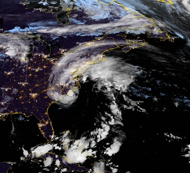
Featured image: Tropical Storm "Ophelia" at 06:10 UTC on September 23, 2023. Credit: NOAA/GOES-East, RAMMB/CIRA, The Watchers
Tropical Storm “Ophelia” made landfall near Emerald Isle, North Carolina, around 10:15 UTC on September 23, 2023, with maximum estimated winds of 110 km/h (70 mph). The storm has since weakened into a post-tropical low but continued to pose a flooding risk across the Mid-Atlantic.
Ophelia brought heavy rains and strong winds, causing hazardous conditions along the North Carolina coast. As the storm progressed northward, episodes of flash flooding became a significant concern. Greenville, located in eastern North Carolina, faced severe flooding on Saturday afternoon (LT) that led to the submersion of parking lots and the rescue of people from dangerous seas.
The storm lost its wind intensity upon moving over land, being reclassified as a tropical depression by Saturday evening. Nonetheless, it continued to bring drenching rain from eastern North Carolina to southern New Hampshire. Wind gusts, as high as 128 km/h (80 mph), were measured in Wrightsville Beach, North Carolina, and resulted in nearly 30 000 power outages across various states by 03:00 UTC on September 24 (23:00 EDT on September 23), according to PowerOutage.us.
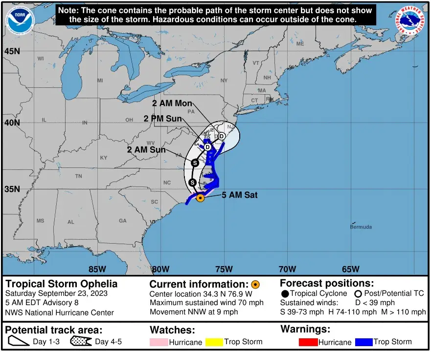
Ophelia’s status was downgraded to a tropical depression at around 00:00 UTC on September 24. All storm surge and tropical storm warnings were discontinued at this time, although coastal flooding warnings and wind advisories remained in place for parts of the U.S. Mid-Atlantic.
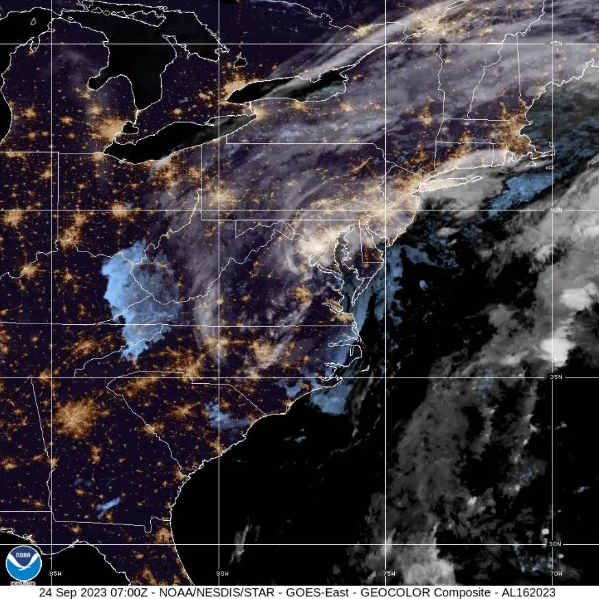
By 03:00 UTC on September 24, Ophelia transformed into a post-tropical low. At that time, its center was located approximately 50 km (30 miles) SSW of Richmond, Virginia, and 134 km (85 miles) SE of Charlottesville, Virginia. It had maximum sustained winds of 55 km/h (35 mph) and a minimum central pressure of 1 003 hPa, moving north at 13 km/h (8 mph).
Despite the downgrade in classification, Ophelia continued to pose a risk of coastal and flash flooding across the Mid-Atlantic. Elevated water levels persisted within portions of Chesapeake Bay and its tidal rivers, although these were expected to recede gradually. Swells generated by Ophelia will remain a risk along the U.S. East Coast through the weekend, with life-threatening surf and rip current conditions expected to continue.
The post-tropical low is forecasted to become absorbed by a frontal boundary by Sunday night or early Monday (LT), leading to a gradual decrease in its impact.
References:
1 Tropical Storm Ophelia – NHC archive – September 23 and 24, 2023
2 Ophelia wreaks havoc with flooding, power outages along East coast – AccuWeather – September 23, 2023
I'm a dedicated researcher, journalist, and editor at The Watchers. With over 20 years of experience in the media industry, I specialize in hard science news, focusing on extreme weather, seismic and volcanic activity, space weather, and astronomy, including near-Earth objects and planetary defense strategies. You can reach me at teo /at/ watchers.news.
Commenting rules and guidelines
We value the thoughts and opinions of our readers and welcome healthy discussions on our website. In order to maintain a respectful and positive community, we ask that all commenters follow these rules.