
Massive Saharan dust plume reaches Florida, U.S.
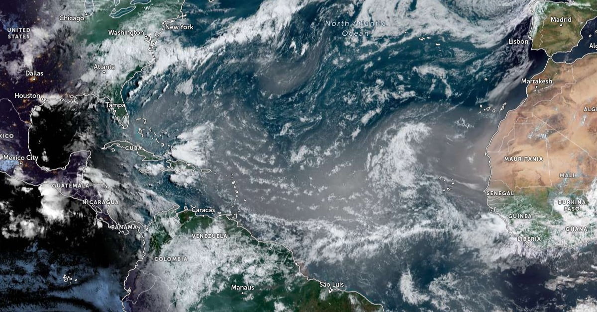
Featured image: Saharan Air Layer (SAL) over the Atlantic Ocean at 12:00 UTC on July 20, 2024. Credit: NOAA/GOES-East, Zoom Earth, The Watchers
A massive Saharan dust plume reached South Florida on July 20, 2024, causing reduced air quality and hazy skies. Rain is also forecasted for the weekend, and the mix of dust and precipitation is expected to bring dirty rains to Florida.
A large Saharan dust plume reached South Florida today, causing reduced air quality and hazy skies.
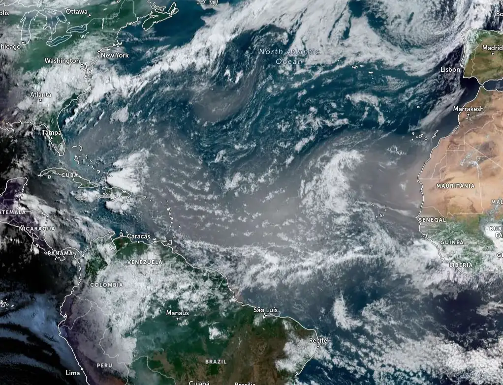
The dust plume is expected to be at its thickest in South Florida on July 20, dissipating slowly as it moves to Central Florida by July 21. This may lead to colorful sunsets and sunrises in the coming days.
Forecasts predict 25 – 50 mm (1 – 2 inches) of rain for Central Florida and 50 – 75 mm (2 – 3 inches) for Southwestern Florida between July 19 and 21. The mix of precipitation and dust is expected to cause mucky rain over the weekend.
7/18 at 8:15am: A plume of Saharan Dust is forecast to arrive across South Florida this upcoming weekend. This may result in reduced air quality, hazy skies, as well as the potential of colorful sunrise and sunsets. pic.twitter.com/chRwQ0KGjj
— NWS Miami (@NWSMiami) July 18, 2024
A new huge #Saharandust plume crossing the #Atlantic.
— ADAM Platform (@PlatformAdam) July 18, 2024
As forecasted by @CopernicusECMWF #CopernicusAtmosphere the cloud is moving toward #Caribbean and Gulf of #Mexico, as showed by the #Copernicus #Sentinel5p aerosol map on July 17th. #AirQuality @WMO pic.twitter.com/MAnYenEYWu
Every three to five days, from late June through the middle of August, a mass of dusty air forms over the Sahara Desert, known as the Saharan Air Layer (SAL).
This sand, dirt, and dust accumulation rises from the Sahara Desert in Africa and can extend from 1 524 m to 6 096 m (5 000 to 20 000 feet) into the atmosphere.
According to the National Oceanic and Atmospheric Administration (NOAA), this “dusty air” will often travel several thousand miles as it moves west across the Atlantic Ocean, “reaching as far as the Caribbean, Florida, and the U.S. Gulf Coast when winds are particularly strong.”
The Saharan dust plume originates more than 4 828 km (3 000 miles) away from northern Africa. Hot, dry air rises from the Saharan Desert, carrying fine particles of dust from the sands. That dust-laden air climbs to the highest reaches of the atmosphere, where Easterlies or Trade Winds (blowing from east to west) carry that dust across the Atlantic Ocean into the Western Hemisphere.
The dry layer will inhibit tropical storm development and give a milky haze to the air that makes for colorful sunrises and sunsets. While most of the dust stays aloft, some of it can reach the surface and degrade air quality.
References:
1 Florida to see ‘dirty rain’ as plume of Saharan dust layer arrives this weekend – FOX Weather – July 19, 2024
2 ‘Massive’ Saharan dust plume will arrive in Florida this weekend; how will it affect you? – Gulflive – July 19, 2024

I am an Assistant Editor and Severe Weather & Science Journalist at The Watchers, specializing in real-time severe weather coverage, geophysical event reporting, and research-driven scientific analysis. You can reach me at rishav(at)watchers(.)news.
Commenting rules and guidelines
We value the thoughts and opinions of our readers and welcome healthy discussions on our website. In order to maintain a respectful and positive community, we ask that all commenters follow these rules.