
Snow fell on parts of the US Northwest just days before first day of summer
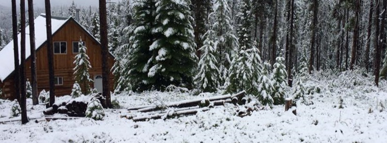
Image credit: NWS Missoula
Snow fell on parts of the US Northwest over the past weekend, just days before the first day of summer.
This upper-level weather system, originating in the Gulf of Alaska, has sent temperatures plunging well below average across the region. In the higher elevations, there has been enough moisture available for snow to coat parts of the northern Rockies and Cascades, said Chris Dulce, TWC meteorologist.
Officials in Idaho urged residents with recreational activities planned for the weekend to prepare for winter-like weather conditions and to be cautious of low visibility from blowing snow.
Our friends around #Dixie #Idaho shared these pics of the 2 inches fresh #snow they received overnight. Elevation ~ 5900 feet.#Junuary #SpringInTheRockies #SpringSnow #IDwx pic.twitter.com/Oh7U39pvmc
— NWS Missoula (@NWSMissoula) June 10, 2018
The summit of #Whitefish Mountain (6817 feet) got some fresh #snow overnight. Here's what it looked like at 730 AM this morning!#Junuary #SpringInTheRockies #SpringSnow #MTwx pic.twitter.com/920H4vTWZr
— NWS Missoula (@NWSMissoula) June 10, 2018
Even the mountains outside of #Grangeville #Idaho (6121 feet) got a nice coating of #snow overnight.#Junuary #SpringInTheRockies #SpringSnow #MTwx pic.twitter.com/mdMiVsUcty
— NWS Missoula (@NWSMissoula) June 10, 2018
Ok @WeslaWong, you win this round. That's an impressive amount of June snow right there!#Junuary #SpringInTheRockies #SpringSnow https://t.co/t2ZxFWKjn4
— NWS Missoula (@NWSMissoula) June 10, 2018
June in Montana! Thanks for the picture Tom Burke of Creston, MT! #mtwx pic.twitter.com/psKCbZbEtu
— Anthony Franze (@AnthonyNBCMT) June 10, 2018
Earlier this morning the @GlacierNPS webcam in #SaintMary captured this amazing #rainbow as showers danced over the area.#SpringInTheRockies #MTwx pic.twitter.com/rh7a1Tfk8y
— NWS Missoula (@NWSMissoula) June 10, 2018
Here's the latest basin wide average Snow Water Equivalent as compared to normal. Despite the active melting, the #Flathead, #LowerClarkFork & #UpperClarkFork are still above average!#MTwx #SnowPackSunday pic.twitter.com/8YtrgNksvu
— NWS Missoula (@NWSMissoula) June 10, 2018
In #Idaho the Snow Water Equivalent at SNOTEL sites is still above normal in the Clearwater drainage.#IDwx #SnowpackSunday pic.twitter.com/hO5MbtJeqs
— NWS Missoula (@NWSMissoula) June 10, 2018
Looks like it's snowing up at #LostTrailPass right now. Be alert if traveling south tonight as heavier precipitation is expected overnight.#MTwx #IDwx #US93 #Junuary #SpringInTheRockies #SpringSnow pic.twitter.com/19wi0Wkai6
— NWS Missoula (@NWSMissoula) June 10, 2018
Planning to be in the high country Monday morning? Mountain snow is again expected tonight, so make sure to plan for cold, snowy, and wet conditions above 5500 feet. #idwx #mtwx #JuneSnow #WhatMonthIsItAgain pic.twitter.com/lcGiljd7M3
— NWS Missoula (@NWSMissoula) June 10, 2018
Showers are getting a little bit heavier & we might be seeing some light slush on #LoloPass. Drive safe if headed over the pass this morning.#MTwx #IDwx #Junuary #SpringInTheRockies #SpringSnow pic.twitter.com/vMxRkI24oQ
— NWS Missoula (@NWSMissoula) June 11, 2018
Daytime highs Sunday morning through Monday morning will be between 50s and 60s (10 to 20 °C) while nighttime lows on Sunday night will be in the 30s and 40s F (-1 to 10 °C) for all of East Idaho, the weather service said, as reported by the ISJ.
Frost that could kill vegetation was expected as the result, even in some lower elevation areas of the region such as Rexburg and Rigby.
I'm a dedicated researcher, journalist, and editor at The Watchers. With over 20 years of experience in the media industry, I specialize in hard science news, focusing on extreme weather, seismic and volcanic activity, space weather, and astronomy, including near-Earth objects and planetary defense strategies. You can reach me at teo /at/ watchers.news.
Commenting rules and guidelines
We value the thoughts and opinions of our readers and welcome healthy discussions on our website. In order to maintain a respectful and positive community, we ask that all commenters follow these rules.