
Persistent slab avalanche danger expected across the Cascades this weekend
Persistent slab avalanche hazards will be the main concern across the Cascade Range this weekend, according to the Northwest Avalanche Center. Forecasters say buried weak layers and recent wind loading have brought several zones close to a “tipping point,” warning that human-triggered avalanches remain possible even under clear skies.
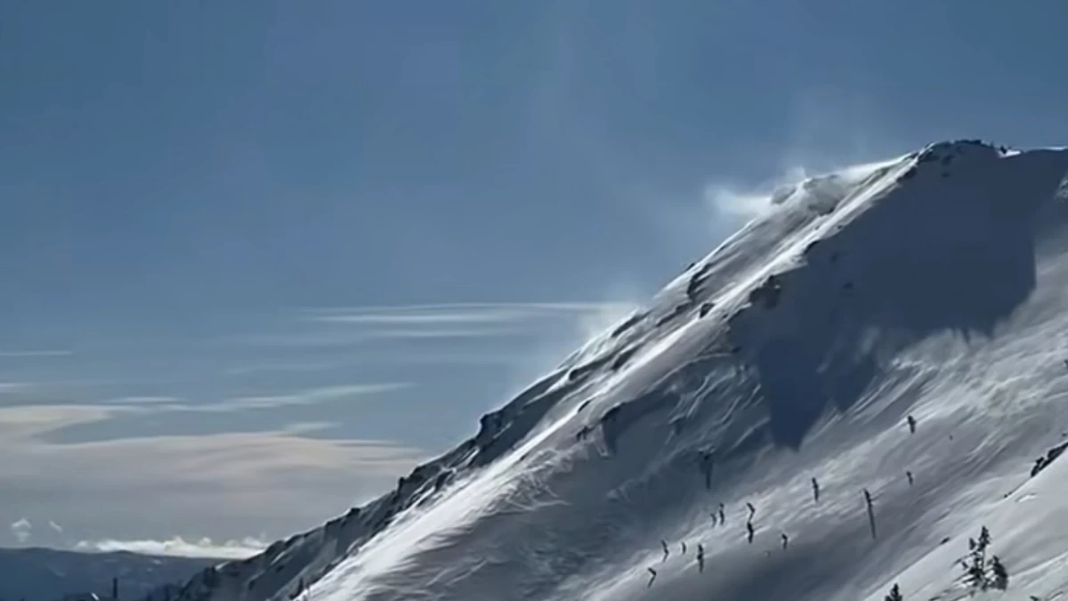
Snow drifting in Olympic Cascades on February 27, 2026. Credit: NWAC
The Northwest Avalanche Center (NWAC) maintains an elevated avalanche hazard outlook through the weekend, February 29 through March 2, across the Cascade Range of Washington and northern Oregon.
While weather conditions are forecast to be mild and calm, the snowpack remains unusually complex with multiple buried weak layers that have shown the potential for wide propagation.
“It’s not your typical snowpack out there, adding that recent storms followed by strong winds have likely pushed conditions toward a tipping point in some areas,” said the NWAC. Persistent slab avalanches have already been reported in several zones, some propagating across large distances and involving deep weak layers.
Persistent slab problems are already being observed at mid and upper elevations across the Mt. Baker, Stevens Pass, Snoqualmie Pass, and Mount Rainier forecast zones.
Multiple natural and human-triggered avalanches have been reported in the past 48 hours at the Mt. Baker zone. The Stevens Pass and Snoqualmie Pass regions show stability ranging from moderate on wind-scoured ridges to poor on leeward slopes that received heavy snow loading.
The Mount Rainier area continues to be affected by strong crosswinds since earlier in the week, producing cohesive slabs over weak layers that could still propagate widely.
While natural avalanches are now less likely, human-triggered slides remain possible, especially on leeward and wind-loaded slopes.
The region is entering a brief warm period, with daytime temperatures forecast to rise above freezing at lower and mid-elevations. Such conditions may temporarily consolidate surface layers, but do not eliminate the underlying weak interfaces. Forecasts indicate generally light winds and isolated high clouds, providing good travel weather that could increase backcountry activity.
The persistent weak layers, once buried, can remain active for weeks, and avalanche triggers may occur remotely or from low-angle terrain connected to steeper slopes.
NWAC continues to advise conservative travel strategies — avoiding steep convexities, recently wind-loaded slopes, and unsupported terrain features — and recommends travelers check zone-specific forecasts before heading into the backcountry.
While the overall avalanche danger level may vary between moderate and considerable depending on location, NWAC underscores that variability itself is the defining hazard this weekend.
“Travel conservatively, give suspect slopes plenty of space, and avoid putting yourself in a position to trigger a large, surprising avalanche,” NWAC said.
References:
1 Mountain Weather Forecast – NWAC – February 27, 2026
2 Backcountry Avalanche Forecast Olympics – NWAC – February 27, 2026

I am an Assistant Editor and Severe Weather & Science Journalist at The Watchers, specializing in real-time severe weather coverage, geophysical event reporting, and research-driven scientific analysis. You can reach me at rishav(at)watchers(.)news.
Commenting rules and guidelines
We value the thoughts and opinions of our readers and welcome healthy discussions on our website. In order to maintain a respectful and positive community, we ask that all commenters follow these rules.