
Hurricane “Bud’ affecting southwestern Mexico, heading toward Baja California Sur
Featured image: Hurricane "Bud" at 10:15 UTC on June 11, 2018. Credit: NOAA/GOES-East
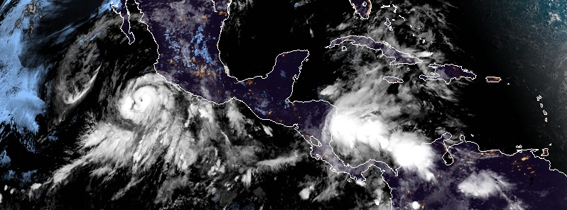
Hurricane "Bud," the second hurricane of the 2018 East Pacific hurricane season, is strengthening off the southwest coast of Mexico and is expected to become a major hurricane today. Life-threatening flash floods and mudslides are possible across much of southwestern Mexico. While this system is expected to remain offshore of the coast of Mexico during the next few days, landfall is expected somewhere along the southern tip of Baja California Sur over the coming weekend.
A new tropical depression, the second of 2018 East Pacific hurricane season, formed June 8, 2018 well south of Mexico and strengthened into a tropical storm, named Bud, at 03:00 UTC on the following day.
At the time, Bud's center was located 535 km (330 miles) S of Zihuatanejo and 920 km (575 miles) SSE of Cabo Corrientes.
Bud became a hurricane, the second of the season, by 21:00 UTC on June 10, forcing the Government of Mexico to issue Tropical Storm Watch for the southwestern coast of Mexico from Manzanillo to Cabo Corrientes. At the time, Bud was moving toward the northwest near 15 km/h (9 mph) with maximum sustained winds of 120 km/h (75 mph) and minimum central pressure of 987 hPa.
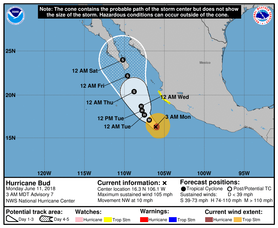
At 09:00 UTC on June 11, the center of Hurricane "Bud" was located 355 km (220 miles) SSW of Manzanillo and 460 km (285 miles). The system had maximum sustained winds of 165 km/h (105 mph), making it a Category 2 hurricane, and minimum central pressure of 970 hPa.
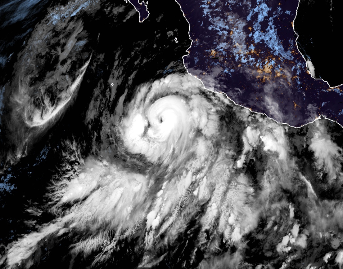
Hurricane "Bud" at 10:15 UTC on June 11, 2018. Credit: NOAA/GOES-East
Bud is moving to the northwest at 17 km/h (10 mph), and this motion is expected to continue today and tonight with a decrease in forward speed.
A turn toward the north-northwest is expected on Tuesday, June 12 and slow NNW motion should continue into mid-week. Some strengthening is expected today, and Bud could become a major hurricane by the end of the day.
On the forecast track, the core of Bud and its stronger winds are expected to remain offshore of the southwestern coast of mainland Mexico during the next few days.
This system is expected to produce total rain accumulations of 76 to 152 mm (3 to 6 inches) across much of southwestern Mexico, with isolated maximum amounts of 254 mm (10 inches) into Tuesday afternoon. These rains could cause life-threatening flash floods and mudslides, NWS warns.
Swells generated by Bud will continue to affect portions of the coast of southwestern Mexico during the next few days.
These swells are likely to cause life-threatening surf and rip current conditions.
I'm a dedicated researcher, journalist, and editor at The Watchers. With over 20 years of experience in the media industry, I specialize in hard science news, focusing on extreme weather, seismic and volcanic activity, space weather, and astronomy, including near-Earth objects and planetary defense strategies. You can reach me at teo /at/ watchers.news.
Commenting rules and guidelines
We value the thoughts and opinions of our readers and welcome healthy discussions on our website. In order to maintain a respectful and positive community, we ask that all commenters follow these rules.