
Extreme winter storm impacts expected in Sierra Nevada as Pacific storms bring up to 2.4 m (8 feet) of snow through February 18
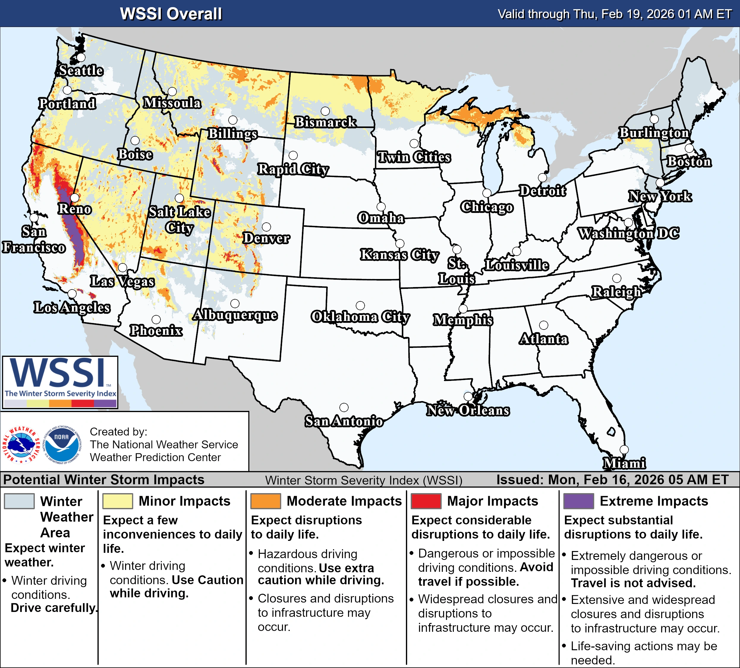
Multiple storms are forecast to bring heavy snowfall to California through February 18, 2026, with snowfall rates exceeding 76 mm (3 inches) per hour in parts of the Sierra Nevada. Extreme impacts are possible across higher elevations, with travel conditions dangerous to impossible, and 1.2–2.4 m (4–8 feet) of snow forecast above pass level.
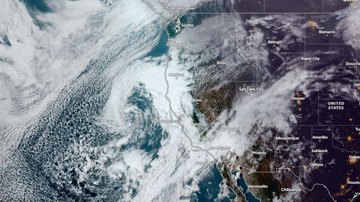
Image credit: NOAA/WPC
Multiple Pacific storms are forecast to bring heavy snowfall to California through February 18, with snowfall rates of over 76 mm (3 inches) per hour forecast for some areas. The Weather Prediction Center’s (WPC) winter storm severity index shows extreme impacts being possible across the Sierra Nevada.
A deep trough off the West Coast continues to move onshore, bringing severe weather west of the Rockies. Subtropical moisture is being pushed across California and the Pacific Northwest, increasing the probability of high-elevation snow and showers.
As the system pushes south-southeast, it will drive moisture further inland across central and southern California.
A Slight Risk (level 2/4) for excessive rainfall is in effect for parts of central and southern California through February 16. Meanwhile, a Marginal Risk remains through February 17 as another weak disturbance brings another round of rainfall.
Up to 1.2 – 2.4 m (4 – 8 feet) of snow is forecast over higher elevation areas of the Sierra Nevada through February 18. Travel conditions are expected to be extremely dangerous to impossible across the region.
“Mountain snow is expected along the Olympics, Cascades, and the Sierra and will extend into the Rockies as another shortwave energy ejects across the northern Plains on February 17,” said the National Weather Service (NWS).
The threat of flash floods from the storms prompted evacuation warnings for residents living near the Palisades and the Eaton burn scar areas in Los Angeles County, California.
Read more:

Rishav Kothari is Editor-in-Chief of The Watchers, where he runs the newsroom and covers earthquakes, volcanoes, severe weather and space weather.
Published in the last 24 hours
- High Risk of excessive rainfall covers Florida’s Space Coast as St. Johns River near Cocoa reaches 5.67 m
- Four small asteroids will pass close to Earth from November 21 to 23
- Cyclone Akvan weakens after landfall near Gopalpur; more than 300 000 evacuated in Odisha, India
- A broad low over southeastern Florida and the northwestern Bahamas has a 30 percent chance of subtropical or tropical development within 48 hours and a 50 percent chance within 7 days, the National Hurricane Center says
