
Hurricane “Dora” forms, first hurricane of the 2017 Pacific hurricane season
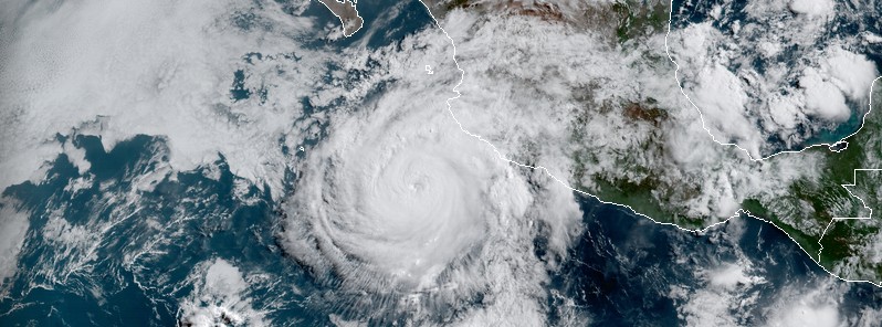
Featured image: Hurricane "Dora" at 14:45 UTC on June 26, 2017. GOES-16 Preliminary Non-Operational Data. Credit: CIRA / RAMMB
Tropical Storm "Dora" continued strengthening near the southwestern coast of Mexico after forming early June 25, 2017 and by 09:00 UTC on June 26 became a hurricane, the first of the 2017 Pacific hurricane season. Landfall is not expected and there are no coastal watches or warnings in effect, but life-threatening swells are expected to spread northwestward and begin affecting portions of the coast of southern Baja California peninsula on Tuesday, June 27.
At 09:00 UTC on June 26 (04:00 CDT), the eye of Hurricane "Dora" was located 275 km (170 miles) SSW of Manzanillo and 415 km (255 miles) S of Cabo Corrientes, Mexico. The system was moving toward the west-northwest near 20 km/h (13 mph) with maximum sustained winds of 130 km/h (80 mph). This general motion with some decrease in forwarding speed is expected over the next 48 hours. Dora's minimum estimated central pressure at the time was 989 hPa.
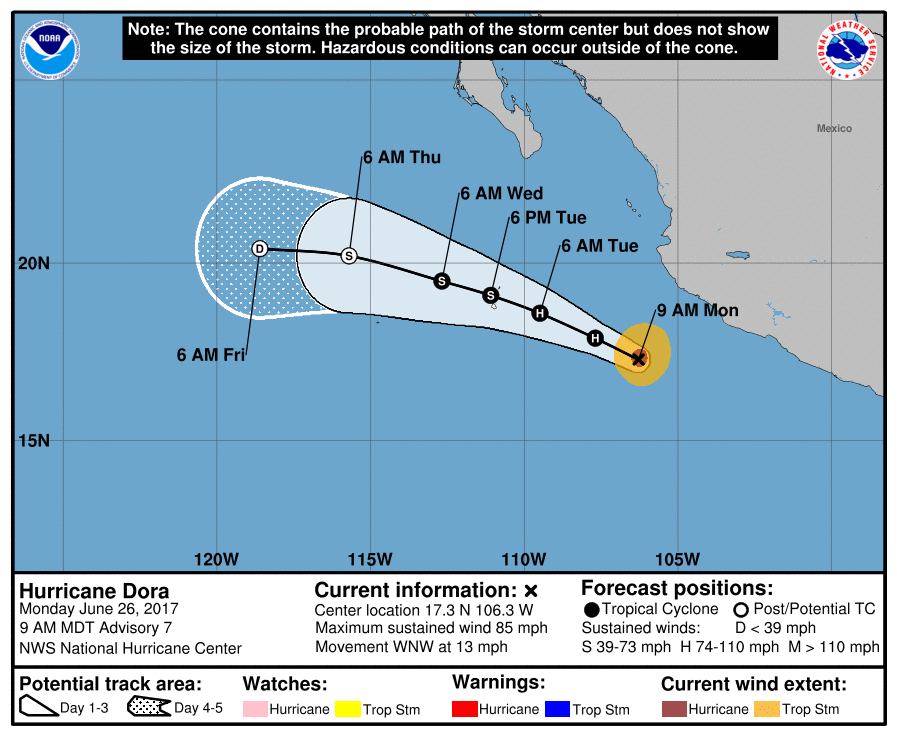
On the current NHC track, the center of Dora is expected to remain offshore of the coast of southwestern Mexico and pass well to the south of the Baja Peninsula on Tuesday.
By 15:00 UTC, Dora's maximum sustained winds have increased to 140 km/h (85 mph) and barometric pressure dropped to 985 hPa. Some additional strengthening is possible today before weakening begins on Tuesday.
Hurricane "Dora" at 14:45 UTC on June 26, 2017. GOES-16 Preliminary Non-Operational Data. Credit: CIRA / RAMMB
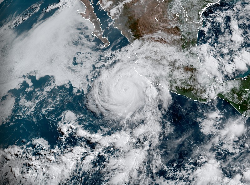
Hurricane "Dora" at 12:15 UTC on June 26, 2017. GOES-16 Preliminary Non-Operational Data. Credit: CIRA / RAMMB
Dora is expected to produce rain accumulation 25 to 51 mm (of 1 to 2 inches) along coastal sections of the Mexican states of Guerrero and Michoacan through this evening.
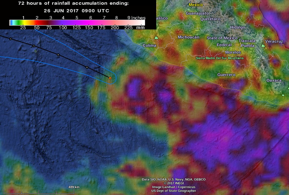
Hurricane Dora – 72 hours of rainfall accumulation by 09:00 UTC on June 26, 2017. Credit: NASA/JAXA GPM, Google
Swells generated by Dora are affecting portions of the coast of southwest Mexico. These swells are expected to spread northwestward and begin affecting portions of the coast of the southern Baja California peninsula on Tuesday. They are likely to cause life-threatening surf and rip current conditions.
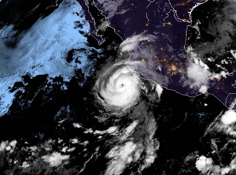
Dora becomes a hurricane – June 25, 2017. Credit: NOAA / GOES-16, CIRA / RAMMB
Dora is the first hurricane of the 2017 Pacific hurricane season and the strongest northern hemisphere tropical cyclone of the 2017 season so far.
I'm a dedicated researcher, journalist, and editor at The Watchers. With over 20 years of experience in the media industry, I specialize in hard science news, focusing on extreme weather, seismic and volcanic activity, space weather, and astronomy, including near-Earth objects and planetary defense strategies. You can reach me at teo /at/ watchers.news.
Commenting rules and guidelines
We value the thoughts and opinions of our readers and welcome healthy discussions on our website. In order to maintain a respectful and positive community, we ask that all commenters follow these rules.