
Severe weather warnings issued as Ex-cyclone Donna approaches New Zealand
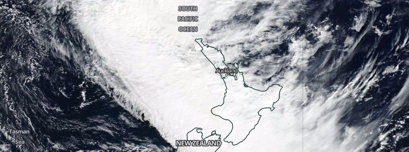
Featured image: North Island, New Zealand - May 11, 2017. Credit: NASA/NOAA Suomi NPP/VIIRS
A slow-moving front, combined with Ex-tropical cyclone Donna, is expected to dump very heavy rain over North Island, New Zealand over the next two days, causing rivers and streams to rapidly rise. Parts of North Island may receive up to 250 mm (9.8 inches) of rain, causing surface flooding, landslides and hazardous driving conditions.
Tropical Cyclone "Donna" was reclassified as an extratropical low yesterday and has moved south out of the tropics. What's left of it is expected to pass just east of Northland and Auckland on Friday, May 12, 2017 (local time) before moving away to the east. At the same time, a slow-moving front will move eastwards across the North Island late Thursday and Friday (local time).
New Zealand's Met Service warned that a period of heavy northerly rain is expected over much of central and northern New Zealand ahead of the front. For parts of Bay of Plenty and the ranges of Gisborne, 200 to 250 mm (7.9 – 9.8 inches) of rain may accumulate, while lower lying parts of Bay of Plenty may receive 100 to 140 mm (3.9 – 5.5 inches) of rain.
Localized downpours with intensities of 25 to 40 mm (1 – 1.6 inches) per hour are likely in these areas, and other North Island areas.
This amount of rain will cause rivers and streams to rise rapidly, and may cause surface flooding and slips. Driving conditions will also be hazardous.
The heaviest and most prolonged rain is forecast to be about Taranaki and across the central North Island High Country to Coromandel Peninsula, Bay of Plenty and the ranges of Gisborne. A HEAVY RAIN WARNING is in force for these areas.
Here is what one of weather models is forecasting in terms of rain totals. More detail in Watches & Warnings at https://t.co/qHyE5zhh6X^Lisa pic.twitter.com/zQkpfSvczj
— MetService (@MetService) May 11, 2017
MetService Severe Weather Warnings in Red, Watches in Orange in this diagram. For the complete picture go to https://t.co/qHyE5zhh6X. ^AB pic.twitter.com/sHnsj3Oa3P
— MetService (@MetService) May 11, 2017
In addition, strong to gale force northeast winds are expected ahead of the front. Also, strong southerly winds may affect parts of northern New Zealand depending on the exact track of Donna.
There is a moderate confidence that rain will reach warning amounts over northern Hawkes Bay and Gisborne on Saturday morning. There is also moderate confidence of severe gale in these areas as well as in eastern Bay of Plenty.
After this, a large high will move onto New Zealand from the Tasman Sea late Saturday and remain slow moving through to Tuesday, ushering settled weather. However, another front is expected to approach the North Island from the Tasman sea late Tuesday, bringing heavy rain across the upper North Island on Wednesday, May 17.
I'm a dedicated researcher, journalist, and editor at The Watchers. With over 20 years of experience in the media industry, I specialize in hard science news, focusing on extreme weather, seismic and volcanic activity, space weather, and astronomy, including near-Earth objects and planetary defense strategies. You can reach me at teo /at/ watchers.news.
Commenting rules and guidelines
We value the thoughts and opinions of our readers and welcome healthy discussions on our website. In order to maintain a respectful and positive community, we ask that all commenters follow these rules.