
Enawo will hit Madagascar with powerful winds and heavy rain
Featured image: Tropical Cyclone "Enawo" at 05:30 UTC on March 7, 2017. Credit: UW-CIMSS
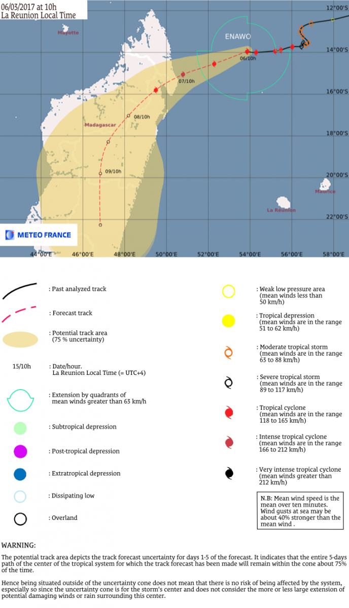
Tropical Cyclone "Enawo" is expected to make landfall over SE Antsiranana Province, Madagascar shortly after 10:00 local time (07:00 UTC) on March 7, 2017. The system is expected to reach the coast as Category 2 hurricane equivalent. Winds produced by Enawo at the time of landfall can cause extensive damage. In addition, Enawo is bringing heavy rain which could cause major flooding and landslides.
At 06:00 UTC on March 6, Tropical Cyclone "Enawo" had maximum sustained winds of 167 km/h (103 mph), with gusts to 203 km/h (126 mph). This made it Category 2 hurricane equivalent on the Saffir-Simpson hurricane wind scale.
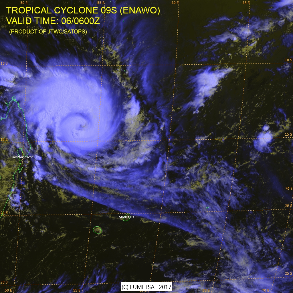
Tropical Cyclone "Enawo" multispectral satellite image at 06:00 UTC on March 6, 2017. Credit: JTWC/SATOPS, EUMETSAT
The system is expected to further intensify over the next 12 hours, peaking at 203 km/h (126 mph), and then begin to weaken. Enawo is being steered toward Madagascar by the subtropical ridge to the southeast and is expected to make landfall shortly after 07:00 UTC on March 7 as a Category 2 hurricane equivalent.
Category 2 hurricanes are producing extremely dangerous winds capable of causing extensive damage. Well-constructed frame homes could sustain major roof and siding damage. Many shallowly rooted trees will be snapped or uprooted and block numerous roads. Near-total power loss is expected with outages that could last from several days to weeks.
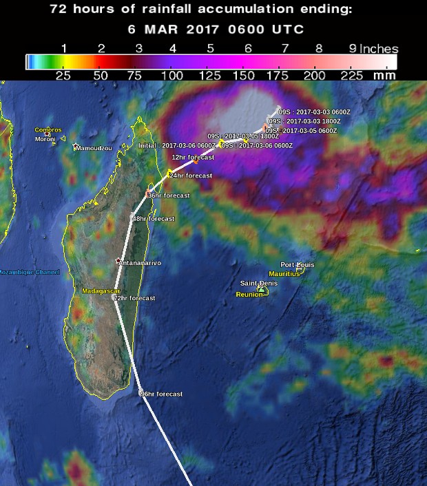
Current JRC estimations indicate a maximum storm surge height of 1 meter (3.3 feet) in Rantranavona (Helodrano Antongila Bay, Toamasina Province) on March 7 at 15.00 UTC.
After landfall, Enawo is expected continue tracking southward across the country and weaken, pass over capital Antananarivo on March 8 and emerge over water near Matanga on March 9.
.jpg)
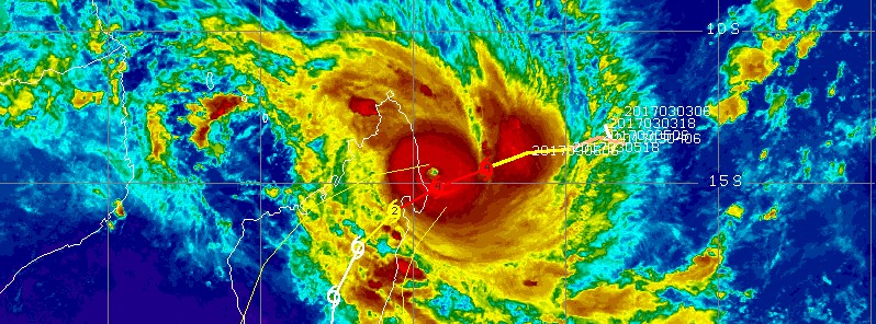
Tropical Cyclone "Enawo" IR satellite image with JTWC forecast track issued 06:00 UTC on March 6, 2017. Credit: UW-CIMSS
Credit: NASA/JAXA GPM, UW-CIMSS, JTWC, Google
Update
March 7, 13:00 UTC
Enawo made landfall at 08:00 UTC (11:00 local time) on March 7 at 14.6 degrees north latitude and 50.2 degrees east longitude, about half way between Sambava and Antalaha. As it hit, Enawo became quasi-stationary and pounded Antalaha with strong winds and heavy rain for several hours.
At 09:00 UTC (4 a.m. EST) its maximum sustained winds were 231 km/h (144 mph) making it a Category 4 hurricane on the Saffir-Simpson Wind Scale.
Drought-stricken Madagascar will likely receive between 700 and 900 mm (27 and 36 inches) of rain this week.
Major flooding and landslides are possible.
El ciclón #Enawo golpea Antalaha #Madagascar
Video: Riccardo Morrelas
Vía @KeraunosObs pic.twitter.com/kqyTbKp1Hn— Geól. Sergio Almazán (@chematierra) March 7, 2017
@TheWatchers_ had some pretty heavy downpours south of Toamasina. pic.twitter.com/KrC8hScz2w
— Mike deCoster-Milman (@mike_dc_m) March 7, 2017
Life-threatening impacts are expected as it moves further inland.
Read more: Enawo makes landfall as third strongest cyclone to hit Madagascar
I'm a dedicated researcher, journalist, and editor at The Watchers. With over 20 years of experience in the media industry, I specialize in hard science news, focusing on extreme weather, seismic and volcanic activity, space weather, and astronomy, including near-Earth objects and planetary defense strategies. You can reach me at teo /at/ watchers.news.
Commenting rules and guidelines
We value the thoughts and opinions of our readers and welcome healthy discussions on our website. In order to maintain a respectful and positive community, we ask that all commenters follow these rules.