
Gezani destroys 18 800 homes, claims 40 lives in Madagascar
At least 40 fatalities have been confirmed, and over 18 800 homes have been destroyed as of February 13, 2026, since Tropical Cyclone Gezani made landfall over Madagascar. The storm remains active and is forecast to continue intensifying through February 13 while remaining in open waters.
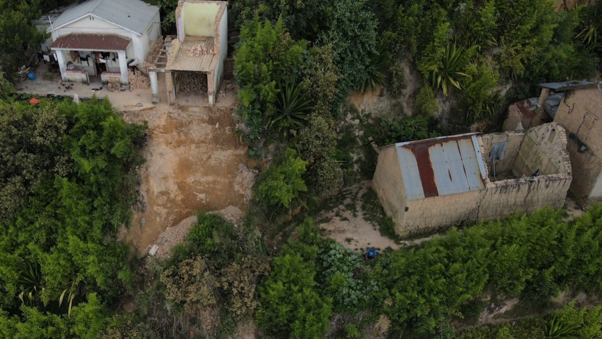
Damaged homes and buildings in Madagascar after the passage of Tropical Cyclone Gezani. Credit: BNGRC
At least 40 people have been confirmed dead in Madagascar after Tropical Cyclone Gezani made landfall on February 10, affecting 23 districts in five regions.
Out of the 40 fatalities, 32 were reported in Toamasina District 2. Two deaths were reported each in Ambatondrazaka and Toamasina District 1. One fatality was recorded in each of Brickaville, Ankazobe, and Manjakandriana.
Six people remain missing, while 427 have been injured. The National Office of Risk and Disaster Management (BNGRC) reported that at least 18 797 homes have been destroyed and another 37 430 were damaged, as of February 13. Around 14 330 homes were flooded by the storm.
At least 269 407 people were affected, of whom 16 318 were displaced. Among the displaced, 11 468 are living in 48 temporary shelter sites, while 4 850 are living with their family and neighbors.
At least 71 classrooms were completely destroyed, while 104 classrooms were partially destroyed, and 561 classrooms were completely unroofed by the storms’ winds.
As of 03:00 UTC on February 13, the storm was located about 230 km west-northwest of Europa Island, with 10-minute maximum sustained winds reaching 167 km/h (104 mph). The storm, a Category 2-equivalent cyclone, was moving west-southwest at 18 km/h (11 mph).
According to the Joint Typhoon Warning Center (JTWC), Gezani is forecast to intensify over the next 24 hours, peaking at wind speeds of 195 km/h (120 mph).
Gezani is currently being steered along the northwestern periphery of a subtropical ridge positioned to its southeast. The cyclone is forecast to continue southwestward through Friday before turning southeast as it rounds the ridge axis.
Forecast models indicate the storm will remain offshore and is unlikely to track north into the Mozambique Channel or toward the mainland.
Read more:

I am an Assistant Editor and Severe Weather & Science Journalist at The Watchers, specializing in real-time severe weather coverage, geophysical event reporting, and research-driven scientific analysis. You can reach me at rishav(at)watchers(.)news.
Commenting rules and guidelines
We value the thoughts and opinions of our readers and welcome healthy discussions on our website. In order to maintain a respectful and positive community, we ask that all commenters follow these rules.