
Tropical Storm Neoguri formed south of Guam
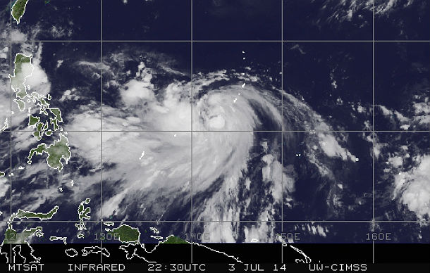
Featured image: MTSAT IR satellite image of TS 08W taken at 01:30 UTC on July 4, 2014. (Credit: NOAA/MTSAT-UWM-CIMSS)
The eight tropical depression (TD 08W) in the Northwestern Pacific ocean formed early on July 3, 2014 just south of Guam and strengthened into a Tropical Storm Neoguri during the afternoon hours. This tropical storm will bring rain and gusty winds to Guam as it continues to strengthen.
Neoguri has a good chance to become second typhoon of the 2014 Western Pacific season as it progress northwest through an area of very warm western Pacific ocean waters and low vertical wind shear.
MTSAT IR satellite image of TS 08W at 01:30 UTC on July 4, 2014 (Credit: NOAA/MTSAT-UWM-CIMSS)
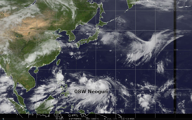
The Joint Typhoon Warning Center (JTWC) expects Neoguri to strengthen into a Typhoon on July 6, after it passes to the west of Guam.
JTWC forecasters then expect the typhoon to move near the Japanese islands of Kadena, Oshima and Amami by July 7 or 8, 2014. Neoguri is expected to begin to take a more northerly track as it approaches the Ryukyu Islands and then turn northeastward and approach southern Japan by July 8, 2014. Landfall is expected somewhere from Kyushu to the Kii Peninsula by July 8/9, 2014.
Forecast track map by JTWC (Credit: JTWC)
.jpg)
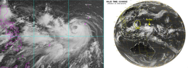
MTSAT-2 visible satellite images of TS 08W (Credit: FNMOC/JTWC/SATOPS)
Satellite Animations
- Storm-Centered Infrared (MTSAT2; NOAA/SSD)
- Storm-Centered Infrared (Aviation Color Enhancement) (MTSAT2; NOAA/SSD)
- Storm-Centered Water Vapor (MTSAT2; NOAA/SSD)
- Storm-Centered Visible (MTSAT2; NOAA/SSD)
- Storm-Centered Visible (Colorized) (MTSAT2; NOAA/SSD)
- Storm-Centered Infrared (MTSAT2; CIMSS)
- Storm-Centered Enhanced Infrared (MTSAT2; CIMSS)
- Storm-Centered Water Vapor (MTSAT2; CIMSS)
- Storm-Centered Visible (MTSAT2; CIMSS)
- Tropical West Pacific Infrared (MTSAT2; NOAA)
- Tropical West Pacific Enhanced Infrared (MTSAT2; NOAA)
- Tropical West Pacific Water Vapor (MTSAT2; NOAA)
- Tropical West Pacific Visible (MTSAT2; NOAA)
Commenting rules and guidelines
We value the thoughts and opinions of our readers and welcome healthy discussions on our website. In order to maintain a respectful and positive community, we ask that all commenters follow these rules.