
Hurricane “Arthur” opens 2014 Atlantic hurricane season

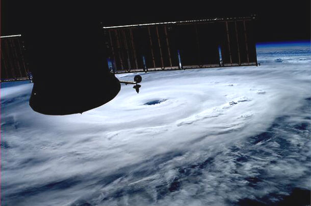
Image credit: Looking out the window of the International Space Station, astronauts spotted a sprawling mass of clouds on July 2, 2014. The clouds were just beginning to take shape as the first tropical storm of the 2014 season built over the Atlantic. Astronaut photograph ISS040-E-030560/ISS Crew Earth Observations Facility and the Earth Science and Remote Sensing Unit, Johnson Space Center/Holli Riebeek)
Tropical Storm Arthur formed on July 2 and strengthened into a hurricane today, the first of the 2014 Atlantic hurricane season. Heavy rains are expected to affect the southern U.S. coastline over the next several days.
Arthur could reach a Category 2 hurricane when it passes over or near the North Carolina coast, just before cool waters off the northeast coast of the U.S. weaken the system.
Conditions are deteriorating along the coast of North Carolina as evacuees make final preparations to leave the Outer Banks, and coastal communities prepare for Tropical Storm and Hurricane conditions.
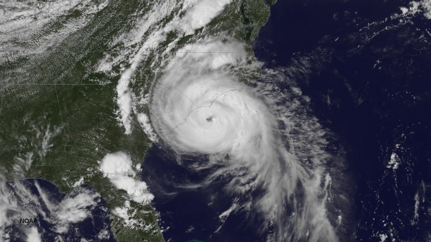
IR satellite image of TS Arthur taken by GOES East at 19:45 UTC on July 3, 2014 (Credit: NOAA/GOES-East)

Astronaut onboard ISS Reid Wiseman captured well-defined Arthur's eye late on July 3, 2014 (Credit: AstroReid/Twitter)
Rough surf with strong rip currents is expected from the Florida east coast to New Jersey, Long Island and southeastern New England. Coastal flooding and minor beach erosion are possible at times of high tide from southeastern Virginia to Cape Cod, Massachusetts. Although, track of Arthur will take the center east of most coastal areas, offshore winds will create large swells leading to powerful waves and strong rip currents.
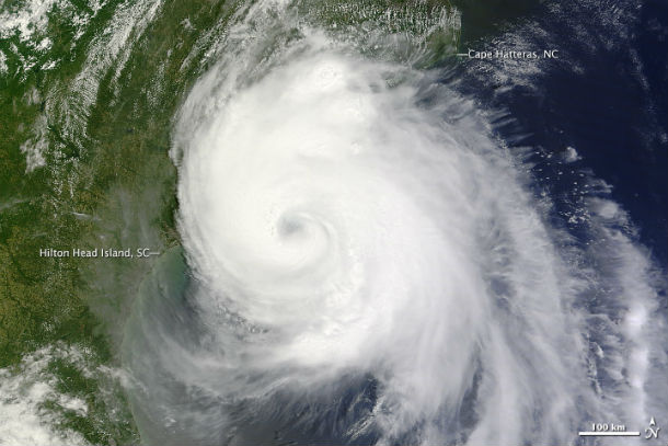
The Moderate Resolution Imaging Spectroradiometer (MODIS) on NASA’s Terra satellite captured image of the storm on July 3, by which time the storm had become a hurricane. Arthur had winds of 150 kilometers per hour (90 miles per hour) and stronger gusts. The northern and western bands of the storm are already over land. (Credit: LANCE Rapid Response/MODIS)
The combination of a dangerous storm surge and the tide will cause normally dry areas near the coast to be flooded by rising waters.
A Hurricane Warning is in effect for Surf City North Carolina to the North Carolina/Virginia border, Pamlico Sound and eastern Albemarle Sound. A Hurricane Watch is in effect for Little River Inlet to south of Surf City.
A Tropical Storm Warning is in effect for South Santee River South Carolina to south of Surf City, the North Carolina/Virginia border to Cape Charles Light, Virginia, including the mouth of the Chesapeake Bay, western Albemarle Sound, Nantucket and Cape Cod from Provincetown to Chatham.
A tropical storm watch is in effect for Nova Scotia from port Maitland to Point Aconi.
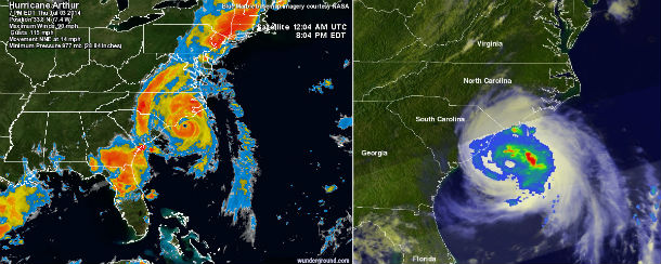
Hurricane Arthur satellite view – winds and TRMM over GOES East rainfall data maps on July 3, 2014 (Credit: NASA/NOAA/BlueMarble/TRMM/GOES)
Currently, Arthur is moving north-northeast near 15 mph (24 km/h) and is expected to turn northeastward with an increase in forward speed. Air Force Reserve and NOAA hurricane hunter aircraft reported maximum sustained winds near 90 mph (150 km/h) with higher gusts. Hurricane force winds extend outward up to 35 miles (55 km) from the center and tropical storm force winds extend outward up to 150 miles (240 km).
The minimum central pressure reported by the Air Force and NOAA hurricane hunter aircraft was 977 mb (28.85 inches).
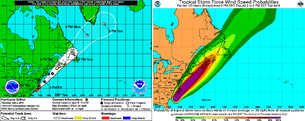
5-day forecast track and tropical storm force wind speed probability map (Credit: NOAA/NHC)
.png)
Hurricane Arthur's forecast models (Credit: NHC/UWM)
Arthur has become the first hurricane of the 2014 Atlantic tropical season and is forecast to take a northeasterly path along the Atlantic coast of the United States in the coming hours. Later during July 4, 2014, the center of Arthur is forecast to steer east of the mid-Atlantic. Arthur is forecast to pass near or over Nova Scotia this weekend shortly after transitioning to a non-tropical system. Remnants of Arthur could still bring damaging winds, coastal erosion and flooding.
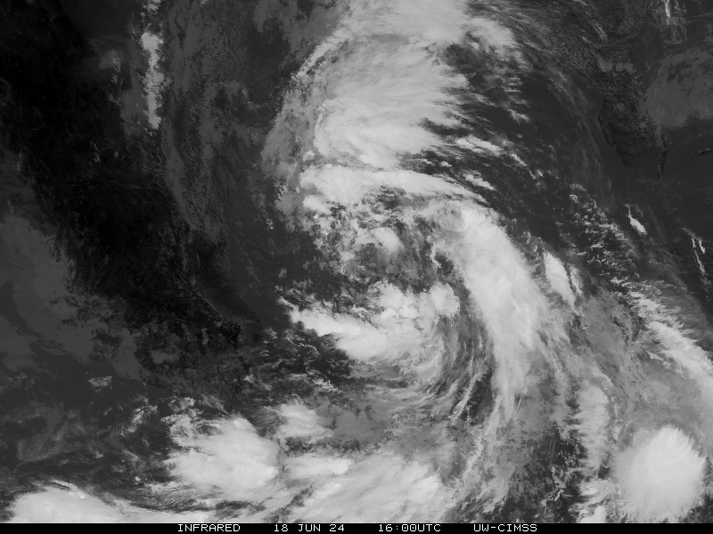
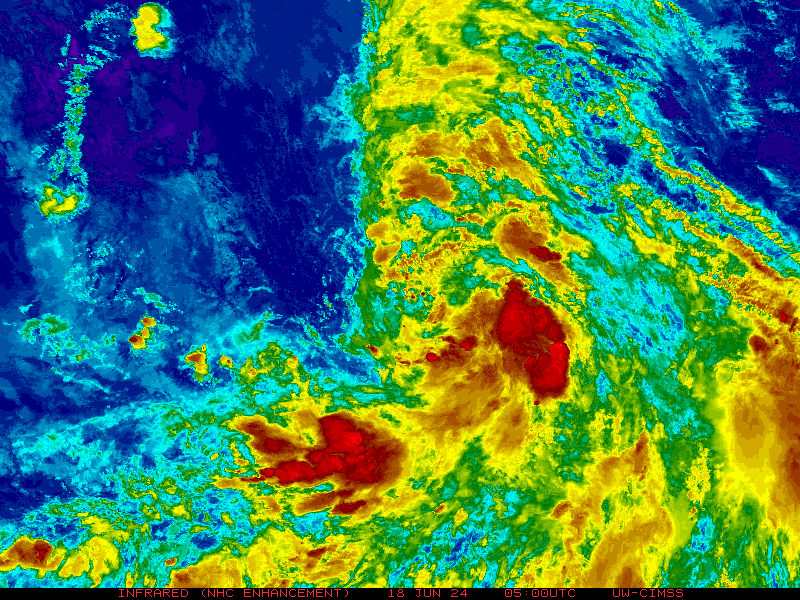
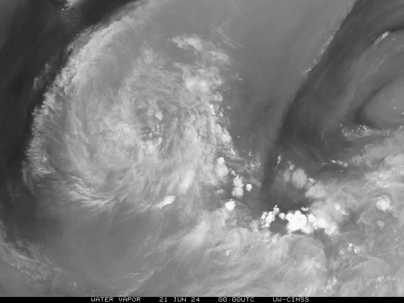
Satellite Animations
- Storm-Centered Infrared (GOES 13; NOAA/SSD)
- Storm-Centered Infrared (Aviation Color Enhancement) (GOES 13; NOAA/SSD)
- Storm-Centered Water Vapor (GOES 13; NOAA/SSD)
- Storm-Centered Visible (GOES 13; NOAA/SSD)
- Storm-Centered Visible (Colorized) (GOES 13; NOAA/SSD)
- Storm-Centered Infrared (GOES 13; CIMSS)
- Storm-Centered Enhanced Infrared (GOES 13; CIMSS)
- Storm-Centered Water Vapor (GOES 13; CIMSS)
- Storm-Centered Visible (GOES 13; CIMSS)
- Tropical Atlantic Hurricane Sector Infrared (GOES 13; NOAA)
- Tropical Atlantic Hurricane Sector Water Vapor (GOES 13; NOAA)
- Tropical Atlantic Hurricane Sector Visible (GOES 13; NOAA)
Commenting rules and guidelines
We value the thoughts and opinions of our readers and welcome healthy discussions on our website. In order to maintain a respectful and positive community, we ask that all commenters follow these rules.