
A low pressure area sitting over the Great Lakes region
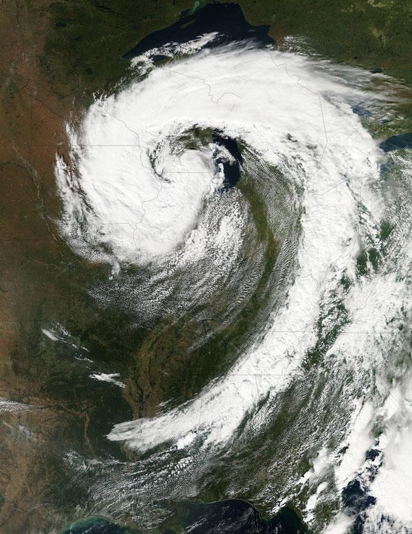
Image credit: TW
A low pressure area has been sitting over the Great Lakes region for about a week now, keeping the region and the U.S. northeast and Mid-Atlantic under cloud cover.
NASA’s Aqua satellite flew over head on Sept. 26, and captured two views of the low pressure system from space.
That low pressure area continues to spin counter-clockwise today over the Great Lakes. Its centered over northern Illinois and southeastern Wisconsin and is once again going to keep the region cloudy, cool and wet with showers.
When the Aqua satellite passed overhead Monday afternoon at 3:05 p.m. EDT (Sept. 26) a detailed, clear image was captured from the Moderate Resolution Imaging Spectroradiometer (MODIS) instrument . The clouds from the low spread in a classic comma shape over Illinois, Wisconsin, parts of Iowa, northeastern Missouri, southeastern Minnesota, Michigan, Ohio, Indiana, Pennsylvania, Kentucky, Tennessee, Alabama, Mississippi, Georgia, and the northeastern and Mid-Atlantic states.
According to the National Weather Service, the low will finally start moving to the east as an upper-atmospheric trough (an elongated area of low pressure) continues to strengthen and move into the upper Midwest. However, a ridge (elongated area) of high pressure will slow its move eastward, so it will be slow clearing this week in the northeastern and Mid-Atlantic. (OurAmazingPlanet)
Commenting rules and guidelines
We value the thoughts and opinions of our readers and welcome healthy discussions on our website. In order to maintain a respectful and positive community, we ask that all commenters follow these rules.