
Two atmospheric rivers to bring rain to Pacific Northwest this week
Two weak atmospheric rivers (ARs) are forecast to make landfall over Washington and Oregon between November 25 and 27, 2025, bringing 50–100 mm (2–4 inches) of rain to coastal and mountain areas.
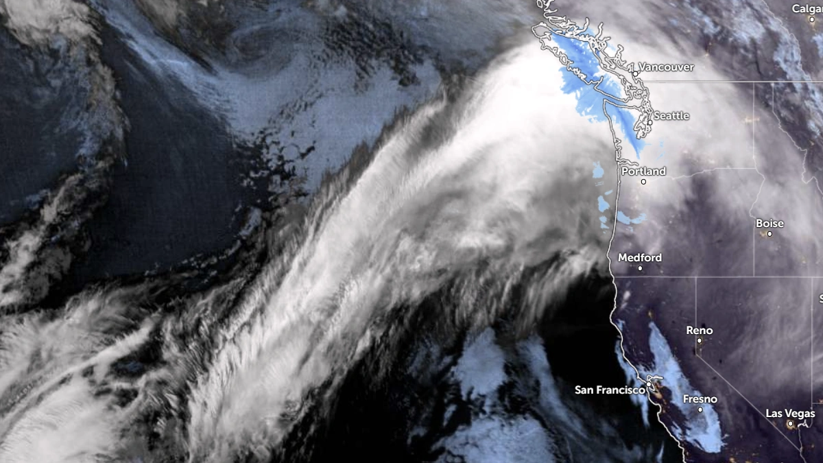
Satellite image of AR over the Pacific as of 11:30 UTC on November 25, 2025. Credit: NOAA/GOES-19, Zoom Earth, The Watchers
Two weak ARs and a low-pressure system are forecast to bring moderate precipitation to the Pacific Northwest between November 25 and 28, according to the Center for Western Weather and Water Extremes (CW3E).
The first AR is expected to make landfall over southern Washington and Oregon on November 25, and dissipate early on November 26. A second AR and associated low-pressure system are forecast to develop soon after, tracking northeast toward the coast late November 26.
The European Centre for Medium-Range Weather Forecasts (ECMWF) projects the first AR’s moisture core to remain stronger and farther north than the Global Forecast System (GFS). The ECMWF also predicts higher integrated vapor transport (IVT) in the second AR’s core, indicating higher rainfall potential.
AR 1 to AR 2 conditions (IVT ≥ 250 kg m-1 s-1) are forecast to persist for more than 48 hours over northern coastal Oregon.
The Weather Prediction Center (WPC) forecasts total precipitation of 50–100 mm (2–4 inches) over coastal Washington, northern coastal Oregon, and the Washington Cascades during the 72-hour period ending 04:00 PT (11:00 UTC) on November 28. Higher localized totals are possible in the Olympic Mountains and near Mount Rainier.
WPC has issued a marginal excessive-rainfall outlook (level 1 of 4)for parts of western Washington and northwestern Oregon for the 24-hour period ending 04:00 PT (11:00 UTC) on November 27.
In the Duwamish watershed, model forecasts show significant differences, with the deterministic ECMWF forecasting about 86 mm (3.4 inches) of mean areal precipitation by early November 28. The deterministic GFS indicates around 36 mm (1.4 inches).
Freezing levels in the Olympic Mountains and Washington Cascades are forecast to rise from 900 m (3 000 feet) to above 1 800 m (6 000 feet) by midday Wednesday as warm, moist air arrives. Most precipitation below 1 500 m (5 000 feet) will fall as rain, limiting new snow accumulation.
References:
1 Quick Look at the Storms Forecast to Impact the Pacific Northwest This Week – CW3E – November 24, 2025

I am an Assistant Editor and Severe Weather & Science Journalist at The Watchers, specializing in real-time severe weather coverage, geophysical event reporting, and research-driven scientific analysis. You can reach me at rishav(at)watchers(.)news.
Commenting rules and guidelines
We value the thoughts and opinions of our readers and welcome healthy discussions on our website. In order to maintain a respectful and positive community, we ask that all commenters follow these rules.