
Atmospheric river forecast to impact coastal British Columbia from August 15 to 17
The first significant rainfall event in weeks is forecast for coastal British Columbia, Canada, with an atmospheric river expected to bring 20–40 mm (0.8–1.6 inches) to the Lower Mainland and over 50 mm (2 inches) to higher elevations from August 15 to 17, 2025. The rainfall is expected to bring some relief to the region following prolonged wildfire activity that has scorched over 7 000 000 ha (1.8 million acres) across Canada, making it the country’s second-worst wildfire season on record.

Satellite image acquired at 23:30 UTC on August 12, 2025. Credit: NOAA/GOES-West, Zoom Earth, The Watchers
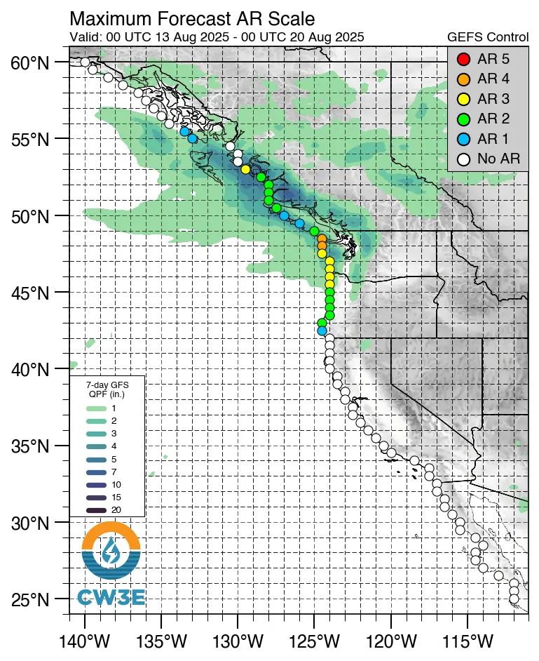
An atmospheric river is expected to bring moderate to locally heavy rainfall to coastal British Columbia, Canada, from the night of August 15 through August 17.
Forecast models indicate precipitation totals of 20–40 mm (0.8–1.6 inches) for the Lower Mainland and over 50 mm (2 inches) in higher-terrain areas.
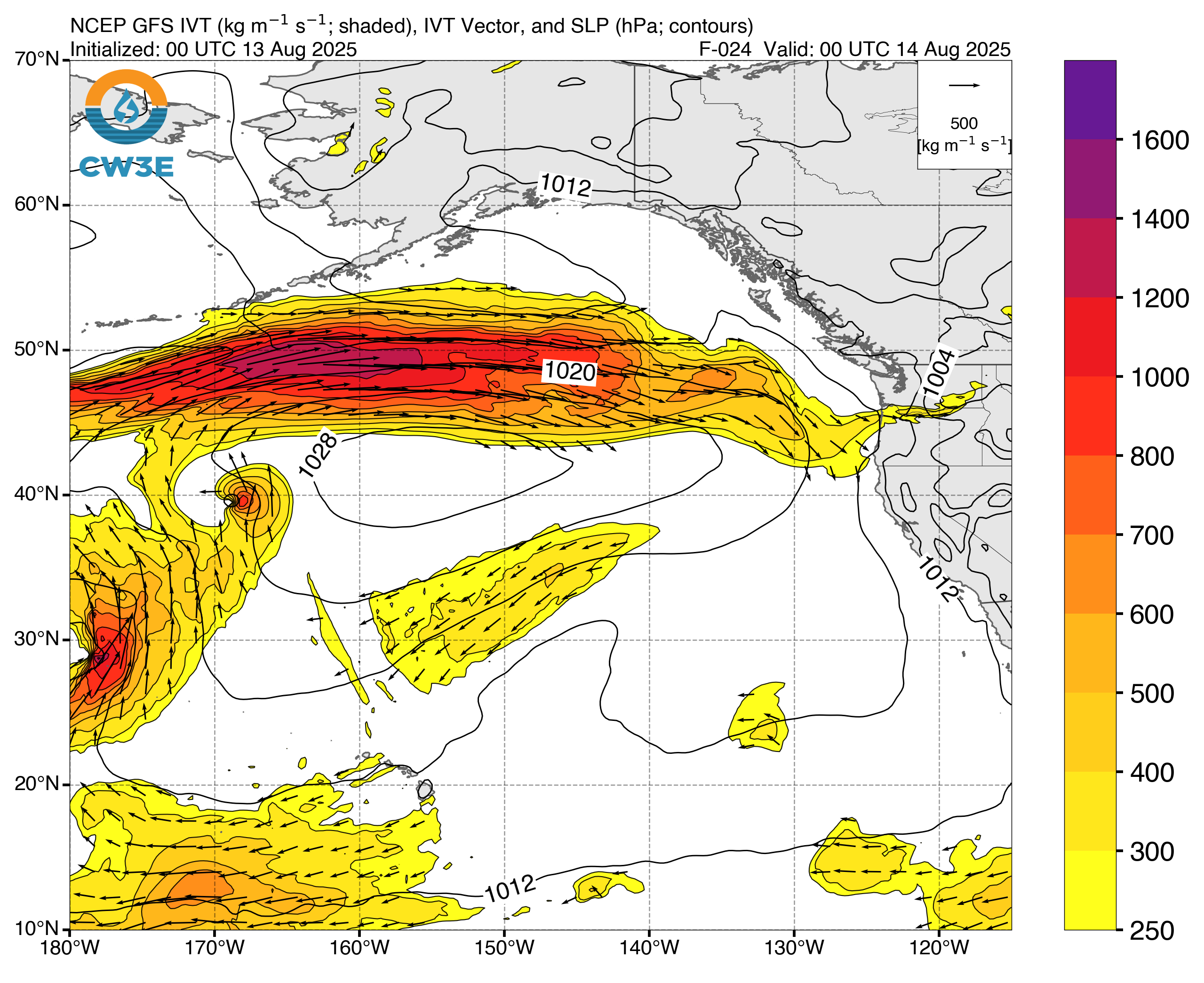
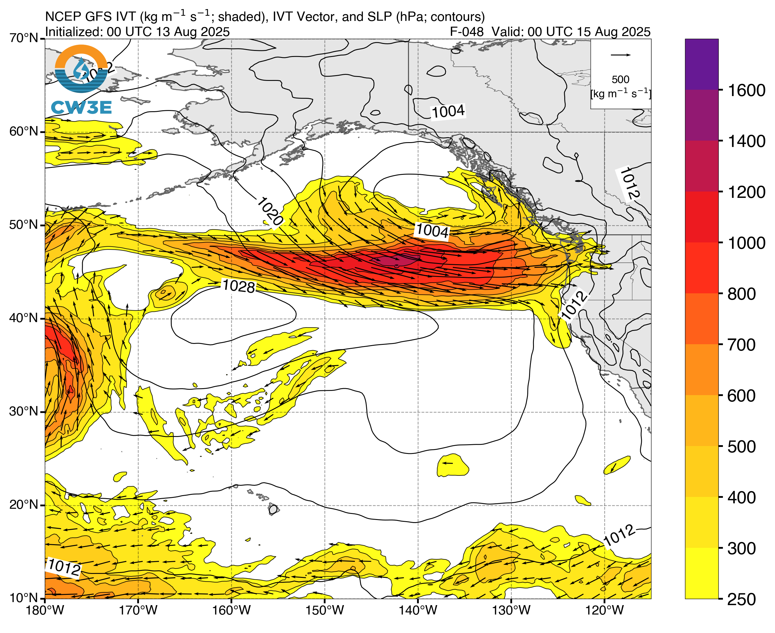
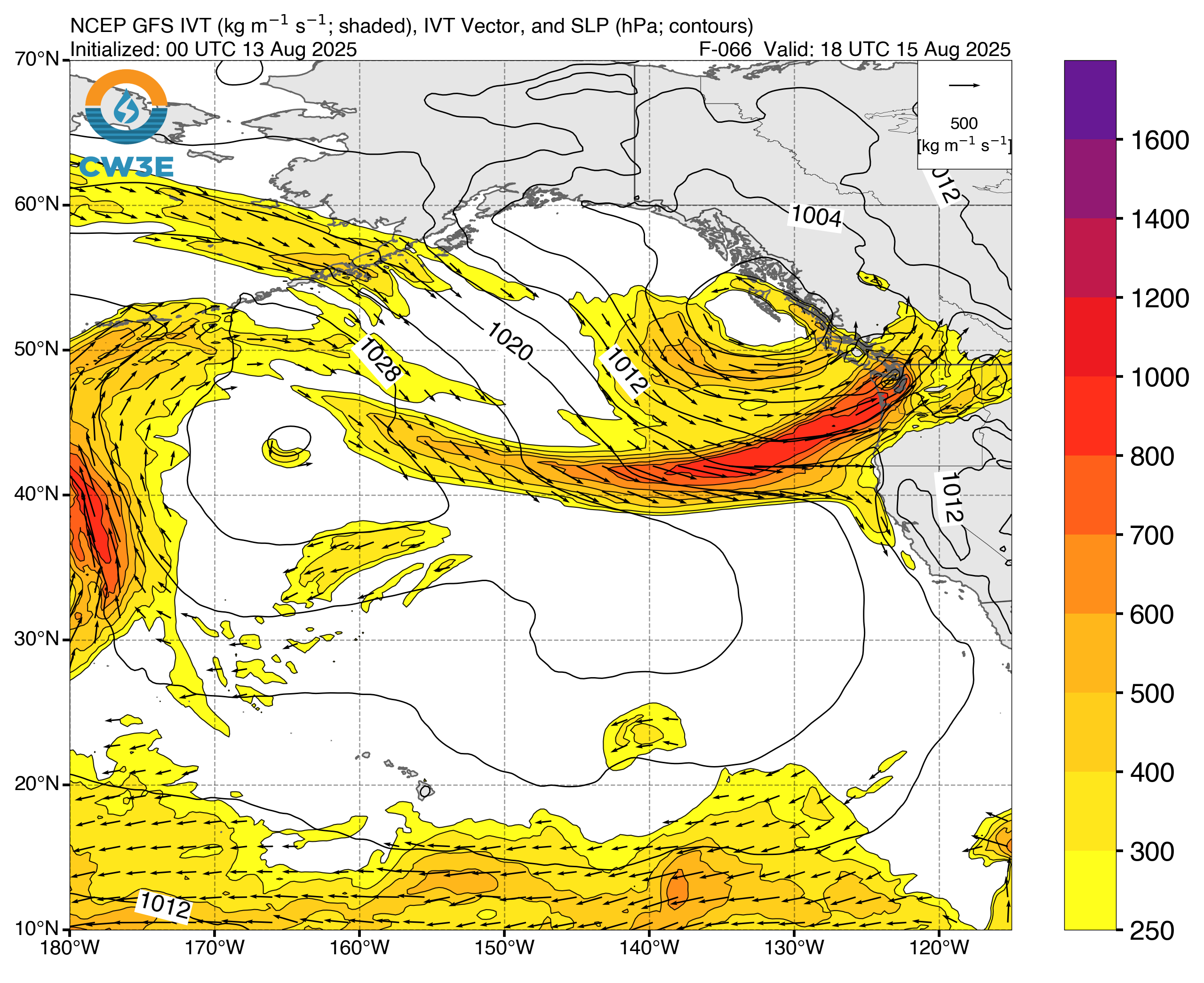
The moisture will be driven by a developing low-pressure system west of Haida Gwaii. Central coastal sections east and southeast of Haida Gwaii may experience AR-3 to AR-4 conditions (strong to extreme) on the CW3E Atmospheric River Scale, while southern Vancouver Island is forecast to see AR-1 to AR-2 (weak to moderate) intensity.
Forecast models also indicate a drop in freezing levels — from above 3 000 m (9 842 feet) to 2 500 m (8 202 feet) by Sunday — raising the potential for snowfall at high elevations.
Temperatures are forecast to remain below seasonal averages through early next week, before a gradual return to warmer and drier conditions mid- to late next week.
This will be the first significant precipitation event in several weeks for British Columbia. As of August 12, the Canadian Interagency Forest Fire Centre (CIFFC) reported 71 active wildfires in the province under full response (8 out of control, 22 being held, 41 under control), 25 active fires under modified response, and 1 monitored fire, making a total of 97 active wildfires.
The total area burned in British Columbia this year has reached 729 633 ha (1 803 000 acres), already above the province’s five-year average of 644 915 ha (1 593 000 acres).
Nationally, as of August 12, Canada has recorded 4 371 wildfires that have burned 7 399 154 ha (18 291 000 acres), about 78 percent above the five-year national average.
The 2025 wildfire season is currently the second-worst on record, surpassed only by 2023, when 17 203 625 ha (42 502 000 acres) burned.

I am an Assistant Editor and Severe Weather & Science Journalist at The Watchers, specializing in real-time severe weather coverage, geophysical event reporting, and research-driven scientific analysis. You can reach me at rishav(at)watchers(.)news.
Commenting rules and guidelines
We value the thoughts and opinions of our readers and welcome healthy discussions on our website. In order to maintain a respectful and positive community, we ask that all commenters follow these rules.