
Red Warning for heavy rain in Tasman District after weeks of wet weather, New Zealand
MetService issued a Red Warning for Heavy Rain for parts of New Zealand’s Tasman District at 09:59 LT on July 11, 2025, warning of flooding, slips, and dangerous road conditions due to highly saturated ground and further rainfall expected through 23:00 LT tonight.
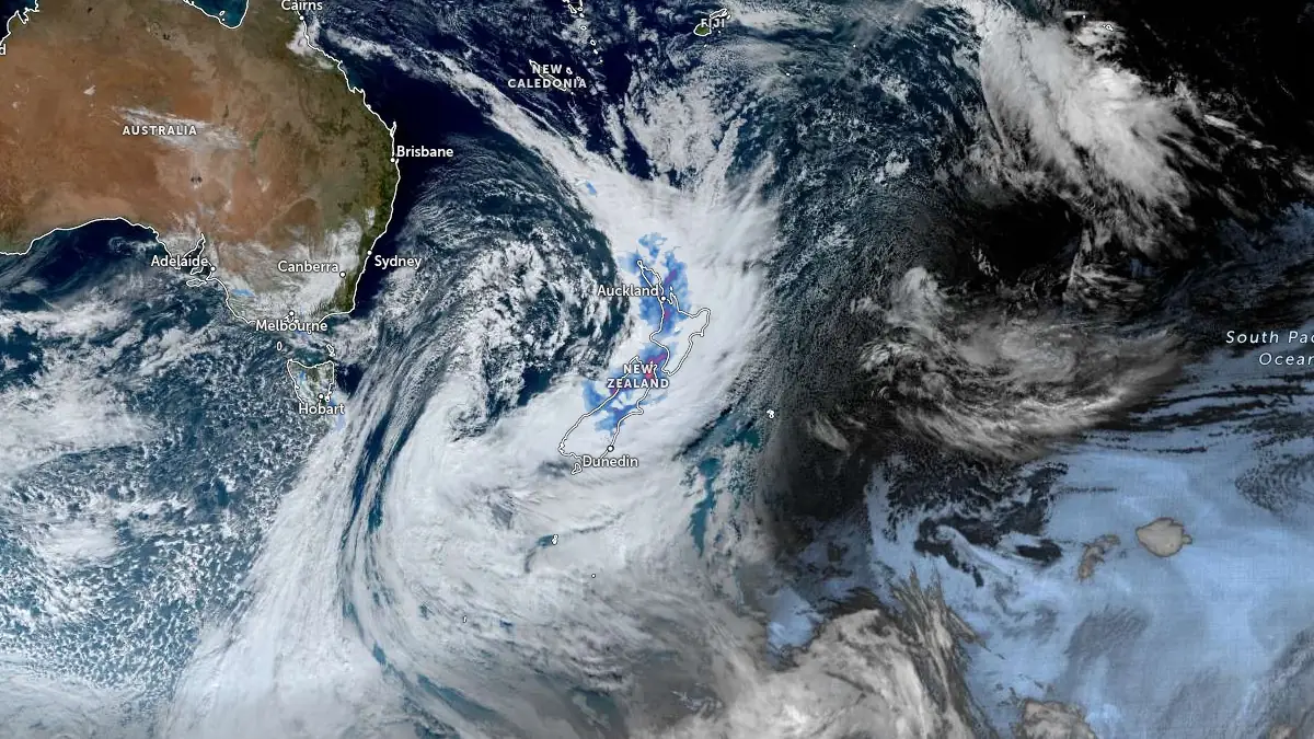
Image credit: JMA/Himawari-9, RAMMB/CIRA, The Watchers. Acquired at 03:00 UTC on July 11, 2025
New Zealand’s MetService upgraded the severe weather warning for the Tasman District to a Red Warning for Heavy Rain at 09:59 LT on July 11 in consultation with the Tasman District Council. Red Warnings are the highest alert level in New Zealand’s official hazard communication system, reserved for events expected to cause significant disruption and require immediate action.
The warning is valid until 23:00 LT and applies to the Tasman District about and southeast of Motueka and north of Lake Rotoroa, excluding Nelson City. The region has experienced continuous rain events over the past three weeks, resulting in very saturated soils and elevated river levels.
By mid-morning, over 50 mm (2 inches) of rain had already fallen in parts of the district and MetService forecasts an additional 80 to 120 mm (3.1 to 4.7 inches) through the end of the warning period. Peak rainfall rates of 10 to 20 mm/h (0.4 to 0.8 inches/h) are expected this afternoon and evening.
“Dangerous river conditions, flooding, slips, and dangerous road conditions are expected,” said MetService meteorologist Mmathapelo Makgabutlane.
“A Red Warning signifies that people need to act now as immediate action is required to protect people, animals and property from the impact of the weather. People should also be prepared to follow the advice of official authorities and emergency services.”
Residents in the affected area are advised to avoid entering floodwaters and to limit travel. Immediate self-evacuation is recommended if rising water is observed. Prepare for potential outages of power and communications.

This is the second Red Warning issued by MetService in 2025 and the 17th such event since the system was introduced in May 2019.
A Watch for Strong Winds is also in place for the district, with northerly and northeasterly winds nearing severe gale strength. The combination of strong winds and saturated ground conditions may increase the risk of falling trees and infrastructure damage.

Heavy Rain Warnings at the Orange level are also in effect for several regions across both islands, including Northland, Auckland, Coromandel Peninsula, Rotorua, Waikato, Bay of Plenty, Gisborne, Taranaki Maunga, and the Nelson–Marlborough region. These areas are forecast to receive between 60 and 180 mm (2.4 to 7.1 inches) of rain, with peak rates of 20 to 30 mm/h (0.8 to 1.2 inches/h). Impacts include surface flooding, slips, rapidly rising rivers, and hazardous driving conditions. Some areas have a moderate chance of upgrade to Red Warning status.
Strong Wind Warnings are active for Taranaki south of the Maunga and Banks Peninsula, with severe gale northeasterlies forecast to reach gusts of up to 120 km/h (75 mph) in exposed areas. Watches are in effect for additional regions, including Northland, Auckland, the central North Island, and parts of Otago, where winds may also approach severe gale strength.
I'm a dedicated researcher, journalist, and editor at The Watchers. With over 20 years of experience in the media industry, I specialize in hard science news, focusing on extreme weather, seismic and volcanic activity, space weather, and astronomy, including near-Earth objects and planetary defense strategies. You can reach me at teo /at/ watchers.news.
Commenting rules and guidelines
We value the thoughts and opinions of our readers and welcome healthy discussions on our website. In order to maintain a respectful and positive community, we ask that all commenters follow these rules.