
Popocatepetl volcano releases high-level ash emissions over Gulf of Mexico
Popocatépetl volcano in Mexico has shown increased activity over the past few days, with significant ash and SO2 emissions recorded since October 24. On October 26, volcanic ash cloud was estimated at approximately 9.1 km (30 000 feet) above sea level, extending about 833 km (517 miles) northeast of the summit into the Gulf of Mexico.
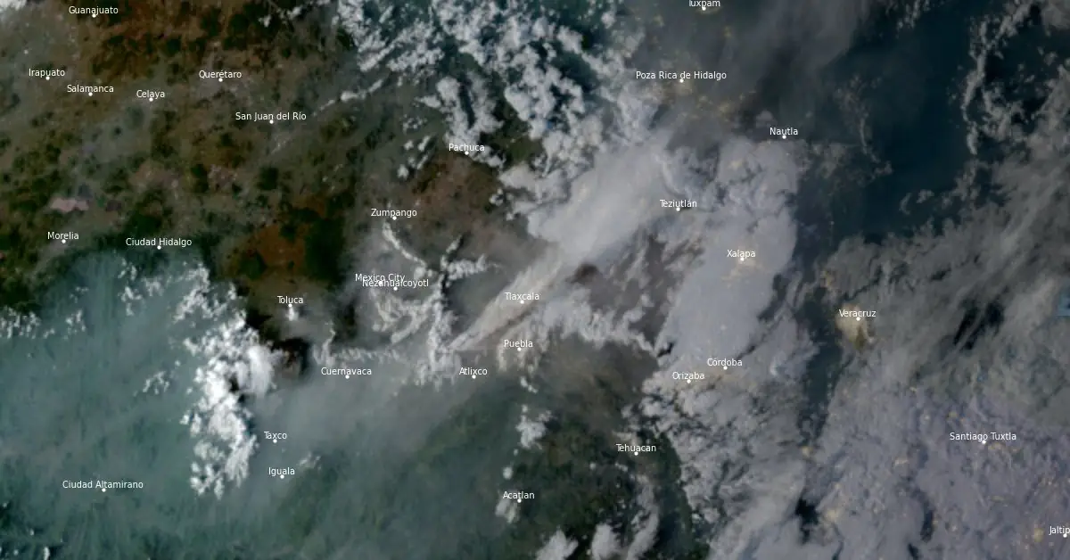
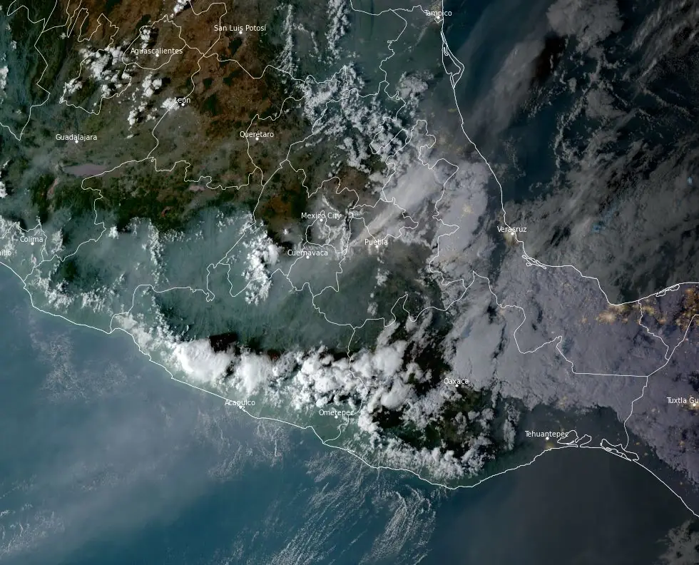
Satellite image of ash rising above Popocatepetl volcano into the Gulf of Mexico at 23:00 UTC on October 25, 2024. Credit: NOAA/GOES-East, RAMMB/CIRA, The Watchers
From October 16 – 22, the Popocatepetl seismic network recorded 9 – 89 long-period events per day, accompanied by steam-and-gas emissions. The seismic network also recorded daily tremors with periods lasting from 54 minutes to 13 hours and 17 minutes, along with a 35-minute emission episode between October 15 – 16.
A significant tremor episode began at 17:47 UTC on October 20, accompanied by a gas-and-ash plume that rose 2 km (6 562 feet) above the crater and incandescent material ejected a short distance from the crater.
Ashfall was reported in Ozumba (18 km/11.2 miles W), Tlalmanalco (30 km/18.6 miles NW), and Ecatzingo (15 km/9.3 miles SW) in the state of Mexico; and around 09:58 in Tlalnepantla (80 km/49.7 miles NW), Tlayacapan (40 km/24.9 miles WSW), and Totolapan in the state of Morelos, according to El Centro Nacional de Comunicación y Operación de Protección Civil (CENACOM).
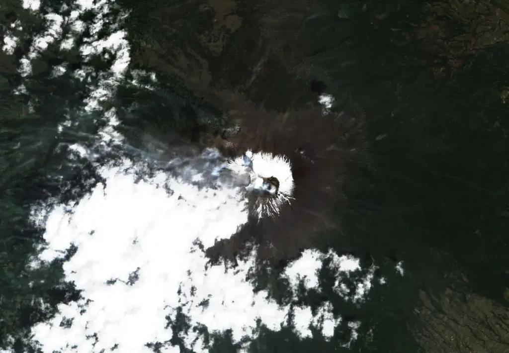
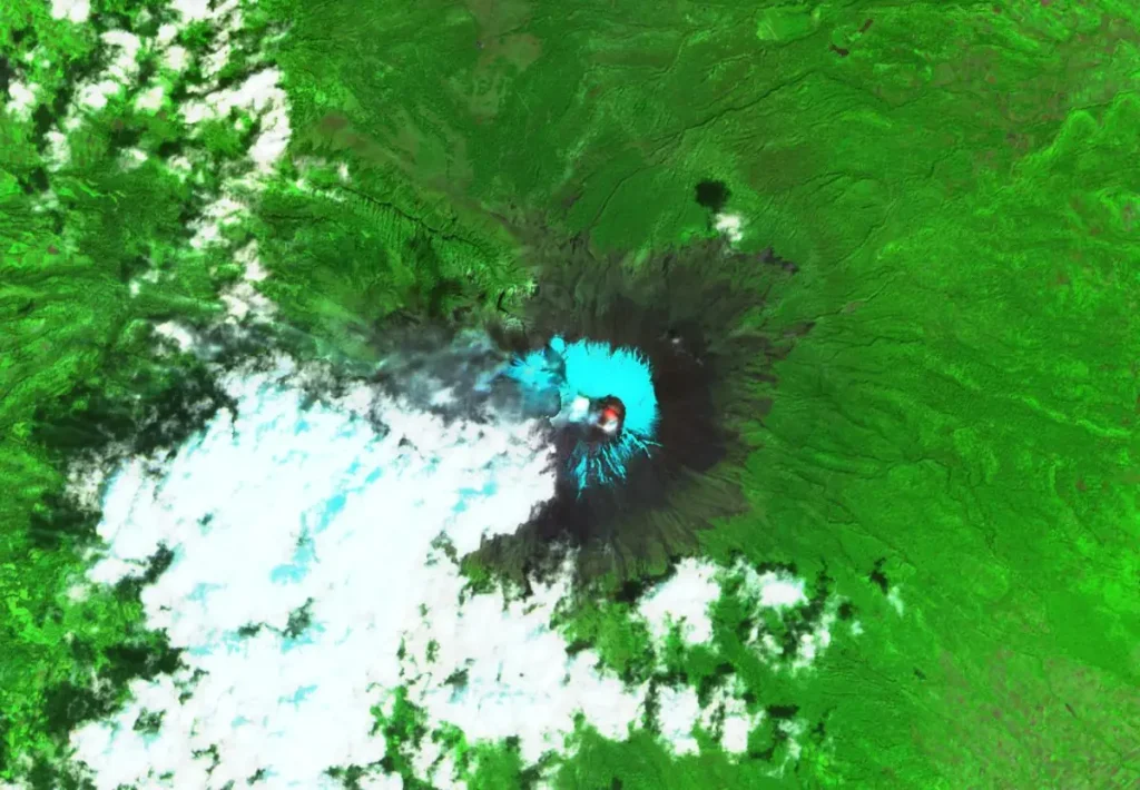
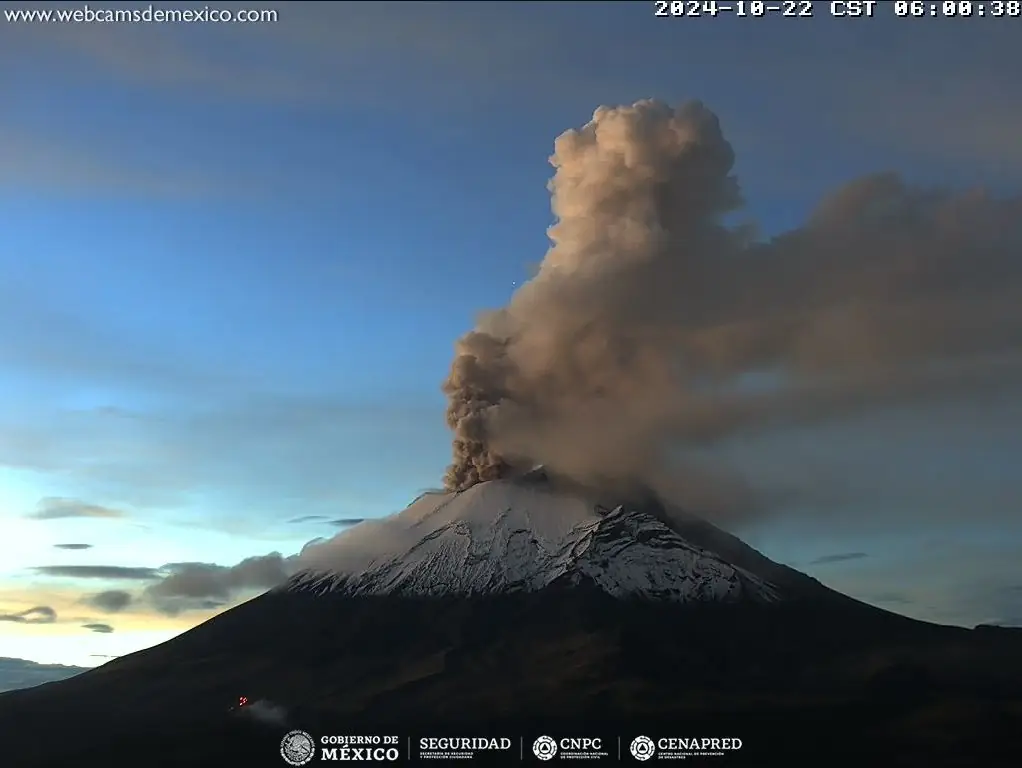
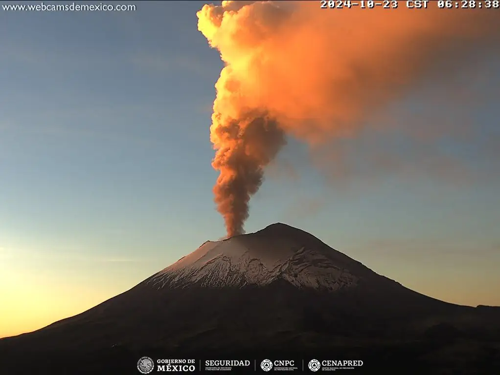
Volcanic activity at the volcano increased further on October 22, with continuous ash emissions observed at 07:06 UTC, rising to 6.1 km (20 000 feet) a.s.l.
By 00:06 UTC on October 23, volcanic ash was reported reaching 6.7 km (22 000 feet) a.s.l. and extending 130 km (80 miles) northwest of the summit.
Mexico’s National Center for Disaster Prevention (CENAPRED) reported 22 exhalations and 1 007 minutes of tremor at the volcano in 24 hours to 17:00 UTC on October 23.
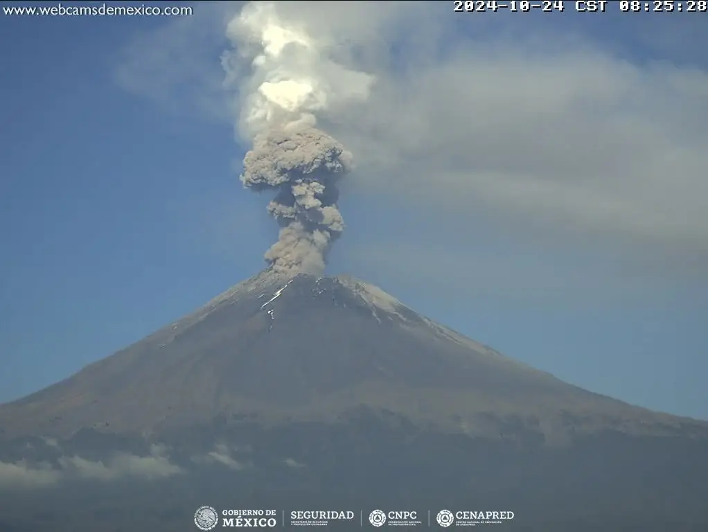
45 exhalations accompanied by water vapor, volcanic gasses, and ash were detected in 24 hours to 17:00 UTC on October 24. Additionally, 908 minutes of high-frequency and low-amplitude tremor were recorded.
By 17:00 UTC on October 25, CENAPRED recorded another 1 005 minutes of high-frequency tremor of low to moderate amplitude and 24 exhalations.
“During the morning and at the time of this report, a continuous emission of water vapor, volcanic gases, and ash was observed with dispersion towards the northeast (NE),” CENAPRED volcanologists reported at 17:00 UTC.
Ash emissions increased further by 20:21 UTC on October 25, with a dense volcanic ash plume detected in satellite imagery rising to approximately 9.8 km (32 000 feet) a.s.l. and reaching about 343 km (213 miles) northeast of the summit into the Bay of Campeche.
By 02:06 UTC on October 26, a large, dense volcanic ash plume was observed approximately 833 km (450 miles) northeast of the summit, with the densest ash within 241 km (130 miles) northeast of the summit
The Washington VAAC reported ash cloud rising to around 9.1 km (30 000 feet) a.s.l.

The Volcanic Alert Traffic Light remains in the Yellow Phase.
CENAPRED is urging residents and tourists not to climb the volcano due to explosions that project incandescent fragments. Additionally, the public is advised to remain aware of the threat of mud and debris flows in case of heavy rain. The population is reminded to respect the 12 km (7.5 miles) radius exclusion zone around the crater.
The current eruptive phase at the volcano started on January 9, 2005.
Popocatepetl is the second-highest volcano in North America, located 70 km (43.5 miles) southeast of Mexico City (population 22 million).
This glacier-covered stratovolcano features a steep-walled crater and is modified by the Ventorrillo peak, a remnant of an older formation. Past gravitational collapses during the Pleistocene created extensive debris-avalanche deposits to the south.
Since the mid-Holocene, the volcano has experienced three major Plinian eruptions, the latest around 800 CE, producing pyroclastic flows and lahars.
Historical eruptions, first noted in Aztec records, have continued into modern times.
References:
1 VAA Popocatepetl – Washington VAAC – Issued from October 22 – 2024
2 Popocatepetl activity updates – CENAPRED – Issued from October 23 – 24, 2024
3 Global Volcanism Program, 2024. Report on Popocatepetl (Mexico) (Bennis, K L, and Sennert, S, eds.) – GVP Weekly Volcanic Activity Report, 16 October-22 October 2024
4 Popocatepetl Geological Summary – GVP – Accessed October 26, 2024
I'm a dedicated researcher, journalist, and editor at The Watchers. With over 20 years of experience in the media industry, I specialize in hard science news, focusing on extreme weather, seismic and volcanic activity, space weather, and astronomy, including near-Earth objects and planetary defense strategies. You can reach me at teo /at/ watchers.news.
Commenting rules and guidelines
We value the thoughts and opinions of our readers and welcome healthy discussions on our website. In order to maintain a respectful and positive community, we ask that all commenters follow these rules.