
Extreme lake effect snow around the Great Lakes
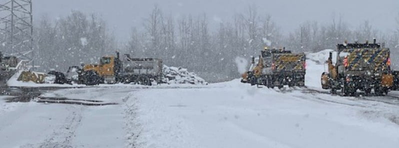
Image credit: NYSDOT Western NY
A major lake effect snow event produced record-breaking snow amounts around the Great Lakes over the past 2 days. The storm buried roads and vehicles and caused the deaths of at least 3 people.
- The event will continue downwind of Lakes Erie and Ontario on Sunday, November 20, the National Weather Service (NWS) warns. As a result, Lake Effect Snow Warnings are in effect for Upstate and western New York and the snowbelt regions of northwestern Pennsylvania and northeastern Ohio.
- The NWS office in Buffalo said the weather pattern responsible for this extreme snow event shares similarities with the historic November 2014 lake effect storm dubbed “Snowvember” when more than 152 cm (5 feet) of snow hit the Buffalo Southtowns.
A new daily snowfall record was set in Buffalo, New York on November 18, 2022, with 40.8 cm (16.1 inches) of snow. The record was again broken on November 19, when 54.6 cm (21.5 inches) of snow fell over the city. The previous record for the date was 19.3 cm (7.6 inches), set in 2014 during a long-duration snowfall event known as Snowvember.
The highest 48-hour snow total, as of 12:00 LT on November 19, was registered in Orchard Park, Western New York with 195.6 cm (77 inches), followed by 187.2 cm (73.7 inches) in 1.9 NW Hamburg, and 183.6 cm (72.3 inches) in 3 SW Natural Bridge.1
Erie County executive, Mark Poloncarz, said on November 18 that two of their county residents died from cardiac complications related to shoveling and attempting to clear the ground. Poloncarz sent his deepest sympathies to the families and reminded them that this snow is very heavy and dangerous.
“Please continue to avoid shoveling this very heavy, wet snow, and use caution and avoid overexertion if you must shovel today.”
A third fatality was reported on November 19.
At least 150 New York National Guard members were activated and sent to Eire County on November 19 to help with response efforts.
A disaster declaration is in preparation.
A rare ‘snownado’ was spotted over Lake Erie just after 08:30 LT on November 18. This weather phenomenon is similar to a waterspout, but with frozen precipitation.
The major lake effect snow event will continue downwind of Lakes Erie and Ontario on Sunday, NWS warns. As a result, Lake Effect Snow Warnings are in effect for Upstate and western New York and the snowbelt regions of northwestern Pennsylvania and northeastern Ohio.
“Periods of heavy lake effect snow will wind down downwind of the Great Lakes tonight. Additional accumulations of 5 – 10 cm (2 – 4 inches) are expected downwind of lakes Michigan, Huron, Superior and Erie, while up to 45 cm (1.5 feet) of snow is possible with locally higher amounts downwind of lake Ontario through tonight,” NWS forecaster Kebede noted.2
Gusty winds and bouts of lighting may cause hazardous driving conditions across upstate New York today, Kebede added.
Heavy snow should taper off by Monday morning when winds are expected to pick up again with the arrival of another low pressure system over northern/central Ontario.
Winter Storm Warnings and Winter Weather Advisories remain in effect for parts of the eastern UP and western Michigan. Lake Effect Snow Warnings and Winter Weather Advisories continue for downwind areas of Lakes Erie and Ontario.
References:
1 NWS Buffalo – Snowfall totals as of 12:00 LT on November 19, 2022
2 Short Range Forecast Discussion – NWS Weather Prediction Center College Park MD – 207 AM EST Sun Nov 20 2022
I'm a dedicated researcher, journalist, and editor at The Watchers. With over 20 years of experience in the media industry, I specialize in hard science news, focusing on extreme weather, seismic and volcanic activity, space weather, and astronomy, including near-Earth objects and planetary defense strategies. You can reach me at teo /at/ watchers.news.
Commenting rules and guidelines
We value the thoughts and opinions of our readers and welcome healthy discussions on our website. In order to maintain a respectful and positive community, we ask that all commenters follow these rules.