
Tropical Depression “Agaton” over Visayas, Philippines
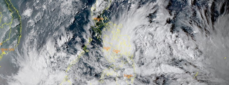
Featured image: Tropical Depression Agaton at 08:10 UTC on April 9, 2022. Credit: JMA/Himawari-8, RAMMB/CIRA, TW
A cluster of heavy showers produced by Tropical Depression “Agaton” is impacting the eastern islands of the Visayas, Philippines on April 9, 2022.
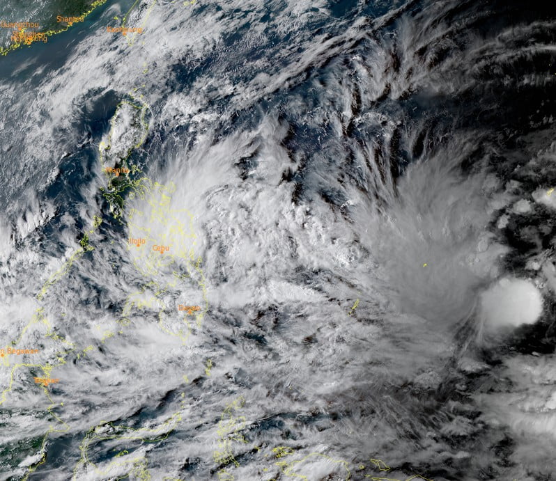
The system is likely to become a tropical storm tomorrow as it slowly moves towards the east-northeast, and will be completely devoured by the influence of the much larger Tropical Storm “Malakas” early next week.
In the meantime, Agaton could produce life-threatening flash flooding and landslides in Samar, Leyte, and Siargao as well as further afield, Force Thirteen reports.
Samar could receive isolated rainfall amounts of over 800 mm (31 inches).
At 08:00 UTC on April 9, the center of Tropical Depression “Agaton” was estimated based on all available data 130 km (80 miles) ESE of Guiuan, Eastern Samar. Its maximum sustained winds were 55 km/h (34 mph), with gusts to 70 km/h (43 mph), and a central pressure of 1 002 hPa.1
TCWS #1 is in effect for Eastern Samar, Visayas and Dinagat Islands and Siargao and Bucas Grande Islands, Mindanao.
Hazards affecting land areas
Heavy rainfall
Today through tomorrow morning (LT): Moderate to heavy with at times intense rains over Eastern Visayas and Dinagat Islands. Light to moderate with at times heavy rains over Masbate, Sorsogon, and the rest of Visayas and Mindanao.
Tomorrow morning through Monday morning (LT): Moderate to heavy with at times intense rains over Eastern Visayas, Dinagat Islands, Surigao del Norte, and the northern portion of Cebu including Bantayan and Camotes Islands. Light to moderate with at times heavy rains over Masbate, Sorsogon, and the rest of Visayas and Mindanao.
Under these conditions and considering significant antecedent rainfall, scattered to widespread flooding
(including flooding) and rain-induced landslides are expected especially in areas that are highly or very highly susceptible to these hazard as identified in hazard maps.
Severe winds
Strong winds (strong breeze to near gale conditions) will be experienced within any of the areas where TCWS #1 is currently in effect during the passage of the tropical depression.
Based on the projected intensity and wind radii of “AGATON”, there is a moderate likelihood that the hoisted wind signals in some localities in Eastern Visayas and Caraga will be upgraded to TCWS #2.
Hazards affecting coastal waters
Over the next 24 hours, rough to very rough seas (2.8 to 4 m / 9 – 13 feet) will prevail over the seaboards of areas where TCWS #1 is hoisted and the northern and eastern coastal waters of Northern Samar. These conditions may be risky for most seacrafts.
Mariners of small seacrafts are advised to remain in port or take shelter, while those operating larger vessels are advised to take precautionary measures when venturing out to sea and, if possible, avoid navigating in these conditions.
Under the influence of the prevailing northeasterly wind flow, a Gale Warning remains in effect for several coastal waters not under any wind signal, specifically the northern and western seaboards of Northern Luzon.
Moderate to rough seas (1.2 to 3.4 m / 3.9 – 11.1 feet)) will also prevail over the remaining seaboards of the country that are not under any wind signal or gale warning. These conditions may be risky for those using small seacrafts. Mariners are advised to take precautionary measures when venturing out to sea and, if possible, avoid navigating in these conditions.
References:
1 TROPICAL CYCLONE BULLETIN NO. 5 – Tropical Depression “AGATON” – Issued at 5:00 PM, 09 April 2022
I'm a dedicated researcher, journalist, and editor at The Watchers. With over 20 years of experience in the media industry, I specialize in hard science news, focusing on extreme weather, seismic and volcanic activity, space weather, and astronomy, including near-Earth objects and planetary defense strategies. You can reach me at teo /at/ watchers.news.
Commenting rules and guidelines
We value the thoughts and opinions of our readers and welcome healthy discussions on our website. In order to maintain a respectful and positive community, we ask that all commenters follow these rules.