
Deep M6.4 earthquake hits Mindanao, Philippines
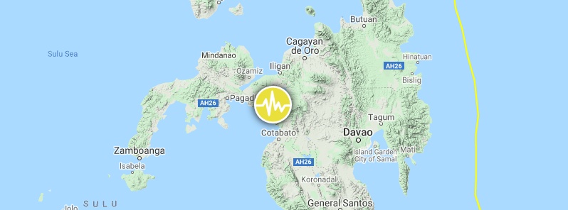
Image credit: TW/SAM, Google
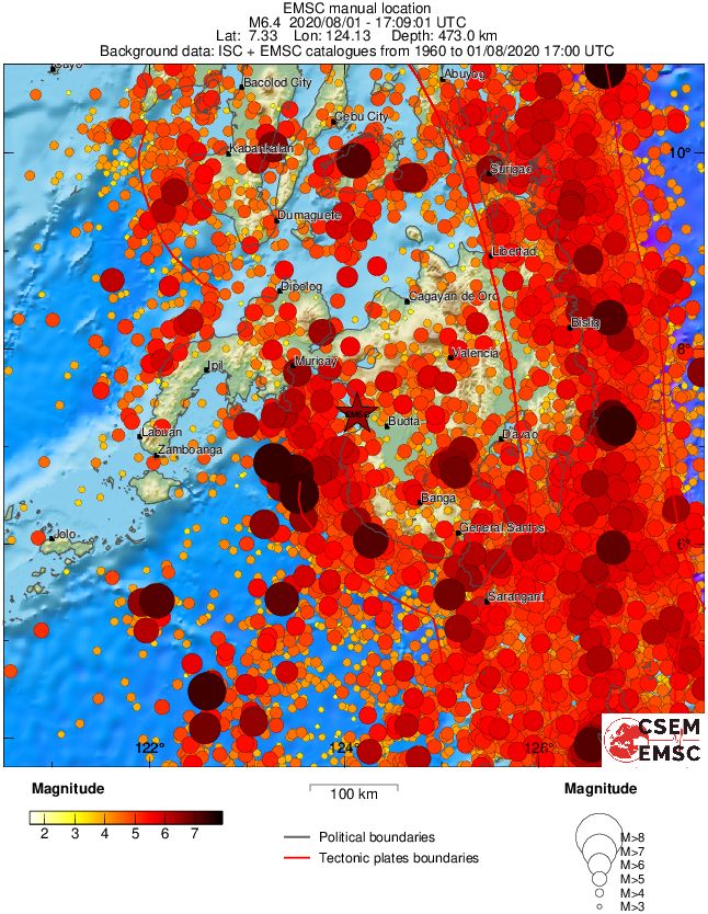
A deep earthquake registered by the USGS as M6.4 hit Mindanao, Philippines at 17:09 UTC on August 1, 2020 (01:09 LT, August 2). The agency is reporting a depth of 479 km (297 miles). PHIVOLCS registered it as M6.1 at a depth of 489 km (303 miles); EMSC as M6.4 at 473 km (293 miles).
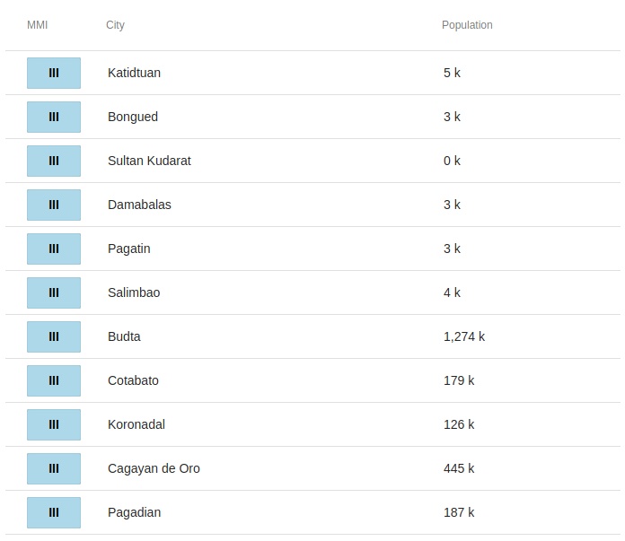
The epicenter was located 10.3 km (6.4 miles) WSW of Polloc (population 3 140), 14.5 km (9.0 miles) NW of Cotabato (population 179 433), 15.9 km (9.9 miles) WSW of Parang (population 44 930), 31.5 km (19.5 miles) W of Pigcawayan (population 11 420), and 31.9 km (19.8 miles) NW of Pagalungan (population 31 052), Philippines.
There are 5 720 000 people living within 100 km (62 miles).
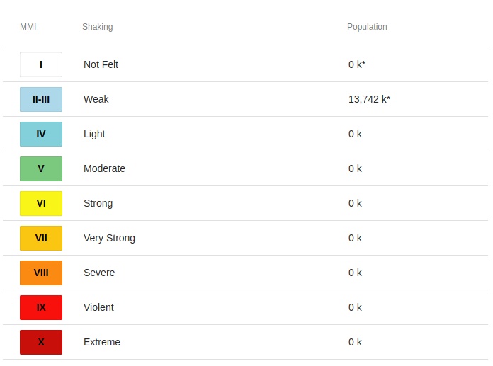
13 742 000 people are estimated to have felt weak shaking.
There is no tsunami threat from this earthquake.
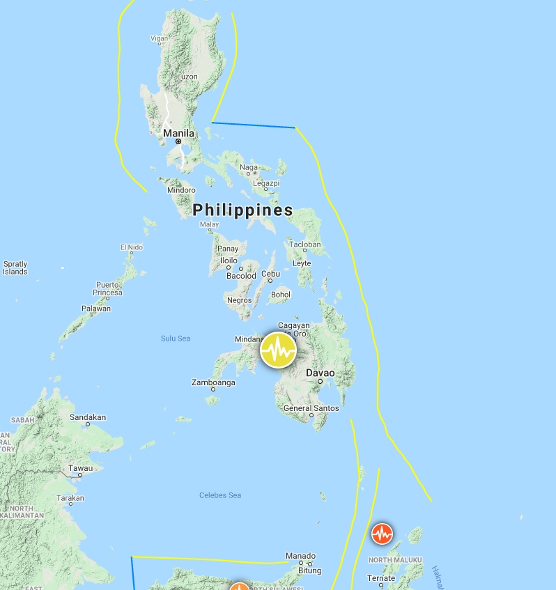
Image credit: TW/SAM, Google
The USGS issued a green alert for shaking-related fatalities and economic losses. There is a low likelihood of casualties and damage.
Overall, the population in this region resides in structures that are a mix of vulnerable and earthquake-resistant construction. The predominant vulnerable building types are unknown/miscellaneous types and heavy wood frame construction.
Recent earthquakes in this area have caused secondary hazards such as landslides that might have contributed to losses.
Estimated population exposure to earthquake shaking
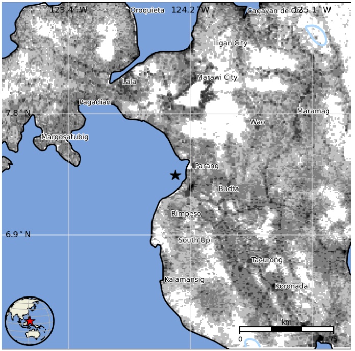
Selected cities exposed
Regional seismicity
I'm a dedicated researcher, journalist, and editor at The Watchers. With over 20 years of experience in the media industry, I specialize in hard science news, focusing on extreme weather, seismic and volcanic activity, space weather, and astronomy, including near-Earth objects and planetary defense strategies. You can reach me at teo /at/ watchers.news.
Commenting rules and guidelines
We value the thoughts and opinions of our readers and welcome healthy discussions on our website. In order to maintain a respectful and positive community, we ask that all commenters follow these rules.