
Strong and shallow M6.1 earthquake hits near the coast of Mindanao, Philippines
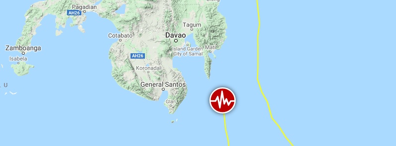
Image credit: Google, TW/SAM
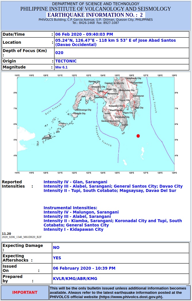
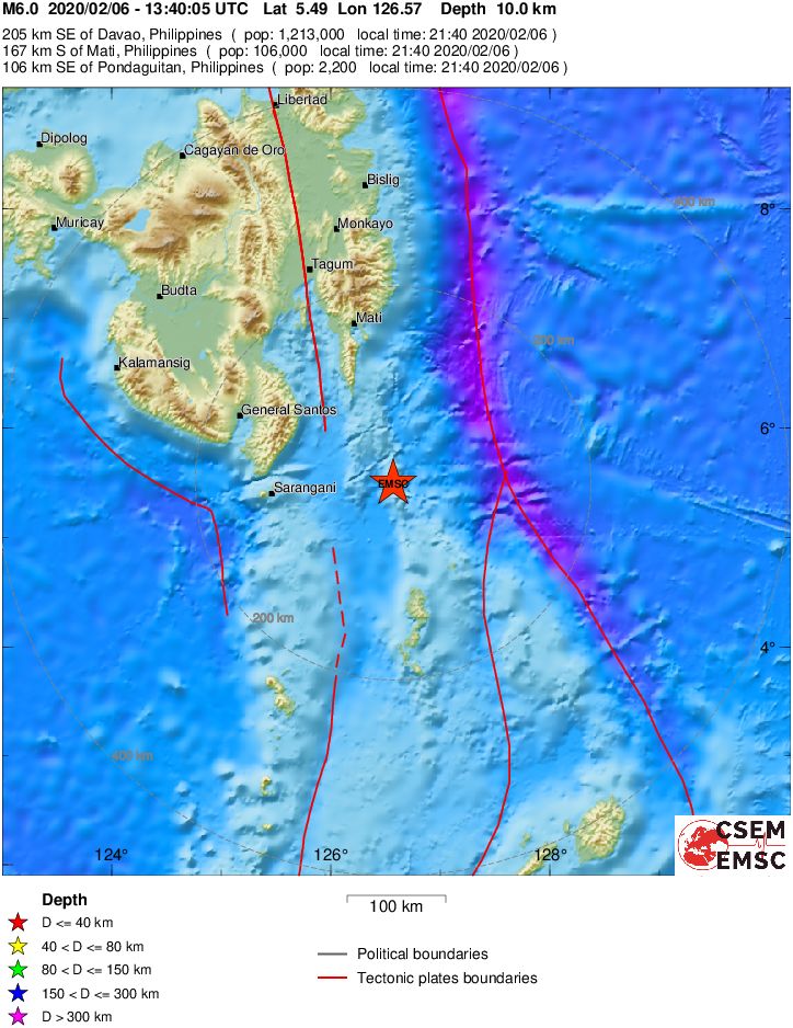
A strong and shallow earthquake registered by the PHIVOLCS as M6.1 (preliminary) hit near the coast of Mindanao, Philippines at 13:40 UTC (21:40 LT) on February 6, 2020. The agency is reporting a depth of 20 km (12.4 miles). The USGS is reporting M6.0 at a depth of 43 km (27 miles); EMSC M6.0 at a depth of 10 km (6.2 miles).
The epicenter was located 205 km (127 miles) SE of Davao (population 1 213 000) and 167 km (104 miles) S of Mati, Philippines.
There are about 600 people living within 100 km (62 miles).
333 000 people are estimated to have felt light shaking and 370 000 weak.
The USGS issued a green alert for shaking-related fatalities and economic losses. There is a low likelihood of casualties and damage.
Overall, the population in this region resides in structures that are a mix of vulnerable and earthquake-resistant construction. The predominant vulnerable building types are unknown/miscellaneous types and heavy wood frame construction.
Recent earthquakes in this area have caused secondary hazards such as landslides that might have contributed to losses.
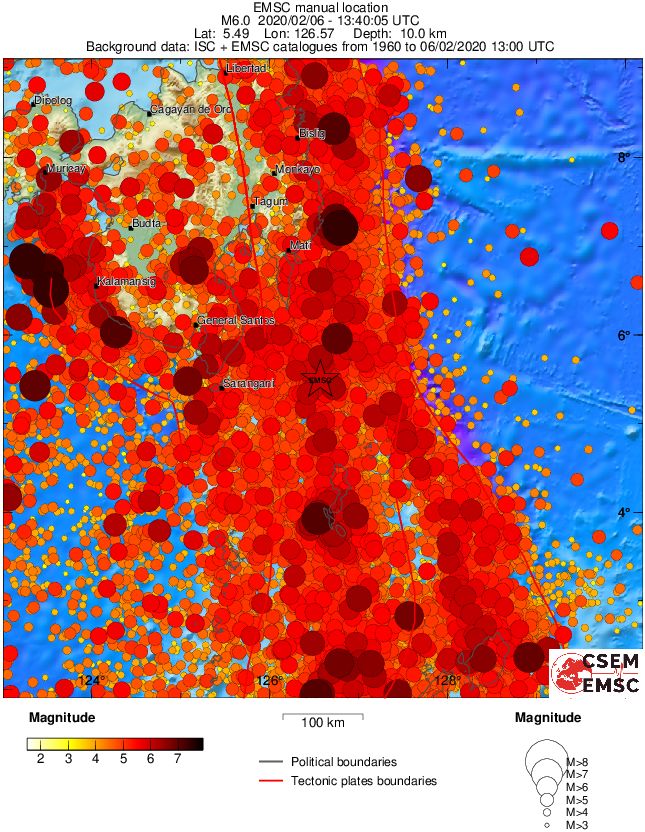
Regional seismicity
I'm a dedicated researcher, journalist, and editor at The Watchers. With over 20 years of experience in the media industry, I specialize in hard science news, focusing on extreme weather, seismic and volcanic activity, space weather, and astronomy, including near-Earth objects and planetary defense strategies. You can reach me at teo /at/ watchers.news.
Commenting rules and guidelines
We value the thoughts and opinions of our readers and welcome healthy discussions on our website. In order to maintain a respectful and positive community, we ask that all commenters follow these rules.