
Tropical Cyclone “Damien” forms near Western Australia, severe impact expected on February 8
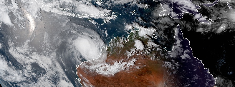
Featured image: Tropical Cyclone "Damien" at 08:30 UTC on February 6, 2020. Credit: JMA/Himawari-8, RAMMB/CIRA
Tropical Cyclone "Damien" formed near Kimberley coast, Western Australia on Thursday, February 6, 2020. It is forecast to hit the Pilbara coast, WA as Category 3 cyclone on the Australian tropical cyclone scale on February 8. Very destructive wind gusts and very dangerous storm tide are expected, followed by likely very dangerous flooding. This is the third named storm of the 2019/20 Australian region cyclone season.
The tropical cyclone should continue to intensify as it tracks to the west southwest overnight Thursday, according to the Australian Bureau of Meteorology (BOM). Damien is expected to turn south towards the Pilbara coast on Friday. A severe tropical cyclone impact is forecast for the Pilbara coast during Saturday.
At 09:00 UTC (17:00 AWST) on Thursday, February 6, the center of Tropical Cyclone "Damien" was located about 355 km (220 miles) NNE of Port Hedland and 475 km (295 miles) NE of Karratha. The cyclone had sustained winds near the center of 75 km/h (46 mph) and gusts to 100 km/h (62 mph). It was moving WSW at 16 km/h (10 mph).
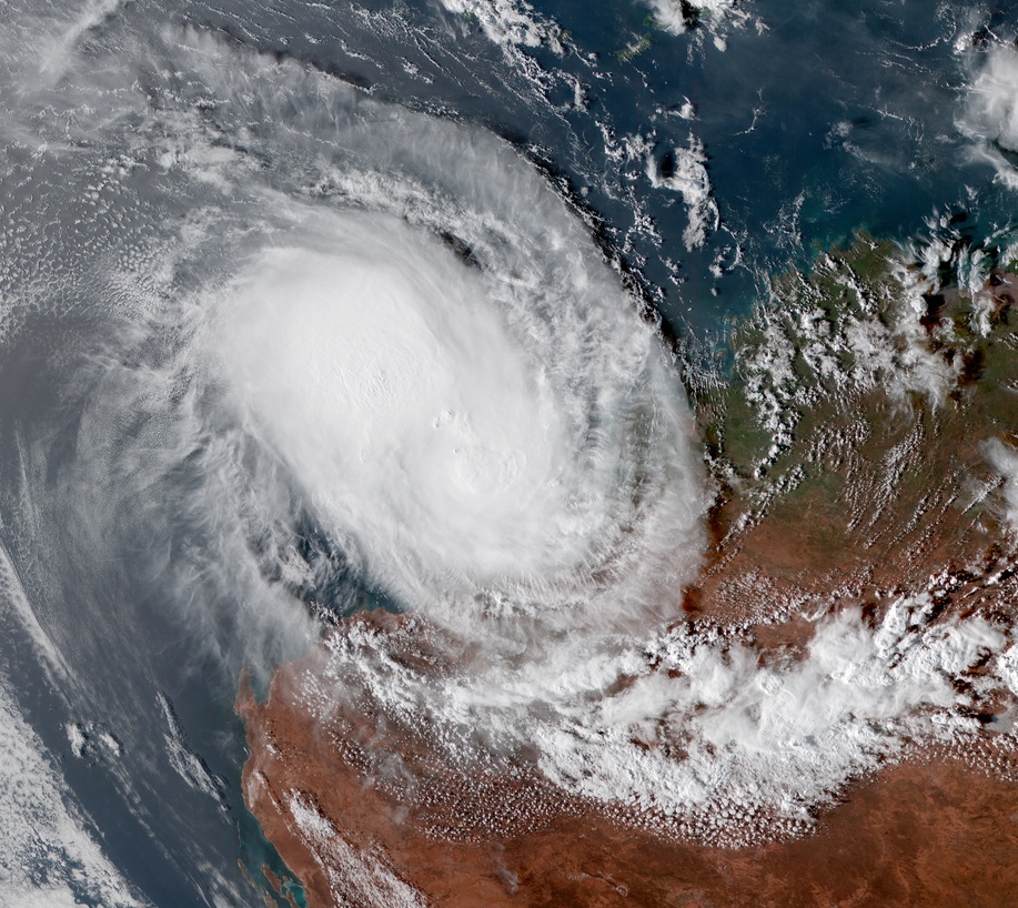
Tropical Cyclone "Damien" at 08:40 UTC on February 6, 2020. Credit: JMA/Himawari-8, RAMMB/CIRA
Gales are forecast to develop along the Pilbara coast between Wallal Downs and Dampier including Port Hedland and Karratha from later Friday afternoon.
Destructive winds with wind gusts to 150 km/h (93 mph) may develop overnight Friday night as the cyclone approaches the coast, increasing further on Saturday with very destructive winds with wind gusts to 230 km/h (145 mph) near the center of the cyclone.
If Damien tracks further to the west then gales may develop Saturday morning west of Dampier to Onslow.
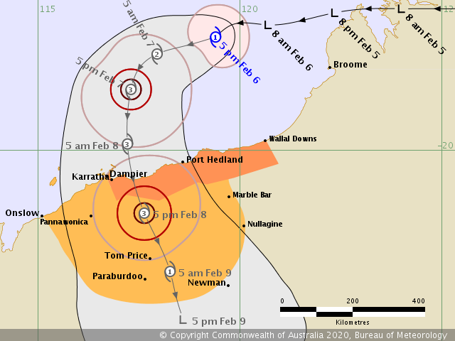
Residents between Dampier and Wallal Downs, including Karratha and Port Hedland, are warned of the potential of a very dangerous storm tide as the cyclone center crosses the coast.
Tides are likely to rise significantly above the normal high tide mark with damaging waves and very dangerous flooding.
Heavy rain is likely to cause flooding in the Pilbara and Gascoyne as the cyclone moves inland over the weekend.
Forecast models
I'm a dedicated researcher, journalist, and editor at The Watchers. With over 20 years of experience in the media industry, I specialize in hard science news, focusing on extreme weather, seismic and volcanic activity, space weather, and astronomy, including near-Earth objects and planetary defense strategies. You can reach me at teo /at/ watchers.news.
Commenting rules and guidelines
We value the thoughts and opinions of our readers and welcome healthy discussions on our website. In order to maintain a respectful and positive community, we ask that all commenters follow these rules.