
Massive flooding sweeps through 22 areas in South Trinidad
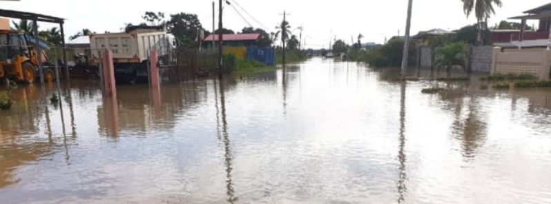
Image credit: Ministry of Rural Development and Local Government
Incessant heavy rain battered parts of South Trinidad beginning Tuesday, December 10, 2019, flooding roads and homes across 22 areas. Chairman of the Penal/Debe Regional Corporation (PDRC) Dr. Allen Sammy described the situation as the "worst ever". Trinidad and Tobago Meteorological Service said Penal recorded 127 mm (5 inches) of rain in two days.
"The people on the ground say it is the worst they have ever seen. There is flooding in areas that do not normally flood. The water is rising, and that is frightening. It does not look too good," Sammy stated.
Communities in the PDRC were affected badly. As of December 13, at least 15 families have been evacuated.
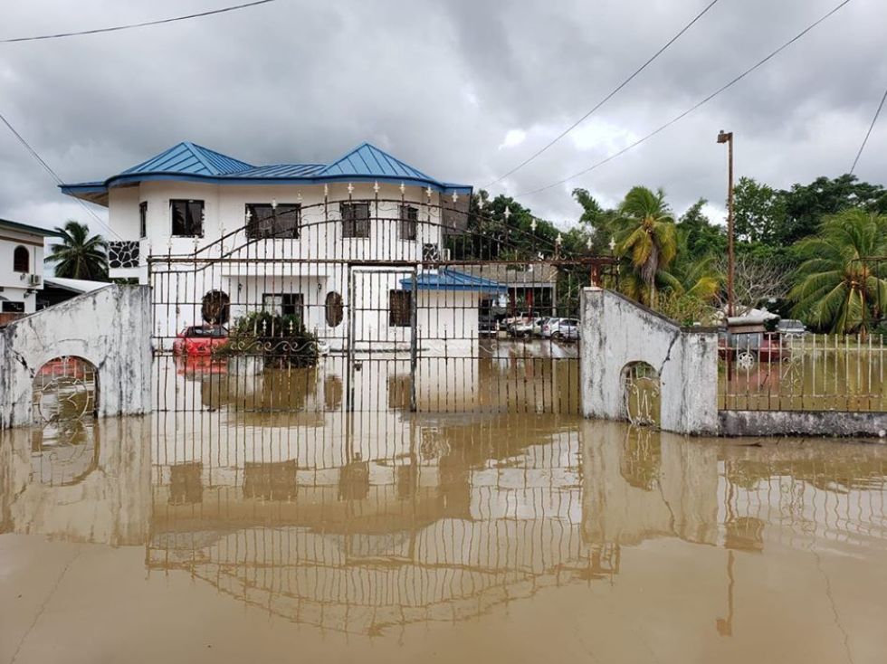
Image credit: PDRC
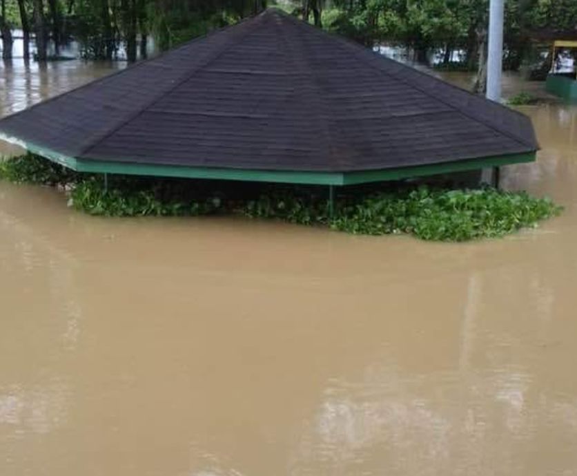
Image credit: PDRC
Image credit: PDRC
Schools and businesses were closed, and floodwaters engulfed most of Clarke Road, Penal Rock Road, Derrick Road, Lalbeharry Trace, Papourie Road, Lower Barrackpore, Hassanali Trace, Clarke Road, Katwaroo Trace, Digity Trace, Batchya, Laltoo Trace, Mohess Road, Ramdharry Trace, Ali Avenue and Community Street in Penal.
"Shelters are open. However, some roads remain impassable to low vehicles. Disaster Management officials are on the ground and continue to partner with the Trinidad and Tobago Defence Force to assist residents who are stranded," said Trinidad and Tobago's Ministry of Rural Development and Local Government.
Livestock farmers expressed devastation over losses.
"The yam gone, the dasheen gone. The doors gone, ducks and all the young goats in water, the hogs drowning. I bring up the cattle and now I come to see how much of the 100 plus ducks in that cage there. The common fowl in the water now. I don't know how many of them will die," farmer Nathaniel Mungal said.
Moreover, at caged chickens drowned at Boodoo's chicken depot, where water was at 1.2 m (4 feet).
"We cannot sell and we have to secure the chickens. We cannot say for sure yet how many drowned," a worker said.
The meteorological service initially issued several yellow level flood warnings, but it had been upgraded to an orange level as floodwaters are still rising in particular areas.
Furthermore, the Caroni River was at maximum capacity and had overflowed its banks into low lying nearby areas. In Siparia, the flooding was caused by the swelling of the Tunaco River.
"Right now we standing in waist height water. The deep freeze floating," said one resident.
Over 600 Community Emergency Response Team (CERT) volunteers trained by the Ministry in emergency response have participated in relief efforts. The Disaster Management Units of the Corporation were activated, and 10 councilors were on the field.
Commenting rules and guidelines
We value the thoughts and opinions of our readers and welcome healthy discussions on our website. In order to maintain a respectful and positive community, we ask that all commenters follow these rules.