
Oil spill from Tobago spreads over 160 km towards Grenada’s marine area
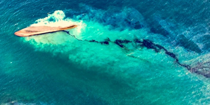
Image credit: Office of the Chief Secretary of Tobago. Acquired on February 11, 2024
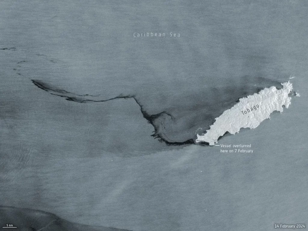
Satellite images from the Copernicus Sentinel-1 mission have revealed the scale of an oil spill off Trinidad and Tobago’s coast, following the Gulfstream shipwreck. The spill has extended over 160 km (100 miles) westwards a week after the incident, threatening neighboring marine areas.
A maritime disaster occurred off the southern shores of Tobago Island on February 7, 2024, when an unidentified vessel ran aground and overturned, leading to a significant oil spill in the surrounding waters. The resulting spill has coated beaches and wildlife, leading the government to declare a national emergency.
The vessel involved in the oil spill off Trinidad and Tobago’s coast, initially identified as the “Gulfstream,” has been a subject of investigation due to the absence of an International Maritime Organization (IMO) registration number.
Research, including contributions from volunteers in Bellingcat’s Discord community, indicates that the vessel is likely an unpowered barge, part of an articulated tug and barge system, explaining the lack of a registration number.
Trinidad and Tobago’s Ministry of National Security announced on February 14 that two vessels were implicated in the incident: a tugboat named Solo Creed, en route from Panama to Guyana, and an unnamed barge, identified as the source of the “black, oily deposits” observed off the Tobago coast.
Satellite imagery provided by the Copernicus Sentinel-1 mission has played a crucial role in understanding the extent of the spill, which has now spread over 160 km (100 miles) westwards from the incident site.
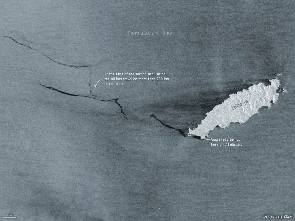
The latest images, captured on February 14 at 22:18 UTC, show the spill moving out of Trinidad and Tobago’s marine jurisdiction and encroaching upon the southern marine area of Grenada. This development raises concerns about the potential environmental impact on Grenada’s waters and the broader implications for neighboring Venezuela.
Radar aboard Sentinel-1, renowned for its effectiveness in monitoring oil spills, has been instrumental in tracking the spill’s progression. The technology’s ability to detect changes in surface texture due to oil’s dampening effect on sea waves has allowed for clear visualization of the spill as dark smears against the ocean’s grey background.
In response to the disaster, national authorities, including the Office of Disaster Preparedness and Management, have activated the International Charter Space and Major Disasters. This activation aims to coordinate satellite imagery analysis and facilitate timely and effective monitoring efforts to mitigate the spill’s environmental consequences.
References:
1 Identifying the Mystery Vessel at the Site of Trinidad & Tobago’s National Emergency Oil Spill – Bellingcat – February 14, 2024
2 Tobago oil spill – ESA – February 16, 2024
I'm a dedicated researcher, journalist, and editor at The Watchers. With over 20 years of experience in the media industry, I specialize in hard science news, focusing on extreme weather, seismic and volcanic activity, space weather, and astronomy, including near-Earth objects and planetary defense strategies. You can reach me at teo /at/ watchers.news.
Commenting rules and guidelines
We value the thoughts and opinions of our readers and welcome healthy discussions on our website. In order to maintain a respectful and positive community, we ask that all commenters follow these rules.