
Tinakula volcano in Solomon Islands erupts, sending lava toward the ocean
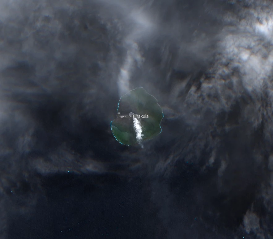
Featured image: Tinakula volcano, Solomon Islands on March 11, 2024. Credit: Copernicus EU/Sentinel-2, EO Browser, The Watchers
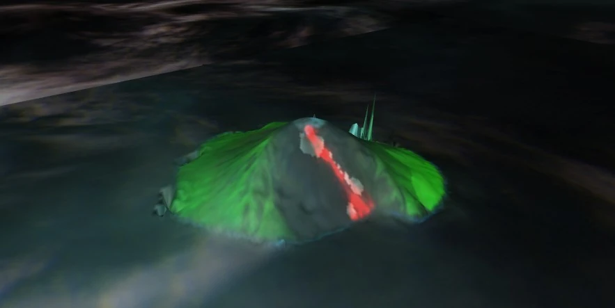
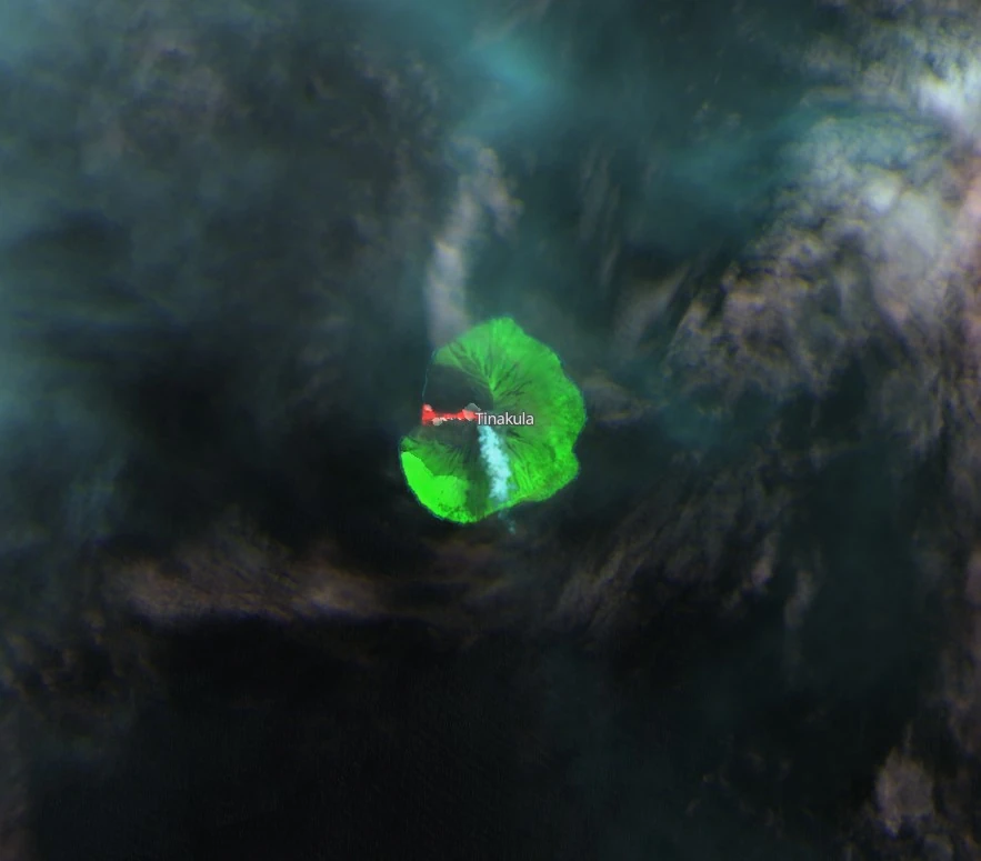
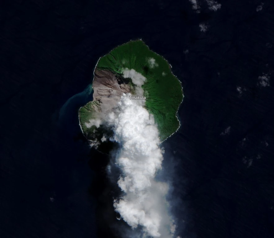
Sentinel-2 satellite image acquired on March 11, 2024, shows Tinakula Volcano in the Solomon Islands undergoing a new effusive eruption, with lava flowing about 1 km down its western slope into the ocean. This eruption continues the activity that began in December 2018.
Sentinel-2 satellite image, obtained on March 11, 2024, has revealed an ongoing effusive eruption at the Tinakula Volcano, located in the Solomon Islands. The imagery showed lava emerging from the summit vent and traveling roughly 1 km (0.6 miles) down the volcano’s western slope to meet the ocean.
This recent activity is part of an eruptive period that commenced in December 2018, following a significant eruption from October 21 – 26, 2017, which was rated at a Volcanic Explosivity Index (VEI) of 3.
Tinakula, a small island approximately 3.5 km (2.17 miles) in width, represents the visible peak of a vast stratovolcano situated at the northwest end of the Santa Cruz islands.
The volcano’s geological structure is notable for a breached summit crater that extends from the peak to below sea level.
A significant landslide in 1965 expanded this breach, creating an embayment on the northwest coast and revealing the Mendana cone on the island’s southeast side. The volcano, primarily composed of andesitic material, has been active since the Spanish began exploration in the 16th century, with frequent eruptions recorded.
An explosive event around 1840 is believed to have generated pyroclastic flows that devastated the island, resulting in the loss of its then-inhabitants. Subsequent eruptions have typically originated from a cone within the large breached crater.
These events have consistently left the upper flanks of Tinakula and the steep slopes within the breach devoid of vegetation, covered instead by lava flows and volcaniclastic debris:
References:
1 Tinakula – Geological summary – GVP
I'm a dedicated researcher, journalist, and editor at The Watchers. With over 20 years of experience in the media industry, I specialize in hard science news, focusing on extreme weather, seismic and volcanic activity, space weather, and astronomy, including near-Earth objects and planetary defense strategies. You can reach me at teo /at/ watchers.news.
Commenting rules and guidelines
We value the thoughts and opinions of our readers and welcome healthy discussions on our website. In order to maintain a respectful and positive community, we ask that all commenters follow these rules.