
Increased seismicity and inflation at Awu volcano, Alert Level raised to 3, Indonesia
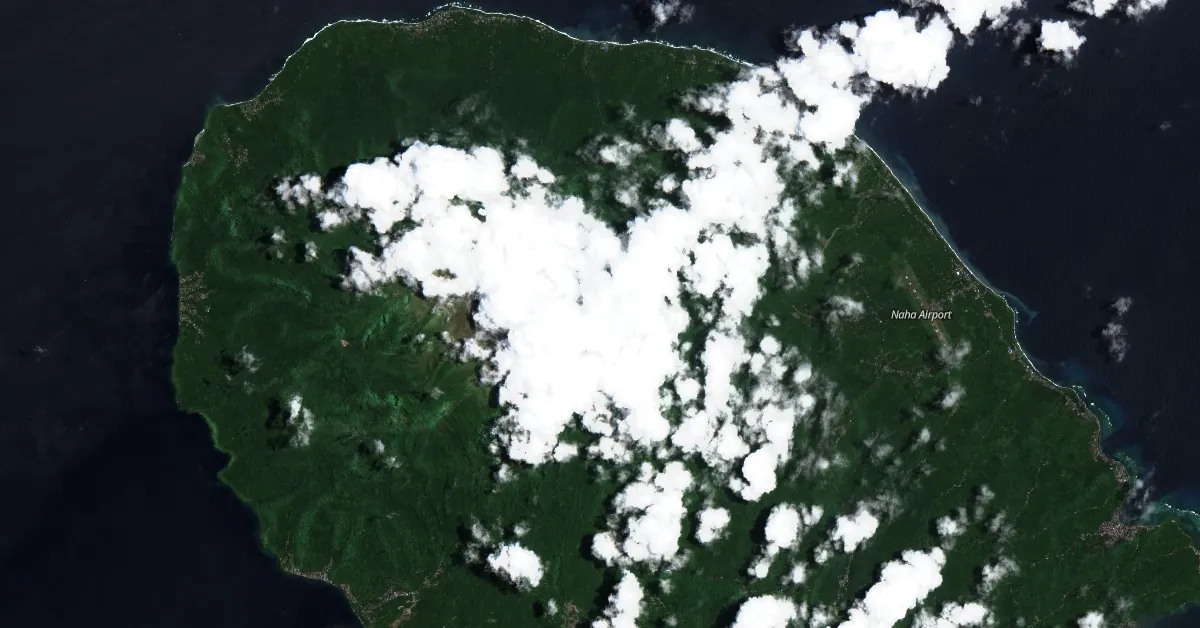
Featured image: Awu volcano on April 2, 2024. Credit: Copernicus EU/Sentinel-2, The Watchers
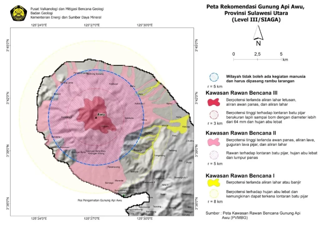
Increased seismic activity and inflation detected at Awu Volcano prompted Indonesian authorities to elevate the alert level from 2 to 3 on April 16, 2024. The Center for Volcanology and Geological Hazard Mitigation (PVMBG) has advised the public to maintain a distance of at least 5 km (3.1 miles) from the crater due to potential explosive eruptions. The last eruption at this volcano took place in 2004 (VEI 2).
PVMBG reported notable changes in seismic patterns beginning March 22, with a further increase from April 10 to April 15, 2024. The observed seismic activity included 284 shallow volcanic earthquakes, 71 deep volcanic earthquakes, 14 local tectonic earthquakes, and 252 deep tectonic earthquakes, signaling a substantial shift in volcanic behavior.
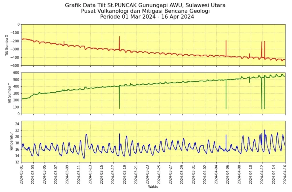
Instrumental measurements from tiltmeters at two stations detected ground inflation between March 1 and March 16, indicating magma movement toward the surface. This underground movement has not yet resulted in visible changes at the surface; however, the PVMBG has noted that such conditions could lead to sudden visual manifestations at any moment.
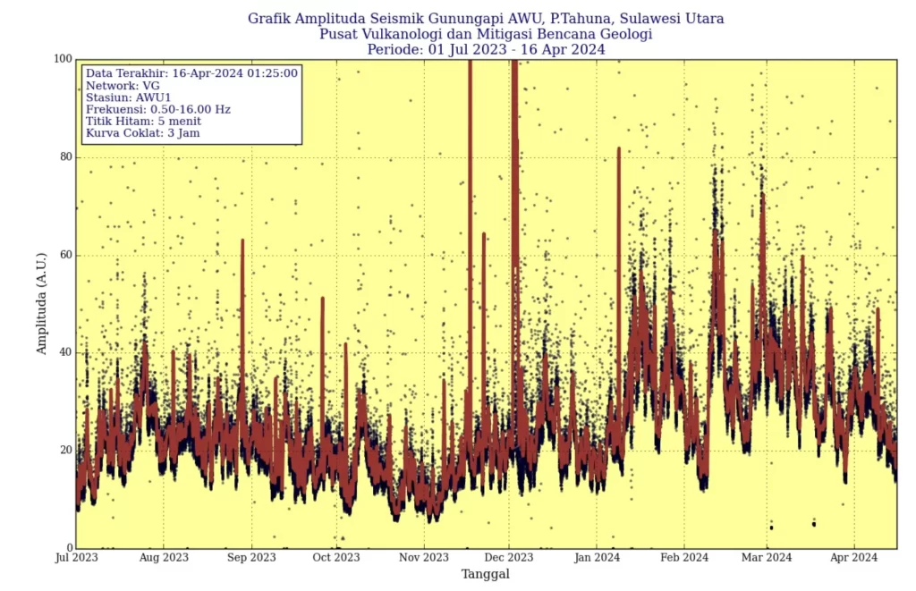
The current seismic and deformation data suggest an ongoing intrusion of magma at depth, which, along with the occurrence of intense local tectonic earthquakes, could precipitate enhanced volcanic activity. The accumulated seismic energy, measured by the Relative Seismic Amplitude Measurement (RSAM) from July 2023 to April 16, 2024, shows an increase compared to previous periods.
Residents and visitors are urged to comply with the safety radius of 5 km (3.1 miles) from the crater to mitigate risks of exposure to potential explosive activities.
The last eruptive period at Awu volcano lasted from June to August 2004 (VEI 2).
Historically, Awu Volcano has been highly active, with devastating eruptions in 1711, 1812, 1856, 1892, and 1966 that produced significant pyroclastic flows and lahars, leading to over 8 000 deaths.
The volcano features deep valleys that serve as channels for lahars and was built within a caldera spanning 4.5 km (2.8 miles) in width. Although a crater lake once existed at the summit, measuring 1 km (0.6 miles) in width and 172 m (564 feet) in depth in 1922, it was largely ejected during the 1966 eruption.
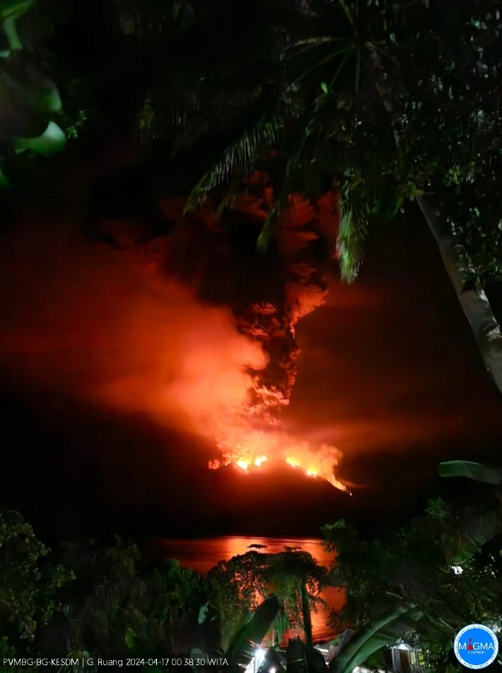
Awu is located about 150 km (93 miles) north of Ruang where violent explosive eruptions on April 16 and 17, 2024, forced thousands to evacuate and temporarily closed the Manado airport, located about 100 km (62 miles) SSE of the volcano. The eruptions sent volcanic ash up to 16.7 km (55 000 feet) above sea level. The Aviation Color Code was raised to Red and the Alert Level to 4 of 4.
References:
1 Penyampaian kenaikan tingkat aktivitas G. Awu, Sulawesi Utara dari Level II (Waspada) menjadi Level III (Siaga) – PVMGB – April 16, 2024
2 Awu volcano geological summary – GVP – Accessed April 18, 2024
I'm a dedicated researcher, journalist, and editor at The Watchers. With over 20 years of experience in the media industry, I specialize in hard science news, focusing on extreme weather, seismic and volcanic activity, space weather, and astronomy, including near-Earth objects and planetary defense strategies. You can reach me at teo /at/ watchers.news.
? — The last eruptive period at Awu volcano lasted from June to August 2024 (VEI 2).
Historically, Awu Volcano has been highly active, … —
Edited.