
Shallow M6.1 earthquake hits near the north coast of Papua, Indonesia
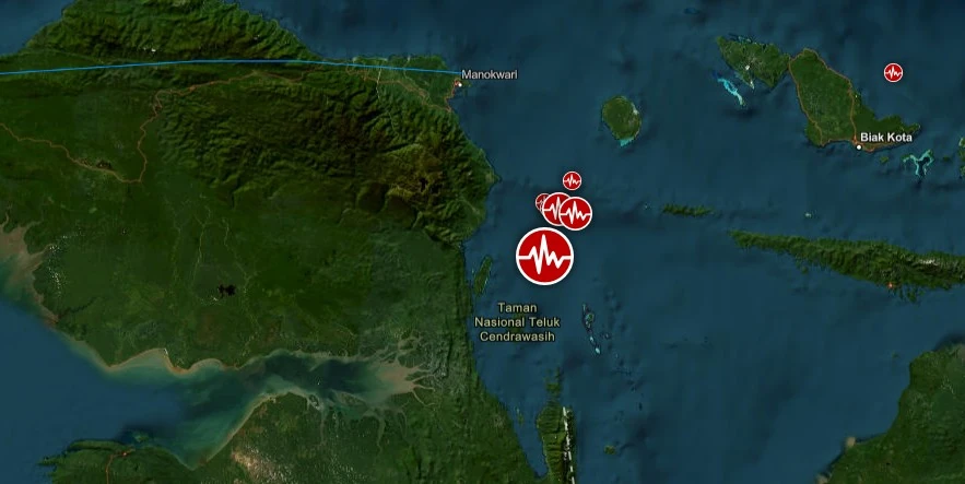
Image credit: TW/SAM, ESRI
A strong and shallow earthquake registered by the BMKG as M6.1 hit near the north coast of Papua, Indonesia at 00:02 UTC (07:02 LT) on April 9, 2024. The agency is reporting a depth of 10 km (6.2 miles). USGS is reporting M6.0 at a depth of 9 km (5.6 miles); EMSC M6.0 at a depth of 10 km (6.2 miles).
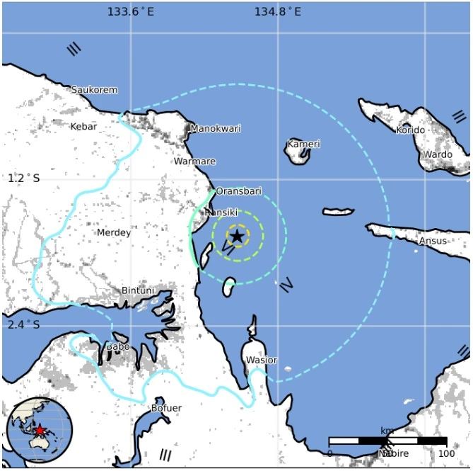
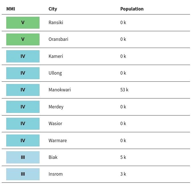
The epicenter was located 35.8 km (22.2 miles) ESE of Ransiki (population 16 245) and 100.5 km (62.5 miles) SSE of Manokwari (population 107 325), West Papua, Indonesia.
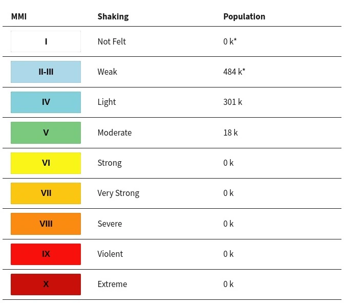
18 000 people are estimated to have felt moderate shaking and 301 000 light.
There is no tsunami threat from this earthquake.
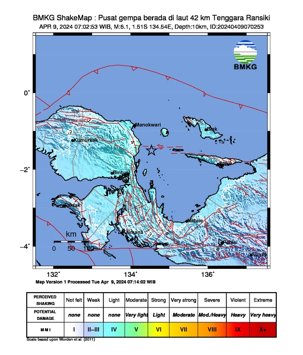
The USGS issued a Green alert for shaking-related fatalities and economic losses. There is a low likelihood of casualties and damage.
Overall, the population in this region resides in structures that are vulnerable to earthquake shaking, though resistant structures exist. The predominant vulnerable building types are unreinforced brick with concrete floor and precast concrete frame with wall construction.
Recent earthquakes in this area have caused secondary hazards such as landslides, fires, and liquefaction that might have contributed to losses.
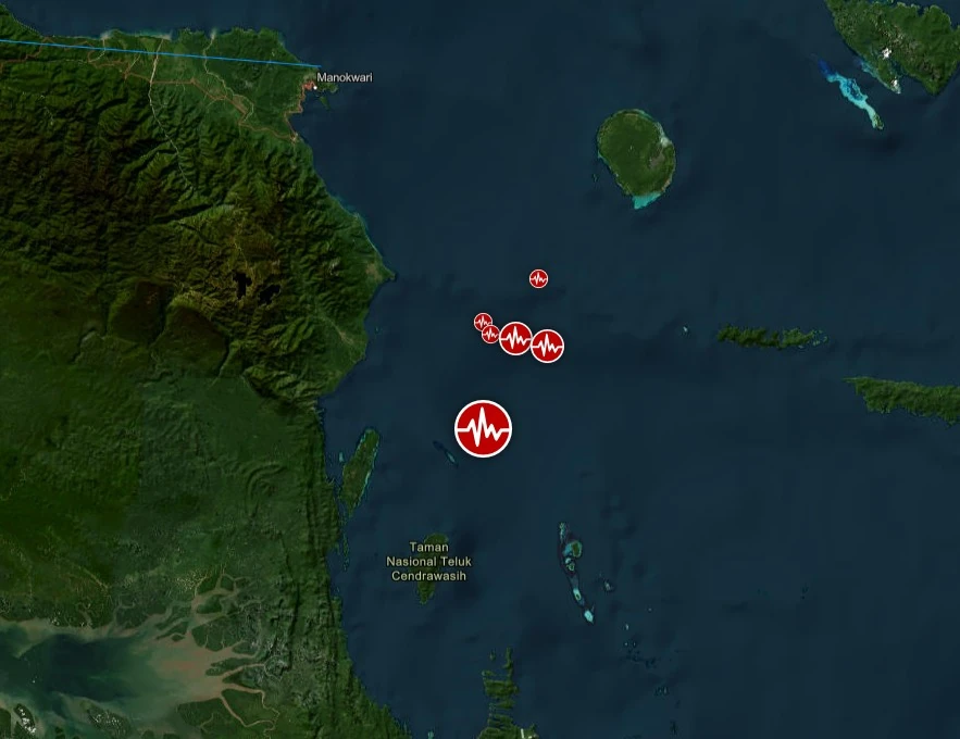
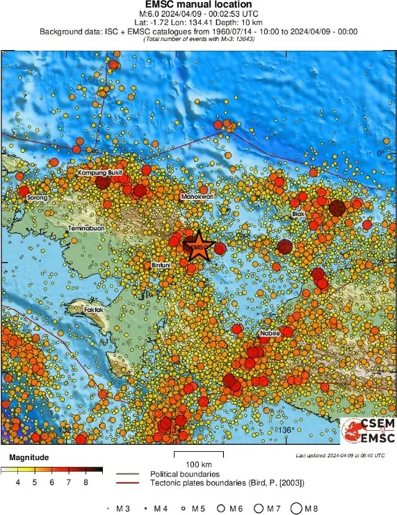
According to the BMKG, the quake was preceded by M3.4 at 18:10 UTC on April 8 and followed by M3.9 at 00:16 UTC on April 9, M2.7 at 00:30 UTC, M3.7 at 03:43 UTC, M4.3 at 04:29 UTC and M4.9 at 05:14 UTC.
Estimated population exposure to earthquake shaking
Selected cities exposed
Regional seismicity
I'm a dedicated researcher, journalist, and editor at The Watchers. With over 20 years of experience in the media industry, I specialize in hard science news, focusing on extreme weather, seismic and volcanic activity, space weather, and astronomy, including near-Earth objects and planetary defense strategies. You can reach me at teo /at/ watchers.news.
Commenting rules and guidelines
We value the thoughts and opinions of our readers and welcome healthy discussions on our website. In order to maintain a respectful and positive community, we ask that all commenters follow these rules.