
Significant ground deformation triggers Yellow alert at Puyehue-Cordón Caulle volcanic complex, Chile
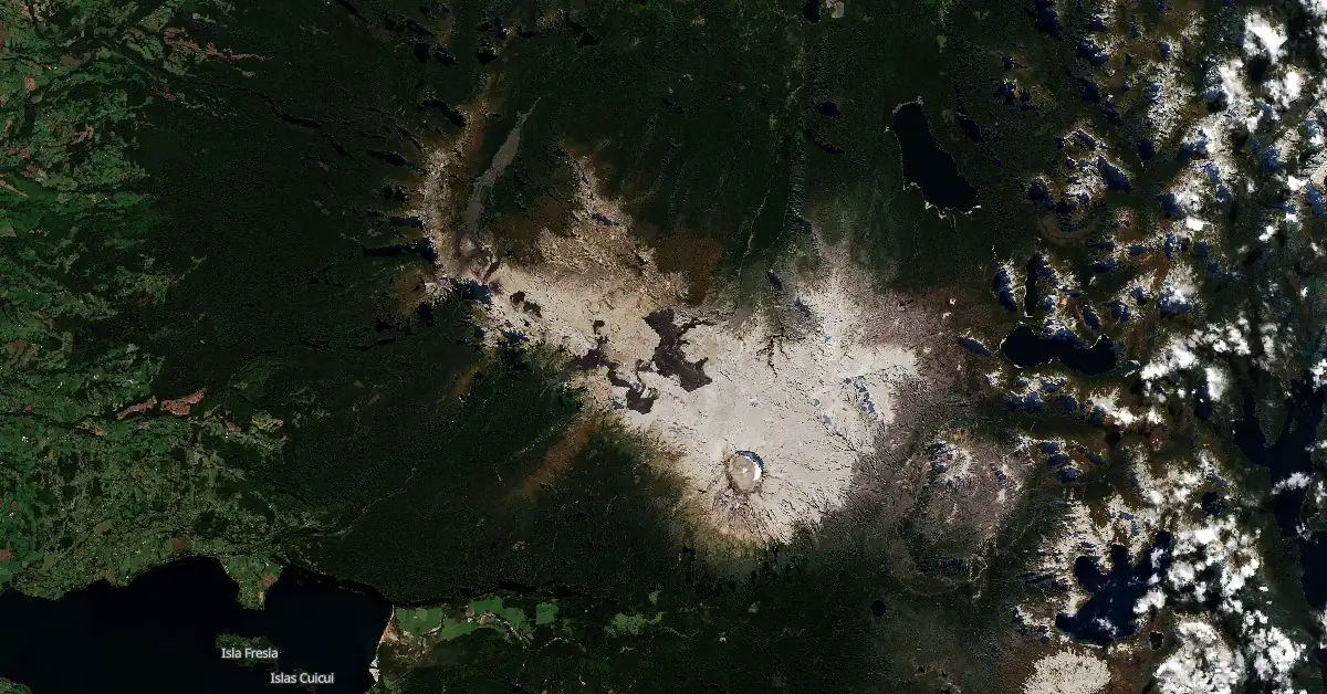
Featured image: Puyehue-Cordón Caulle volcanic complex on April 13, 2024. Credit: Copernicus EU/Sentinel-2, The Watchers
The Puyehue-Cordón Caulle Volcanic Complex in Chile was placed under a Yellow alert at 20:00 UTC on April 26, 2024. This decision followed observations of increased ground deformation linked to an active inflation zone, located 6 km (3.7 miles) west-northeast of the 2011 eruption site. Monitoring data have shown the highest deformation rates since measurements began, reaching up to 2.4 cm (0.95 inches) per month.
- The last eruptive period at this volcano lasted from June 2011 to April 2012 (VEI 5).
The National Geology and Mining Service of Chile (Sernageomin) has raised the alert level for the Puyehue-Cordón Caulle volcanic complex in Chile to Yellow on April 26, citing a significant increase in ground deformation. This deformation has been intensively monitored using GNSS stations and RADAR satellite images through In-SAR techniques.
Since 2012, an active inflation zone has been detected approximately 6 km (3.7 miles) west-northeast from the 2011 eruption’s emission center, where the maximum deformation is located. Recent measurements from the first months of 2024 have recorded vertical rise rates of up to 2.4 cm (0.95 inches) per month, the highest observed since monitoring efforts began.
The total vertical displacement at the nearest GNSS station, located 3 km (1.8 miles) from the inflation zone, has now reached 42 cm (16.5 inches).
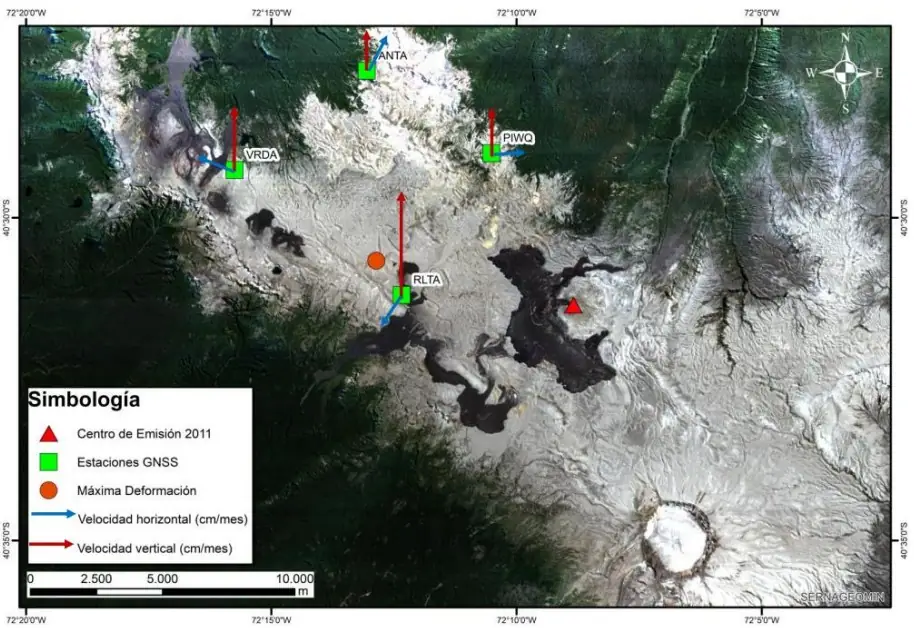
Additionally, the region has experienced an uptick in volcano-tectonic (VT) and hybrid (HB) seismic events of significant magnitudes (ML≥3.0) since mid-2020, predominantly associated with a shallow subsurface source near the 2011 eruption center. Despite the increased seismic activity, the movement of fluids within the volcanic structure remains low.
Near the 2011 eruption’s emission point, surface temperatures have been recorded at about 90 °C (194 °F), likely indicative of a shallow magmatic body left from the eruption. These conditions, while indicative of an active system, have not led to a significant destabilization of the volcanic system that would suggest an imminent eruptive process is underway.
Located entirely within Chile, specifically on the border of the Rivers and Lakes regions, the Puyehue-Cordón Caulle ranks fourth in Chile’s Volcanic Risk Ranking. Despite its elevated activity, there has been no reported impact on Argentine territory, with the closest Argentine communities—Villa La Angostura, San Carlos de Bariloche, San Martín de los Andes, and Villa Traful—located 50 to 100 km (31 – 62 miles) away.
Authorities continue to urge locals and visitors within proximity of the volcano, especially those at the Cardenal Samoré pass, merely 20 km (12.4 miles) from the eruptive center, to stay informed about the volcano’s status and any new developments.
This volcanic complex forms an extensive NW-SE-trending chain that spans from the late-Pleistocene to the Holocene, characterized by basaltic to rhyolitic compositions southeast of Lago Ranco. At the complex’s northwest end lies the Pleistocene Cordillera Nevada caldera, standing at 1 799 m (5 902 feet) and separated from the Puyehue stratovolcano at the southeast by the Cordón Caulle fissure complex.
Additionally, the Pleistocene Mencheca volcano, accompanied by Holocene flank cones, is located northeast of Puyehue. Of all the structures within the PCCVC, Puyehue volcano is noted for its exceptional geochemical diversity.
This flat-topped, 2 236 m (7 336 feet) high volcano was developed atop a 5 km (3.1 miles) wide caldera and is crowned by a 2.4 km (1.5 miles) wide Holocene summit caldera. Its eastern flank features lava flows and domes, predominantly of rhyolitic composition.
Historically, eruptions attributed to Puyehue, including significant events in 1921-22 and 1960, have since been reassigned to the Cordón Caulle rift zone. The Cordón Caulle geothermal area, which covers a 6 km x 13 km (3.7 miles x 8.1 miles) volcano-tectonic depression, represents the largest active geothermal region in the southern Andes volcanic zone.
References:
1 Reporte Especial de Actividad Volcanica (REAV) for Puyehue-Cordón Caull – Sernageomin – April 26, 2024
2 Special Volcanic Activity Report for Puyehue-Cordón Caulle – SegemAR – April 26, 2024
3 Puyehue-Cordón Caulle – Geological summary – GVP
I'm a dedicated researcher, journalist, and editor at The Watchers. With over 20 years of experience in the media industry, I specialize in hard science news, focusing on extreme weather, seismic and volcanic activity, space weather, and astronomy, including near-Earth objects and planetary defense strategies. You can reach me at teo /at/ watchers.news.
Commenting rules and guidelines
We value the thoughts and opinions of our readers and welcome healthy discussions on our website. In order to maintain a respectful and positive community, we ask that all commenters follow these rules.