
Powerful eruption of Tinakula volcano, ash to 10.7 km (35 000 feet), Solomon Islands
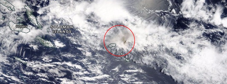
Featured image: Ash after the eruption of Tinakula volcano, Solomon Islands on October 20, 2017. Credit: NASA Terra/MODIS. Acquired October 21, 2017 Annotation: The Watchers
After more than 5 years of quiescence, a powerful eruption started at Tinakula volcano, Temoto Province, Solomon Islands at 19:20 UTC on October 20, 2017. A second eruption was registered at 23:40 UTC. Heavy ashfall was reported on nearby islands.
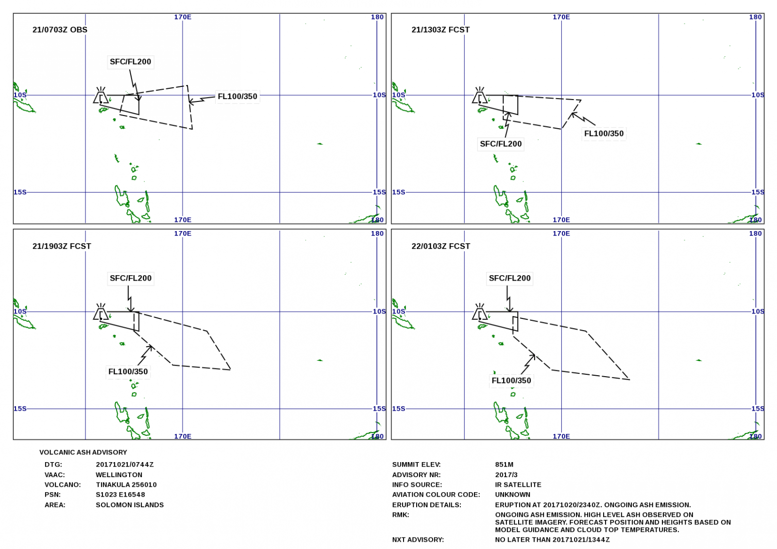
According to the Wellington VAAC, ash cloud was observed reaching an altitude of 35 000 feet (10.7 km) above sea level at 01:10 UTC on October 21, drifting east.
Authorities in the Solomon Islands are trying to work out if there's been any damage after a remote volcano erupted early this morning, Radio New Zealand reported. Villages on nearby islands have reported heavy ashfall.
Loti Yates, the director of the National Disaster Management Office in Honiara, said a police patrol had been deployed from the provincial capital, Lata. He said information had been slow to trickle out of the remote area, and it could be sometime before the full situation was known.
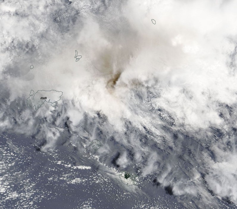
Ash after the eruption of Tinakula volcano, Solomon Islands on October 20, 2017. Credit: NASA Terra/MODIS. Acquired October 21, 2017
An aviation warning has been issued for the Santa Cruz area.
The last known eruption of this volcano, although incomparable to this one, took place in February 2012, after satellites detected thermal anomalies starting February 13. A gas plume and a possible ash content rose from the volcano on February 14 and 17.
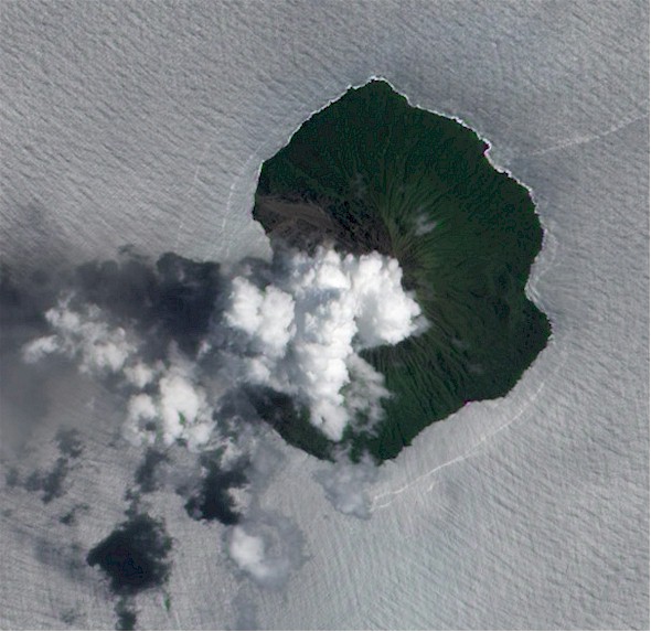
Tinakula eruption on February 17, 2017. Credit: NASA / Earth Observatory
Geological summary
The small 3.5-km-wide (2.2 miles) uninhabited island of Tinakula is the exposed summit of a massive stratovolcano that rises 3 – 4 km (1.9 – 2.5 miles) from the sea floor at the NW end of the Santa Cruz islands.
Tinakula resembles Stromboli volcano in containing a breached summit crater that extends from the 851-m-high (2 792 feet) summit to below sea level. Landslides enlarged this scarp in 1965, creating an embayment on the NW coast.
The satellitic cone of Mendana is located on the SE side. The dominantly andesitic Tinakula volcano has frequently been observed in eruption since the era of Spanish exploration began in 1595.
In about 1840, an explosive eruption apparently produced pyroclastic flows that swept all sides of the island, killing its inhabitants. Frequent historical eruptions have originated from a cone constructed within the large breached crater. These have left the upper flanks of the volcano and the steep apron of lava flows and volcaniclastic debris within the breach unvegetated.
I'm a dedicated researcher, journalist, and editor at The Watchers. With over 20 years of experience in the media industry, I specialize in hard science news, focusing on extreme weather, seismic and volcanic activity, space weather, and astronomy, including near-Earth objects and planetary defense strategies. You can reach me at teo /at/ watchers.news.
Commenting rules and guidelines
We value the thoughts and opinions of our readers and welcome healthy discussions on our website. In order to maintain a respectful and positive community, we ask that all commenters follow these rules.