
Gas emission observed over Mount Michael, South Atlantic Ocean
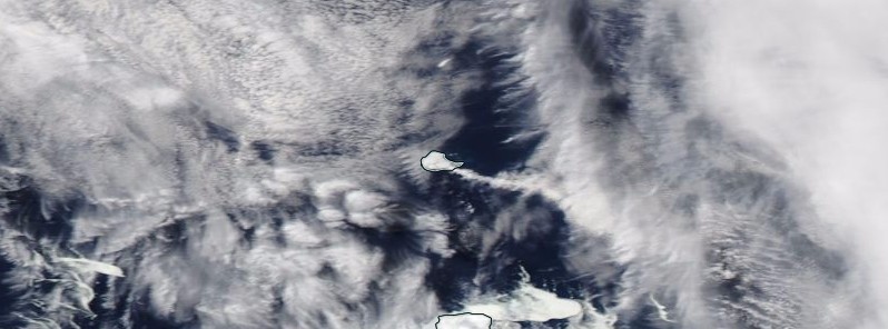
Featured image: Gas plume emanating from Mount Michael, Sounders volcano, the South Sandwich Islands on October 15, 2017. Credit: NASA Aqua/MODIS
Satellite images acquired October 15, 2017 show what appears to be a gas emission originating from Mount Michael on Saunders Island, South Atlantic Ocean. Prior to August 2015, the most recent eruptive activity detected was in the second half of 2012.
Gas emissions originating from Saunders Island also showed up in satellite images acquired on October 4 and 5. Possible aerosols drifting from Saunders Island showed in satellite images from October 17, 19 and 20, South Sandwich Islands Volcano Monitoring Blog reports.
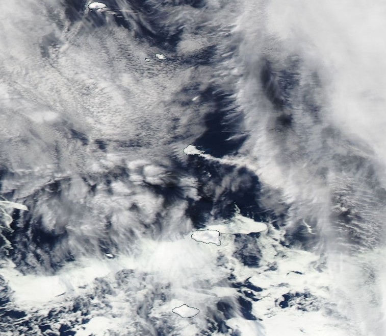
Gas plume emanating from Mount Michael, Sounders volcano, the South Sandwich Islands on October 15, 2017. Credit: NASA Aqua/MODIS
A gas plume originating from Mount Michael was also observed on August 18, 2017. A plume containing aerosols was observed on August 10.
The last entry in Smithsonian/USGS Global Volcanism Program's Weekly Reports database for this volcano was in October 2015. The MODVOLC thermal alert system detected thermal anomalies over Michael's summit crater during September 30 – October 7. Thermal alerts, however, started on August 28.
The previous entry was in October 2005. "The first MODVOLC alerts at Mount Michael since May 2003 recently began, indicating an increased level of activity in the island's summit crater (and presumed lava lake). The alerts occurred on October 3, 5, and 6."
Geological summary
Saunders Island is a volcanic structure consisting of a large central edifice intersected by two seamount chains, as shown by bathymetric mapping (Leat et al., 2013).
The young constructional Mount Michael stratovolcano dominates the glacier-covered island, while two submarine plateaus, Harpers Bank and Saunders Bank, extend north. The symmetrical Michael has a 500-m-wide (1 640 feet) summit crater and a remnant of a somma rim to the SE. Tephra layers visible in ice cliffs surrounding the island are evidence of recent eruptions.
Ash clouds were reported from the summit crater in 1819, and an effusive eruption was inferred to have occurred from a N-flank fissure around the end of the 19th century and beginning of the 20th century. A low ice-free lava platform, Blackstone Plain, is located on the north coast, surrounding a group of former sea stacks.
A cluster of parasitic cones on the SE flank, the Ashen Hills, appear to have been modified since 1820 (LeMasurier and Thomson, 1990). Vapor emission is frequently reported from the summit crater. Recent AVHRR and MODIS satellite imagery has revealed evidence for lava lake activity in the summit crater. (GVP)
I'm a dedicated researcher, journalist, and editor at The Watchers. With over 20 years of experience in the media industry, I specialize in hard science news, focusing on extreme weather, seismic and volcanic activity, space weather, and astronomy, including near-Earth objects and planetary defense strategies. You can reach me at teo /at/ watchers.news.
Commenting rules and guidelines
We value the thoughts and opinions of our readers and welcome healthy discussions on our website. In order to maintain a respectful and positive community, we ask that all commenters follow these rules.