
Strong M6.1 earthquake hits near Bristol Island volcano, South Sandwich Islands
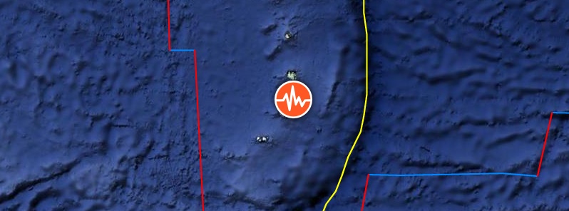
Image credit: Google, TW/SAM
A strong earthquake registered by the USGS as M6.1 hit near Bristol Island, South Sandwich Islands, Southern Atlantic Ocean at 06:51 UTC on January 20, 2020. The agency reported at depth of 91.3 km (56.7 miles). EMSC registered it as M6.1 at a depth of 115 km (71.4 miles). The last known eruption of this volcano took place in 2016. This was the first sign of activity since 1956.
The epicenter was located 28 km (17 miles) S of Bristol Island and 57 km (35 miles) E of Cook Island, South Sandwich Islands.
There are no people living within 100 km (62 miles).
Bristol Island is a very active volcano, but also one of the least known volcanoes because of its remote location.
The size of the island is 9 x 19 km (5.6 x 11.8 miles). Largely glacier-covered, it contains a horseshoe-shaped ridge at the interior extending northward from the highest peak, 1100-m-high (3 610 feet) Mount Darnley.
A steep-sided flank cone or lava dome, Havfruen Peak, is located on the east side, and a young crater and fissure are on the west flank. Three large sea stacks lying off Turmoil Point at the western tip of the island may be remnants of an older now-eroded volcanic center.
Historic eruptions occurred in 1823 (VEI 2), the 1930s (VEI 2), and the 1950s (VEI 3).
A new eruption was reported from Mount Sourabaya, a cone near the center of the island, beginning at the end of April 2016. It produced ash plumes and strong thermal anomalies most likely generated by lava flows until the end of July 2016 (VEI 1).
It was the first sign of activity since 1956. Take a look at we recorded using Landsat-8 satellite imagery:
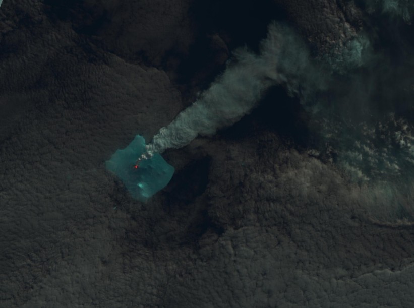
Bristol Island volcano erupting on April 24, 2016. Image credit: USGS LANDSAT-8/OLI
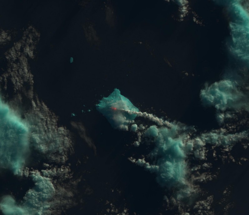
Bristol Island volcano erupting on May 1, 2016. Image credit: USGS LANDSAT-8/OLI
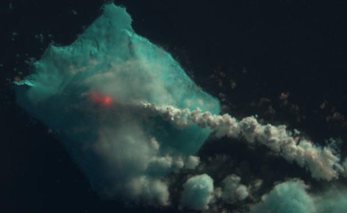
Bristol Island volcano erupting on May 1, 2016. Image credit: USGS LANDSAT-8/OLI
The 1956 eruption, originated from the west-flank crater, and deposited cinder over the icecap. The extensive icecap and the difficulty of landing make it the least explored of the South Sandwich Islands.
I'm a dedicated researcher, journalist, and editor at The Watchers. With over 20 years of experience in the media industry, I specialize in hard science news, focusing on extreme weather, seismic and volcanic activity, space weather, and astronomy, including near-Earth objects and planetary defense strategies. You can reach me at teo /at/ watchers.news.
Commenting rules and guidelines
We value the thoughts and opinions of our readers and welcome healthy discussions on our website. In order to maintain a respectful and positive community, we ask that all commenters follow these rules.