
Bristol Island volcano showing first signs of activity since 1956
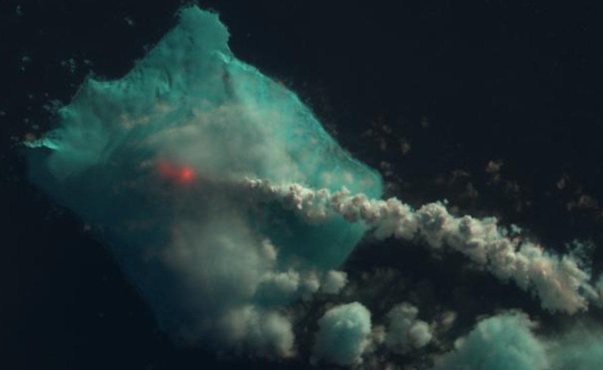
Featured image: Gas and steam plume from the Bristol Island volcano on May 1, 2016. Image credit: USGS LANDSAT-8/OLI
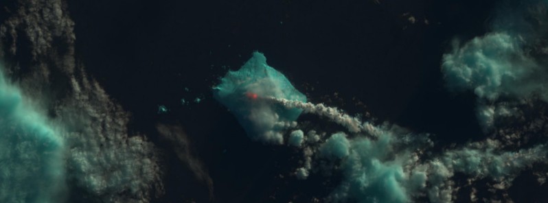
Data collected by the Landsat-8 satellite suggests the Bristol Island volcano, which hasn't erupted since 1956, may have entered a phase of increased activity in late April 2016. The clear weather view has shown a plume of gas and steam which may have contained volcanic ash, on May 1. However, more close monitoring will be required to understand the exact nature of the occurrence.
The South Sandwich Islands, a deserted UK territory, have formed from a subduction in the Atlantic Ocean, and are entirely of volcanic origin. Some of them, such as Mount Michael or the Montagu Island for which strong indications exist for the presence of lava lake, show regular signs of eruption. However, the Bristol Island hasn't shown any known signs of eruption since 1956.
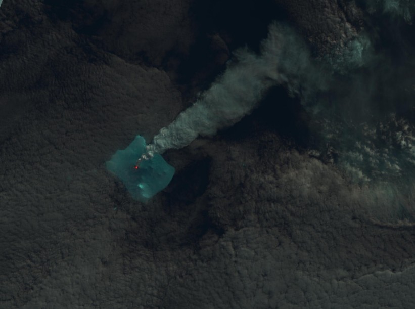
Bristol Island volcano erupting on April 24, 2016. Image credit: USGS LANDSAT-8/OLI
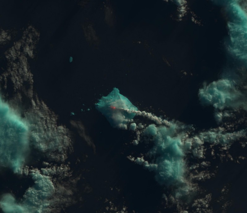
Bristol Island volcano erupting on May 1, 2016. Image credit: USGS LANDSAT-8/OLI
Bristol Island volcano erupting on May 1, 2016. Image credit: USGS LANDSAT-8/OLI
Data collected on April 24 by Operational Land Imager (OLI) instruments and SHOOTING (Thermal Infrared Sensor) show the presence of a strong thermal signal located in the middle of the island. Another set of data collected on May 1 indicates a similar intensity. More satellite data, collected by NASA's Suomi NPP, whose VIIRS sensor is sensitive to thermal infrared radiation, on May 3, show the activity detected earlier has continued.
Images collected earlier in the month show no similar signs of activity. However, it is possible the clouds have blocked the detection of infrared activity.
As of May 5, 2016, the Global Volcanism Program has no Weekly Reports available for Bristol Island.
Geological summary
The 9 x 10 km (5.6 x 6.2 miles) Bristol Island near the southern end of the South Sandwich arc lies across Fortser's Passage from the Southern Thule Islands and forms one of the largest islands of the chain. Largely glacier-covered, it contains a horseshoe-shaped ridge at the interior extending northward from the highest peak, 1 100-m-high (3 609 feet) Mount Darnley.
A steep-sided flank cone or lava dome, Havfruen Peak, is located on the east side, and a young crater and fissure are on the west flank. Three large sea stacks lying off Turmoil Point at the western tip of the island may be remnants of an older now-eroded volcanic center. Both summit and flank vents have been active during historical time. The latest eruption, during 1956, originated from the west-flank crater, and deposited cinder over the icecap. The extensive ice cap and the difficulty of landing make it the least explored of the South Sandwich Islands. (GVP)
Commenting rules and guidelines
We value the thoughts and opinions of our readers and welcome healthy discussions on our website. In order to maintain a respectful and positive community, we ask that all commenters follow these rules.