
Deep M6.2 earthquake hits west of Calabria, Italy
A strong earthquake registered by the USGS as M6.2 struck southern Italy at 22:12 UTC on June 1, 2026. The agency is reporting a depth of 243 km (151 miles). INGV is reporting an ML6.2 (Mw6.1) earthquake at a depth of 250 km (155 miles).
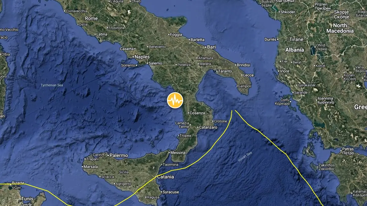
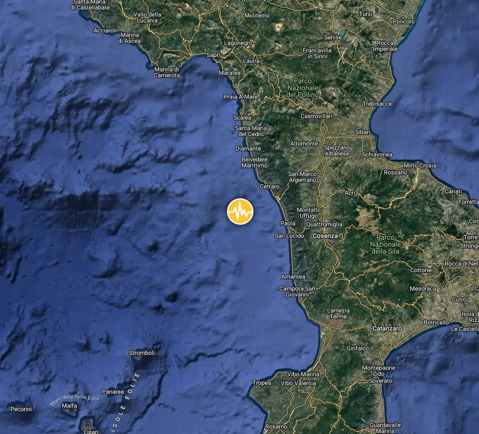
Epicenter of M6.2 earthquake in southern Italy on June 1, 2026. Credit: TW/SAM, Google
The epicenter was located 22 km (14 miles) WNW of Scarcelli (population 1 700), 22 km (14 miles) W of Paola (population 12 649), 40 km (24 miles) E of Quattromiglia (population 22 889), and 41 km (25 miles) W of Cosenza (population 63 852), Calabria, Italy.
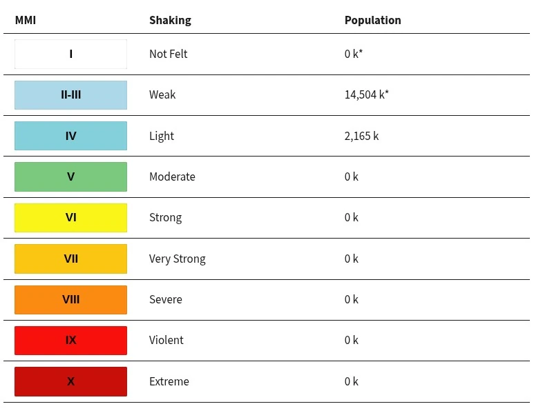
14 504 000 people are estimated to have felt weak shaking, and 2 165 000 light shaking.
The U.S. Geological Survey (USGS) issued a Green alert for shaking-related fatalities and economic losses. There is a low likelihood of casualties and damage.
Overall, the population in this region resides in structures that are a mix of vulnerable and earthquake-resistant construction. The predominant vulnerable building types are unreinforced brick with mud and unknown/miscellaneous types of construction.
Recent earthquakes in this area have caused secondary hazards such as landslides that might have contributed to losses.
No damage or injuries were reported.
The Italian National Institute of Geophysics and Volcanology (INGV) said deep earthquakes, which are characteristic of this sector of the southern Tyrrhenian Sea, are caused by the geological process of subduction of the Ionian lithosphere beneath Calabria.
Despite its great hypocentral depth, the earthquake in the Tyrrhenian Sea was widely felt from Lazio to Sicily, INGV said.
According to the Parametric Catalogue of Italian Earthquakes (CPTI15 v.4.0), several earthquakes with estimated magnitudes (Mw) between 4 and 5 have occurred in this area in the past. Among them was the October 2, 1743 earthquake, with an estimated magnitude of Mw5.1, whose epicenter was located near Amantea (Cosenza Province).
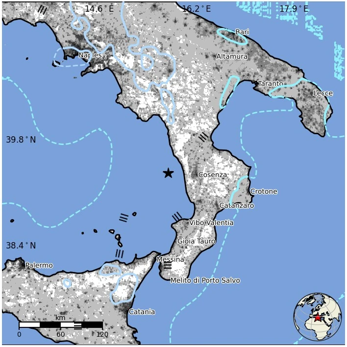
The instrumental seismicity map from 1985 to the present shows that earthquakes occur frequently in this area, including events exceeding magnitude 4. Notable examples include the ML5.1 earthquakes of December 17, 2008, and May 18, 1998. Both events had very deep hypocenters, between 270 and 310 km (168–193 miles), similar to the earthquake recorded overnight.
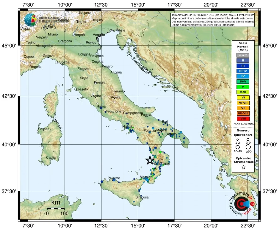
The ShakeMap seismic shaking map, calculated using data from the INGV and Italian Civil Protection Department (DPC) seismic and accelerometric networks, indicates widespread shaking levels across southern Italy, with maximum intensities reaching IV–V on the MCS (Mercalli–Cancani–Sieberg) scale.
Estimated population exposure to earthquake shaking
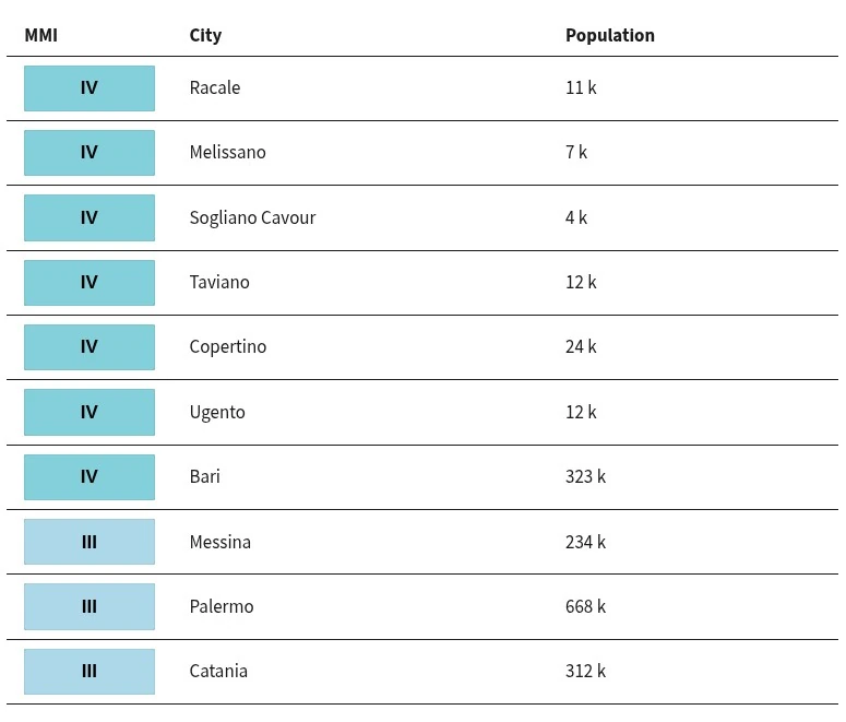
Selected cities exposed
References:
1 M6.2 earthquake Southern Italy – USGS – June 1, 2026
2 M6.2 earthquake Southern Italy – EMSC – June 1, 2026
3 Evento sismico Mw 6.1 al largo della Costa Calabra nord occidentale, 2 giugno 2026 – INGV – June 1, 2026

I am an Assistant Editor and Severe Weather & Science Journalist at The Watchers, specializing in real-time severe weather coverage, geophysical event reporting, and research-driven scientific analysis. You can reach me at rishav(at)watchers(.)news.
Rishav, nice job including the INGV link where we can notice the Parametric Catalogue of Italian Earthquakes revealing adjacent quakes in 1986 and 1983, just a super quick non-analytic glance however I could not help notice the time-associative nature of those with the 1980s bradyseism crisis at Campi Flegrei that took place between 1982 and 1984.
We also had that similarly deep circa M6.0 west of CF not so long ago, yielding useful insights.
Earthquake in Italy warning from God to avoid death by strong earthquakes more mag 7 earthquake tsunami volcano meteorites in Italy in Europe in Asia in Africa in Pacific Ocean in North and South America Pope Leo XIV non-Muslims to convert to Islam and Muslims to apply the Quran 100% immediately June 2, 2026.