
Lan becomes a Super Typhoon, landfall expected just southwest of Tokyo
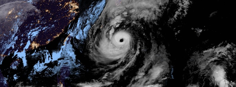
Featured image: Super Typhoon "Lan" satellite image at 10:10 UTC on October 21, 2017. Credit: JMA/Himawari-8 (CIRA)
Typhoon "Lan" is now a Super Typhoon heading toward Japan. Landfall is expected just southwest of Tokyo late Sunday (UTC), October 22 or early Monday, October 23, as a Category 2 or 3 hurricane equivalent on the Saffir-Simpson Hurricane Wind Scale. Very heavy rain will accompany its life-threatening hurricane-force winds, which will likely lead to flash floods, landslides and serious wind damage.
Lan is a Very Large and Very Strong typhoon with a 93 km (57 miles) wide eye. At 09:45 UTC on October 21, its center was located 590 km (367 miles) SW of Okinawa-Jima, 967 km (601 miles) S of Kagoshima and 1 581 km (983 miles) S of Tokyo, Japan. Lan was heading NNE at 30 km/h (18.6 mph) and had a minimum central pressure of 925 hPa.
According to data provided by the Japan Meteorological Agency (JMA), its maximum wind speed near the center is 175 km/h (110 mph) with gusts to 250 km/h (155 mph). No change in intensity is expected over the next 24 hours.
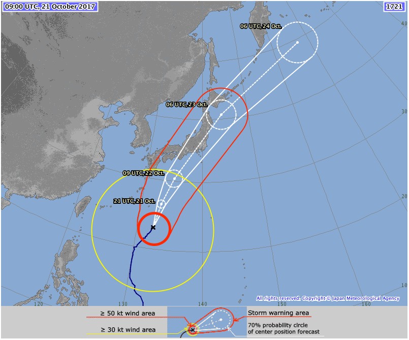
Super Typhoon "Lan" forecast track by JMA at 09:00 UTC on October 21, 2017
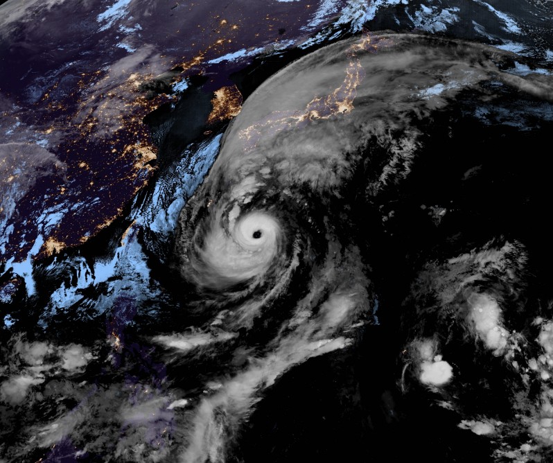
Super Typhoon "Lan" satellite image at 10:10 UTC on October 21, 2017. Credit: JMA/Himawari-8 (CIRA)
"It is becoming increasingly likely that Lan will make landfall southwest of Tokyo Monday morning local time," said Jonathan Oh, a meteorologist at the Western Pacific Weather.
"However, the wraparound moisture along with the forward momentum of the system will bring serious heavy rainfall that could lead to flash flooding along with powerful winds that could cause some damage from Nagoya eastward," Jonathan said.
"Those between Kansai and Kanto regions should be preparing for the powerful system to really disrupt life in terms of public transportation overnight Sunday throughout the daytime hours on Monday," he warns.
"Once Lan interacts with Japan Monday, the system will quickly depart and weaken into a post-cyclonic system, though it will still kick things up with rain and winds for those in northern Japan for several hours before completely leaving the scene."
I'm a dedicated researcher, journalist, and editor at The Watchers. With over 20 years of experience in the media industry, I specialize in hard science news, focusing on extreme weather, seismic and volcanic activity, space weather, and astronomy, including near-Earth objects and planetary defense strategies. You can reach me at teo /at/ watchers.news.
Commenting rules and guidelines
We value the thoughts and opinions of our readers and welcome healthy discussions on our website. In order to maintain a respectful and positive community, we ask that all commenters follow these rules.