
Strong M6.4 earthquake hits Shikoku, Japan
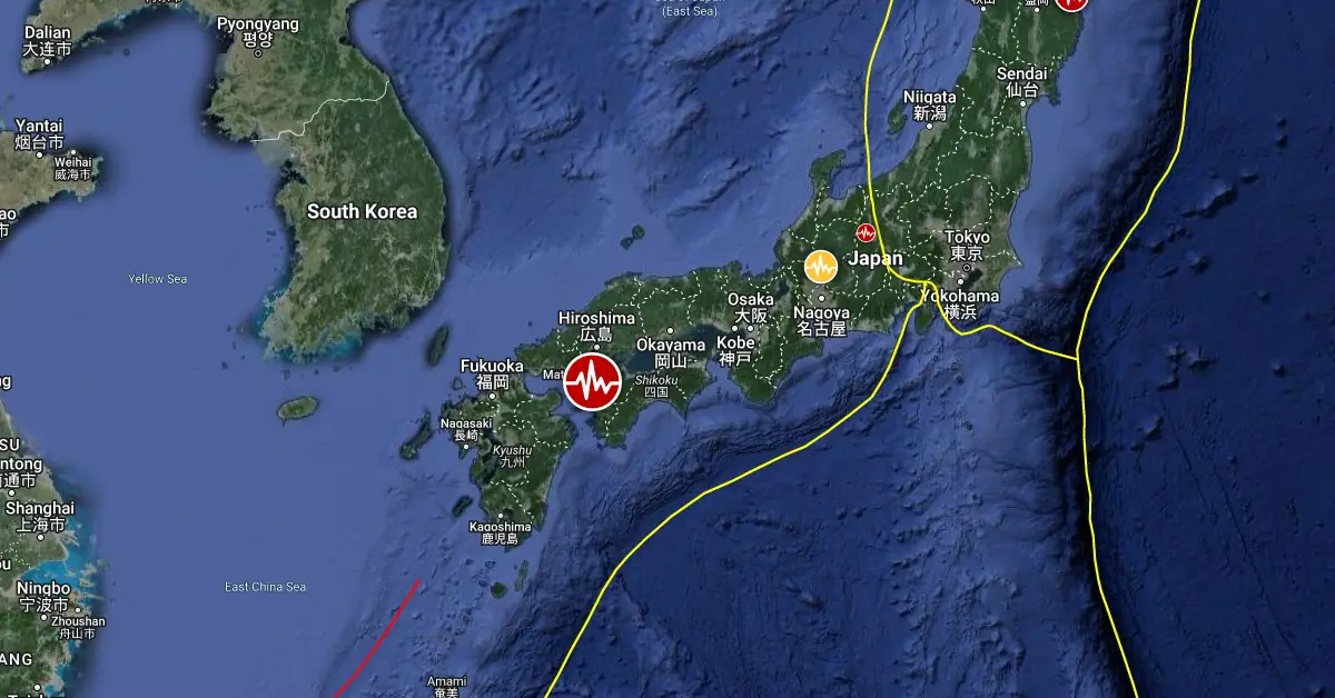
Image credit: TW/SAM, Google
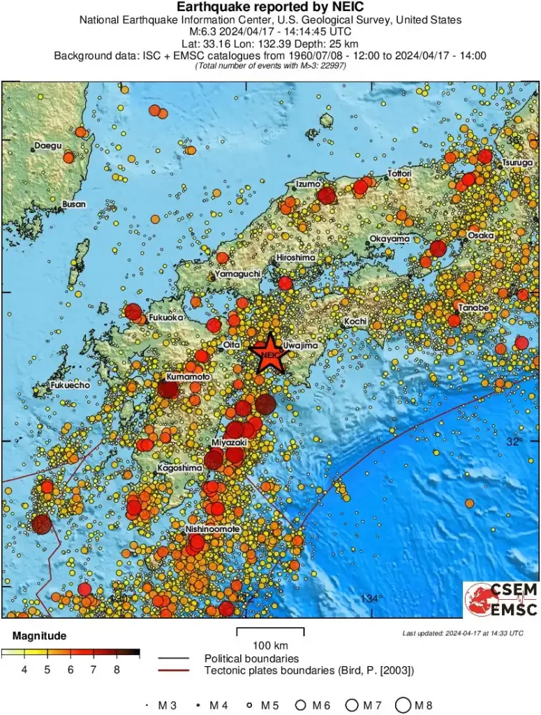
A strong earthquake registered by the Japan Meteorological Agency (JMA) as M6.4 hit Shikoku at 14:14 UTC (23:14 LT) on April 17, 2024. The agency is reporting a depth of 50 km (31 miles). USGS is reporting M6.3 at a depth of 25.7 km (16 miles).
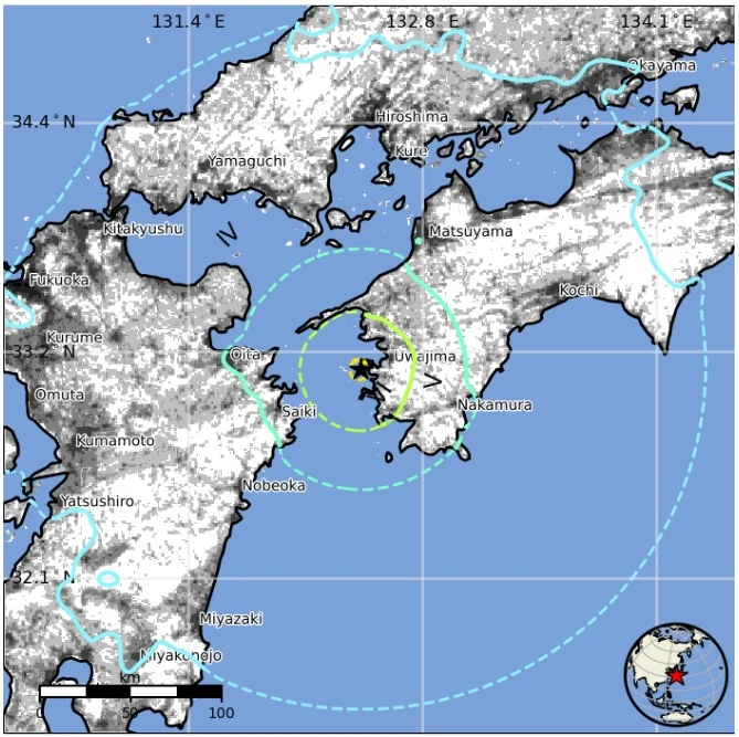
The epicenter was located 17.5 km (10.9 miles) WSW of Uwajima (population 58 971), 29.5 km (18.3 miles) WSW of Kihoku-chō (population 10 772), 33.1 km (20.6 miles) S of Yawatahama (population 31 385), 40.5 km (25.2 miles) SSW of Ōzu (population 38 833), and 73.7 km (45.8 miles) E of Ōita (population 477 715), Japan.
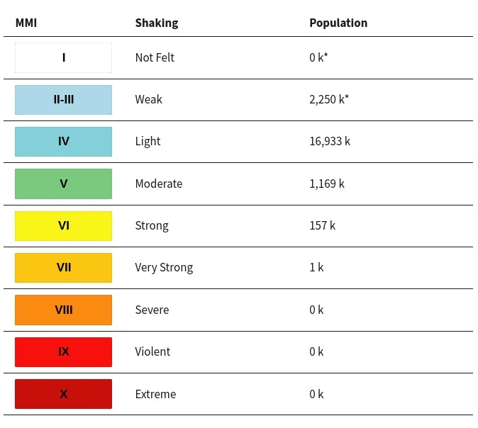
1 000 people are estimated to have felt very strong shaking, 157 000 strong, 1 169 000 moderate, and 16 933 000 light.
There is no tsunami threat from this earthquake.
JMA registered several aftershocks, including M5.0 at 14:19 UTC and M4.3 at 14:27.
The USGS issued a Green alert for shaking-related fatalities and economic losses. There is a low likelihood of casualties and damage.
Overall, the population in this region resides in structures that are resistant to earthquake shaking, though vulnerable structures exist. The predominant vulnerable building types are heavy wood frame and reinforced/confined masonry construction.
Recent earthquakes in this area have caused secondary hazards such as landslides, fires, and liquefaction that might have contributed to losses.
Estimated population exposure to earthquake shaking
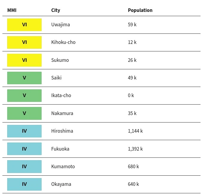
Selected cities exposed
Regional seismicity
Updates
12:28 UTC, April 16
5 people were injured in Ehime Prefecture, 2 in Oita and 1 in Kochi.
Shikoku Electric Power Co. said power generation output fell about 2% at the No. 3 reactor of the Ikata nuclear power plant in Ehime Prefecture, but no radiation leaks were observed around the plant. It will take about a day to inspect and restore the facility.
Landslides forced the closure of a section of National Route 197 in Ozu, Ehime Prefecture.
The quake occurred in an area where seismologists have long anticipated a megaquake known as the Nankai Trough earthquake to occur.
However, JMA said today that they do not believe the latest quake has sharply raised the megaquake’s probability as the seismic mechanism was different from the one that is expected to trigger the Nankai Trough earthquake.
Additionally, the hypocenter of the quake indicates it occurred inside the Philippine Sea Plate, which is located deeper than its boundary with the continental plate, JMA officials said. Conversely, the megaquake is expected to occur around the boundary between the two plates.
References:
1 Eight injured after earthquake rocks Shikoku and Kyushu – The Asahi Shimbun – April 18, 2024
I'm a dedicated researcher, journalist, and editor at The Watchers. With over 20 years of experience in the media industry, I specialize in hard science news, focusing on extreme weather, seismic and volcanic activity, space weather, and astronomy, including near-Earth objects and planetary defense strategies. You can reach me at teo /at/ watchers.news.
Commenting rules and guidelines
We value the thoughts and opinions of our readers and welcome healthy discussions on our website. In order to maintain a respectful and positive community, we ask that all commenters follow these rules.