
Heavy rainfall triggers widespread flooding and infrastructure damage across Trinidad
Heavy rainfall from June 9 to June 12, 2025, caused widespread flooding and infrastructure damage across Trinidad, leading authorities to issue a high-level flood warning for the Caroni River and adjacent areas.

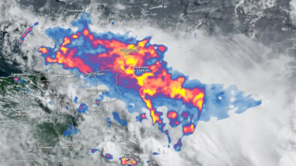
Flood in Trinidad - June 2025. Credit: TT Weather Center
Sustained rainfall associated with Tropical Wave 04 and a low-level trough affected Trinidad from June 9 to June 12, resulting in widespread flash and riverine flooding across northern, central, and southern regions of the island. Rainfall totals ranged from 75 to over 200 mm (3 to 8 inches) in northern Trinidad, saturating soils and overwhelming drainage systems.
The Trinidad and Tobago Meteorological Service (TTMS) issued a Yellow Level Adverse Weather Alert, active through June 12, citing continued thunderstorms, gusty winds reaching up to 50 km/h (31 mph), and localized street flooding.
On June 11, TTMS upgraded the Riverine Flood Alert to Orange Level for the Caroni River Basin, indicating a high probability of river overflow in flood-prone areas. This was confirmed by the Office of Disaster Preparedness and Management (ODPM), which urged residents to monitor updates, activate emergency plans, and avoid floodwaters.
At the height of the alert, several rivers recorded critical water levels. The Manuel Congo River exceeded 108 percent capacity. The Caroni River reached 79 percent capacity at Bamboo Settlement #3 and 94 percent at El Carmen. Other rivers, including the North Oropouche, South Oropouche, Arouca, Cipero, and Tumpuna, approached or exceeded alert thresholds. TTMS warned that further rainfall could result in additional riverine overflow, particularly in areas with saturated soils and compromised drainage.
In northwest Trinidad, areas such as Port of Spain, Diego Martin, Westmoorings, Maraval, and St. James experienced significant street flooding. In the central and eastern parts of the island, districts including Tunapuna, Arima, and Sangre Grande reported overland flooding and road obstructions.
The worst affected were southern regions such as Penal, Debe, Barrackpore, and Siparia. In some of these locations, floodwaters reached heights of 1 to 1.5 m (3.3 to 5 feet) inside homes. The Madras Settlement in St. Helena was affected by recurring flood events due to river overflow and insufficient drainage capacity.
Roads were submerged, landslides occurred in hilly regions, and clogged culverts further delayed water recession. Emergency services responded to multiple incidents involving fallen trees, trapped vehicles, and residents cut off by rising waters.
The Trinidad and Tobago Ministry of Education announced it was actively monitoring river levels and meteorological updates, with school operations subject to change based on flood risk assessments.
2:20 PM – The Caroni River at New Street, Kelly Village
— TTWeatherCenter (@TTWeatherCenter) June 12, 2025
Live updates of flooded areas: https://t.co/07zPfWXJXP pic.twitter.com/TAJc3bFkQy
2:00 PM – Heavy rainfall affecting parts of Trinidad, as seen from El Carmen #4, where riverine flooding is ongoing as the Caroni River overtops.
— TTWeatherCenter (@TTWeatherCenter) June 12, 2025
Avoid venturing into flood waters!
Live updates of flooded areas: https://t.co/07zPfWXJXP pic.twitter.com/mFWqxe1Cl7
TURN AROUND. DON’T DROWN.
— TTWeatherCenter (@TTWeatherCenter) June 12, 2025
Determining the depth of flood waters, particularly at night, can be treacherous.
: Talparo, Central Trinidad (Driver is okay)
A Riverine Flood Alert is in effect for the Caroni River Basin.
Live updates continue: https://t.co/iGz6sGnzNA pic.twitter.com/Tao98BFlC0
In Tobago, the Tobago Emergency Management Agency (TEMA) confirmed ten flood-related incidents, including flash floods and fallen trees damaging homes and roads. School closures and adjustments to examination venues were implemented in response.
As of June 12, no fatalities or injuries have been confirmed by authorities. Property damage assessments remain ongoing.
The Ministry of Rural Development and Local Government and regional corporations have issued advisories urging residents to secure personal belongings, avoid driving through flood-prone areas, and prepare for possible displacement. Several primary schools and community centers have been designated as temporary shelters in high-risk areas.
The TTMS forecasts continued heavy showers and isolated thunderstorms through June 14, with the passage of Tropical Wave 05. Daily rainfall totals of 25 to 50 mm (1 to 2 inches) are expected, with localized accumulations of up to 100 mm (4 inches). Due to already saturated soils and elevated river levels, there remains a high risk of additional flash and riverine flooding, landslides, and localized infrastructure disruptions.
Residents are urged to remain vigilant, follow official advisories, and avoid exposure to floodwaters as hydrological and meteorological conditions remain hazardous.

I’m a science journalist and researcher at The Watchers, contributing to the Epicenter edition, where I cover peer-reviewed scientific research and emerging discoveries across Earth and space sciences. With a background in astronomy and a passion for environmental science, I’ve worked in shark and coral conservation in Fiji, conducting reef and shark-behavior research, contributing to mangrove restoration, and earning PADI Open Water and Coral Reef Certifications. I bring a blend of scientific rigor and storytelling to illuminate the discoveries shaping our planet and beyond.
Commenting rules and guidelines
We value the thoughts and opinions of our readers and welcome healthy discussions on our website. In order to maintain a respectful and positive community, we ask that all commenters follow these rules.