
Tropical Cyclone “Hikaa” to make landfall in Oman on September 24
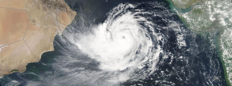
Featured image: Tropical Cyclone "Hikaa" on September 23, 2019. Credit: NASA Aqua/MODIS
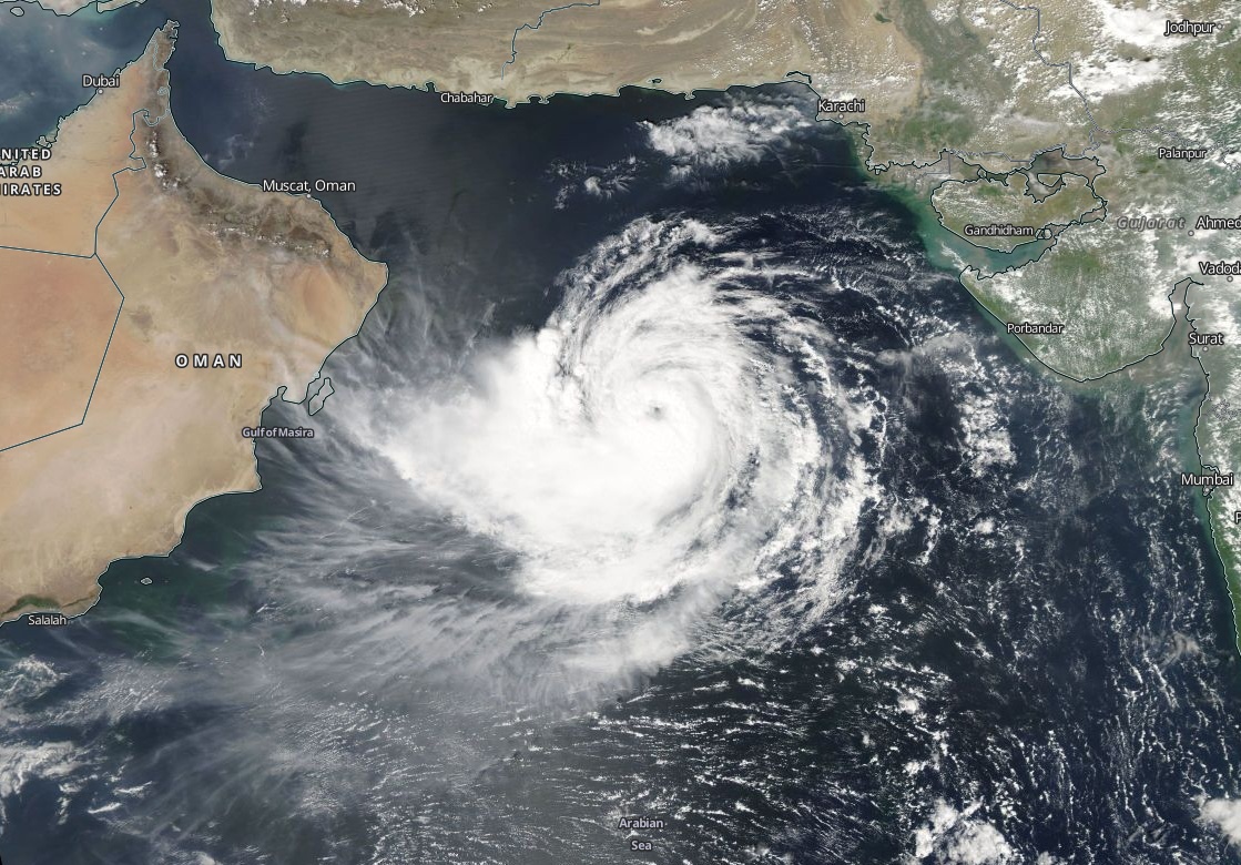
Tropical Cyclone "Hikaa" formed September 22, 2019, over the Arabian Sea as the 5th named storm of the 2019 North Indian Ocean cyclone season. On the forecast track, Hikaa is expected to make landfall in Oman on September 24.
The season's first named storm, Pabuk, entered the basin on January 4, becoming the earliest-forming cyclonic storm of the North Indian Ocean on record. The second cyclone of the season, Cyclone "Fani," was the strongest tropical cyclone in the Bay of Bengal by 3-minute maximum sustained wind speed and minimum barometric pressure since the 1999 Odisha cyclone.
At 09:00 UTC on September 23, the center of Tropical Cyclone "Hikaa" was located approximately 605 km (376 miles) NM east of Masirah Island, Oman, according to data provided by JTWC.
Its maximum sustained winds were 102 km/h (63 mph) and gusts to 130 km/h (80 mph).
The cyclone tracked westward at 24 km/h (14.9 mph) over the past six hours.
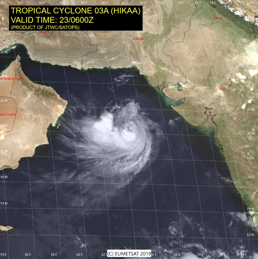
"Animated enhanced infrared satellite imagery shows a compact system with tightly-curved banding wrapping into a developing eye," JTWC meteorologists noted 09:00 UTC.
Hikaa is forecast to track generally WSW, steered by a subtropical ridge anchored north of the Arabian Sea. The recent development of a visible eye structure, coupled with persistent low vertical wind shear along the forecast track suggests a brief period of intensification is possible before Landfall at 21:00 UTC, south of Masirah Island.
Once over land, Hikaa will rapidly erode due to the frictional effects of terrain and lack of underlying ocean driven convection. Numerical models continue to agree on the west-southwestward track, lending to overall high confidence in the JTWC forecast track.
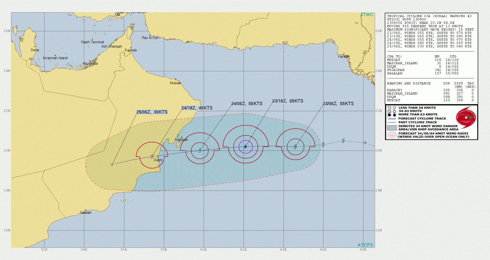
Hikaa is likely to intensify further during the next 12 hours and weaken gradually from the morning of September 24 (IST)," RSMC New Delhi said 08:10 UTC today. "It is very likely to move nearly westwards and cross Oman coast between latitude 19°N and 20°N during early hours of September 25, 2019, as a deep depression."
Tropical Cyclone "Hikaa" on September 23, 2019. Credit: NASA Aqua/MODIS
Forecast models
I'm a dedicated researcher, journalist, and editor at The Watchers. With over 20 years of experience in the media industry, I specialize in hard science news, focusing on extreme weather, seismic and volcanic activity, space weather, and astronomy, including near-Earth objects and planetary defense strategies. You can reach me at teo /at/ watchers.news.
Commenting rules and guidelines
We value the thoughts and opinions of our readers and welcome healthy discussions on our website. In order to maintain a respectful and positive community, we ask that all commenters follow these rules.