
Interactive geonarrative about the 2018 Kilauea eruption
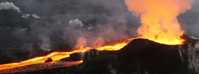
Image credit: USGS
An interactive online geonarrative about the 2018 Kilauea eruption has been launched by geologists.
The site lets viewers re-live the event using an interactive timeline feature and an overview of the historic eruption.
The experience is made even more fascinating by combining images and footages from the event.
Aside from the visually-stunning media, the site also offers historic facts and notable information about the event.
A must read! This new geonarrative from #HVO provides a fascinating overview of Kīlauea Volcano's 2018 events, https://t.co/nDS2o9K1CE. pic.twitter.com/xUDCurZI5a
— USGS Volcanoes (@USGSVolcanoes) September 18, 2019
The Kilauea volcano erupted on May 3, 2018, on Hawaii's Big Island.
According to geologists, the Kilauea eruption was the largest Lower East Rift Zone eruption in at least two centuries.
In a span of four months, the volcano blew at least 0.8 km3 (0.2 mi3) of lava, which is equivalent to the size of more than 300 000 Olympic pools of molten rock.
Thank you for the link to an excellent presentation style summary.
One of the best examples I have seen of bringing challenging scientific data from a world-wide interest news event and presenting for a wider audience.
This can be enjoyed and understood by all from trained Geologists (as myself) to schoolchildren, and everyone in between. Well done to the USGS for breaking the norms of presentations aimed solely at the scientific community.
regards