
Tropical Storm “Karen” forms near Windward Islands
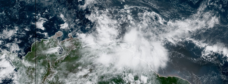
Featured image: Tropical Storm "Karen" at 14:30 UTC on September 22, 2019. Credit: NOAA/GOES-Eas
Tropical Storm "Karen" formed just east of the Windward Islands at 09:00 UTC on September 22, 2019, as the 11th named storm of the 2019 Atlantic hurricane season. On Average, the 11th named storm forms on October 28.
A Tropical Storm Warning is in effect for Trinidad and Tobago, Grenada and its dependencies, St. Vincent and the Grenadines. A Tropical Storm Watch is in effect for U.S. Virgin Islands, Puerto Rico, including Vieques and Culebra, British Virgin Islands.
At 15:00 UTC, the center of newly formed Tropical Storm "Karen" was located about 45 km (30 miles) N of Grenada and 105 km (65 miles) SSW of St. Vincent. The storm had maximum sustained winds of 65 km/h (40 mph) and minimum central pressure of 1 006 hPa.
Karen was moving WNW at 20 km/h (13 mph) and this general motion is expected to continue today.
A turn toward the NW is forecast on Monday, September 23, followed by a turn toward the north on Tuesday.
Karen moved across the Windward Islands today and is now moving away from it, across the Caribbean Sea.
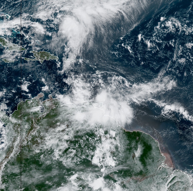
Tropical Storm "Karen" at 14:30 UTC on September 22, 2019. Credit: NOAA/GOES-East
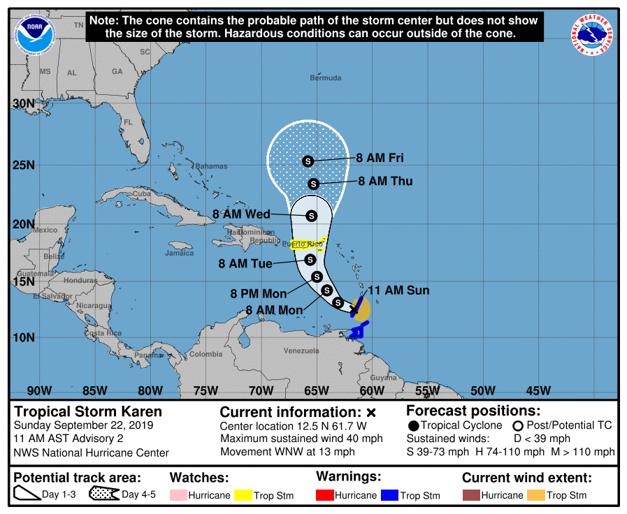
On the forecast track, Karen is expected to approach Puerto Rico and the Virgin Islands on Tuesday.
Karen is expected to produce the following rainfall accumulations through Wednesday:
- Windward Islands: 75 – 150 mm (3 to 6 inches), isolated 200 mm (8 inches).
- Leeward Islands: 25 – 75 mm (1 to 3 inches), isolated 125 mm (5 inches).
- Far northeastern Venezuela and Barbados: 25 – 75 mm (1 to 3 inches).
These rains may cause flash flooding and mudslides, especially in mountainous areas.

Teo Blašković founded The Watchers in 2011 and edited it until 2026, covering seismic and volcanic activity, extreme weather, space weather and near-Earth objects. Articles on this page are his archive.
Published in the last 24 hours
- Cyclone Akvan weakens after landfall near Gopalpur; more than 300 000 evacuated in Odisha, India
- Male toads abandoned a pond in Italy five days before a deadly 2009 earthquake, while a scientist was counting them Epicenter
- An asteroid was spotted 19 hours before it exploded over Sudan in 2008, and students picked its pieces off the desert Epicenter
- A wave up to 3 m (10 feet) high rose out of Lake Michigan on a sunny June morning in 1954 and swept fishermen off Chicago’s piers, and when a second came 10 days later, warnings had cleared the shore Epicenter
