
Tropical Storm “Nanmadol” forms, heading toward mainland Japan
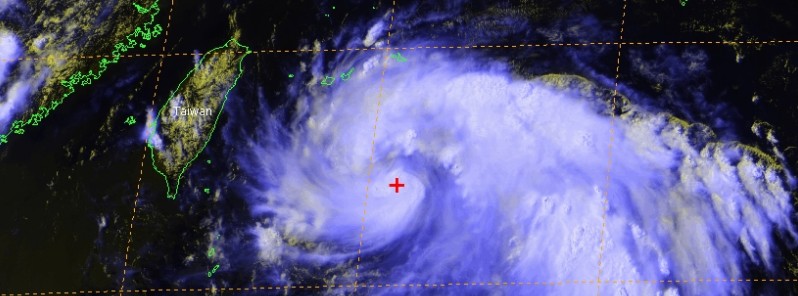
Featured image: Tropical Storm "Nanmadol" at 06:00 UTC on July 2, 2017. Credit: JTWC/SATOPS, Himawari
Tropical Storm "Nanmadol" (05W) formed July 2, 2017 east of Taiwan as the 6th named storm (PAGASA and JMA) of the 2017 Pacific typhoon season. The system is expected to pass over Yaeyama Island group, Okinawa Prefecture, Japan in the hours ahead, bringing moderate to heavy rain. Nanmadol is expected to continue intensifying, and accelerate northeastward within 36 hours as it begins extra-tropical transition. It should complete the transition within the next 72 hours as it tracks across Honshu and weakens significantly. This cyclone is known in the Philippines as Emong. The main threat is rain.
At 06:00 UTC on July 2, 2017, the center of Tropical Storm "Nanmadol" was located about 315 km (196 miles) SSE of Yaeyama, Iriomote-Jima and 540 km (336 miles) S of Okinawa, Japan. Its maximum sustained winds, according to the JTWC, were reaching 65 km/h (40 mph). The system was tracking northwestward at 31 km/h (19 mph).
Imagery courtesy of JMA/Himawari-8
By 12:00 UTC, Nanmadol was located 130 km (81 miles) SSE of Yaeyama. It was heading NNW at a speed of 35 km/h (22 mph) and had an estimated minimum central pressure of 998 hPa, according to the Japan Meteorological Agency.
Animated multispectral satellite imagery depicts a consolidating low-level circulation center with tightly-wrapped convective banding wrapping into a well-defined center, JTWC said 09:00 UTC today. Animated radar imagery from the Miyako-Jima radar shows a well-defined, shallow (light to moderate rainfall), and compact eyewall.
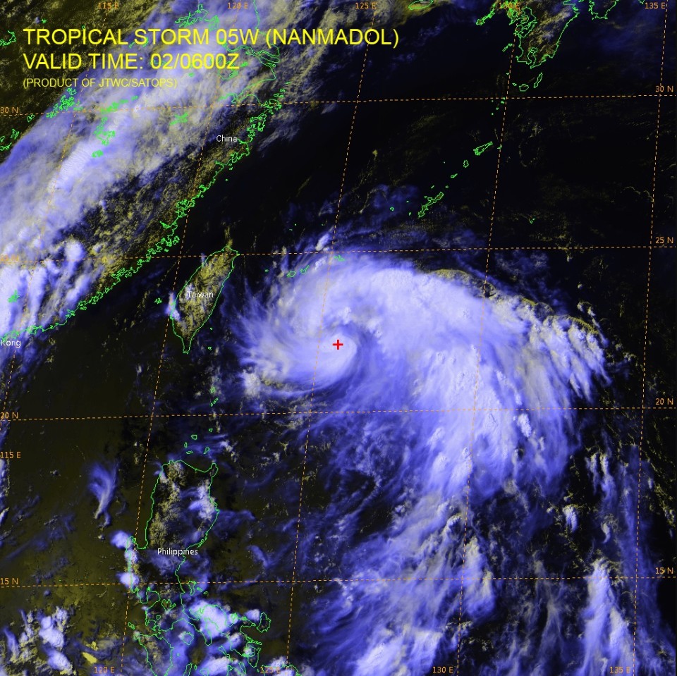
Tropical Storm Nanmadol July 2, 2017 at 06:00 UTC. Credit: JTWC/SATOPS, HIMAWARI
Upper-level analysis continues to indicate robust outflow and favorable environmental conditions to include low vertical wind shear. Sea surface temperatures are favorable at 30 to 31 °C (86 to 87.8 °F).
The system is tracking quickly poleward along the western edge of the deep subtropical ridge and is expected to continue to do so over the next 24 hours, reaching a peak intensity of 102 km/h (63 mph) by 09:00 UTC on July 3.
"There is some uncertainty in the peak intensity with some guidance indicating a peak of 120 km/h (75 mph)," JTWC noted.
The system is expected to re-curve and accelerate northeastward as it begins extra-tropical transition while interacting with the midlatitude westerlies by 21:00 UTC on July 3. After 09:00 UTC on July 4, Nanmadol is expected to accelerate east-northeastward within the zonal westerly flow and is expected to complete the transition by 09:00 UTC on July 5 as it tracks across Honshu and weakens significantly.
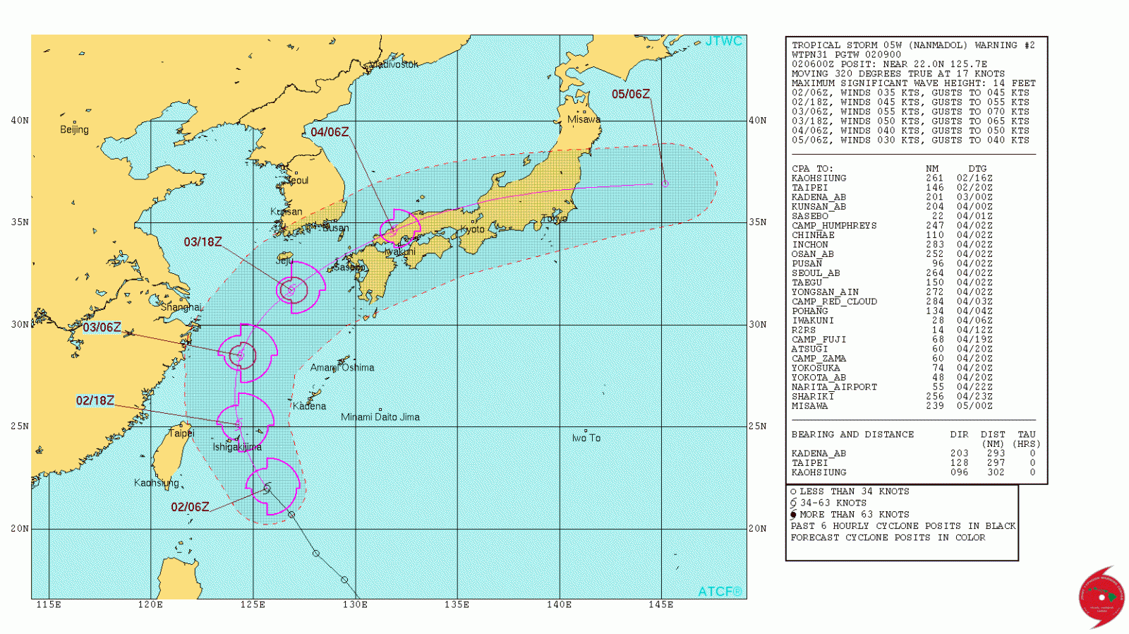
Tropical Storm "Nanmadol" forecast track by JTWC at 09:00 UTC on July 2, 2017
"The dynamic aids are in unusually tight agreement for a re-curve scenario, leading high confidence to the forecast track," JTWC said.
According to current forecast track and models, up to 101.4 million people can be affected by wind speeds of tropical storm strength and above. In addition, no people are living in coastal areas below 5 m (16 feet) and can therefore be affected by storm surge.
The main threat from this system is moderate to heavy rainfall.
This is the 6th named storm of the 2017 Pacific typhoon season, including three named tropical depressions by PAGASA – Auring, Bising and Crising. It is, however, only the third named storm by the JMA, WMO authority for this part of the world.
I'm a dedicated researcher, journalist, and editor at The Watchers. With over 20 years of experience in the media industry, I specialize in hard science news, focusing on extreme weather, seismic and volcanic activity, space weather, and astronomy, including near-Earth objects and planetary defense strategies. You can reach me at teo /at/ watchers.news.
Commenting rules and guidelines
We value the thoughts and opinions of our readers and welcome healthy discussions on our website. In order to maintain a respectful and positive community, we ask that all commenters follow these rules.