
Off-season, very dangerous Tropical Cyclone “Donna” heading toward Vanuatu
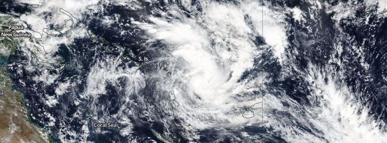
Featured image: Tropical Cyclone "Donna" on May 3, 2017. Credit: NASA/NOAA Suomi NPP/VIIRS
Tropical Cyclone "Donna" (18P) formed northeast of Vanuatu on May 3, 2017, 3 days after the official end of the 2016/17 South Pacific Cyclone Season. Donna is expected to rapidly intensify over the next 24 hours to Category 3 or 4 cyclone on the Saffir-Simpson scale and start its very dangerous track over Vanuatu.
Although models still slightly disagree on the exact timing, intensity, and track, Donna will likely bring significant damage and destruction to many islands of Vanuatu. Wind gusts might reach as high as 260 km/h (161 mph), rainfall totals between 300 and 500 mm (11.8 and 19.7 inches). There is a potential for significant river flooding, severe flash flooding, and landslides. Dangerous and damaging waves including coastal tidal surge and inundation could develop across the country.
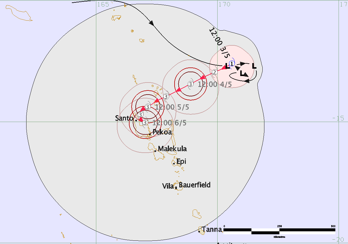
Tropical Cyclone "Donna" RSMC Nadi forecast track on May 3, 2017
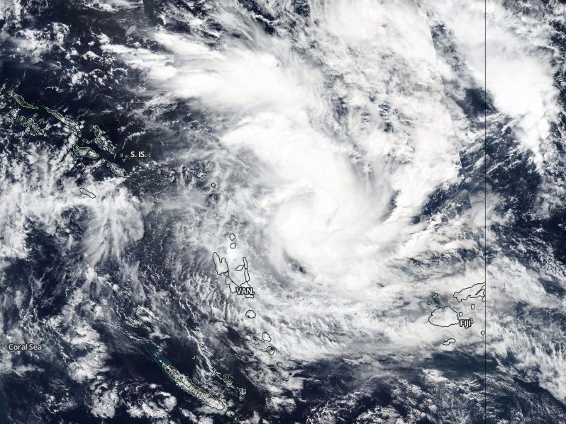
Tropical Cyclone Donna on May 3, 2017. Credit: NASA/NOAA Suomi NPP/VIIRS
At 09:00 UTC on May 3, the center of Tropical Cyclone "Donna" was located approximately 637 km (395 miles) north-northeast of Port Vila, Vanuatu, and has tracked westward at 9 km/h (5.7 mph) over the past six hours. At the time, its maximum sustained winds were 102 km/h (63 mph) with wind gusts to 130 km/h (80 mph), according to JTWC.
The system has turned westward over the past six hours under the influence of a developing subtropical steering ridge to the south. It has steadily intensified and became increasingly organized under the favorable influences of strong poleward outflow aloft, low vertical wind shear and passage over very warm water.
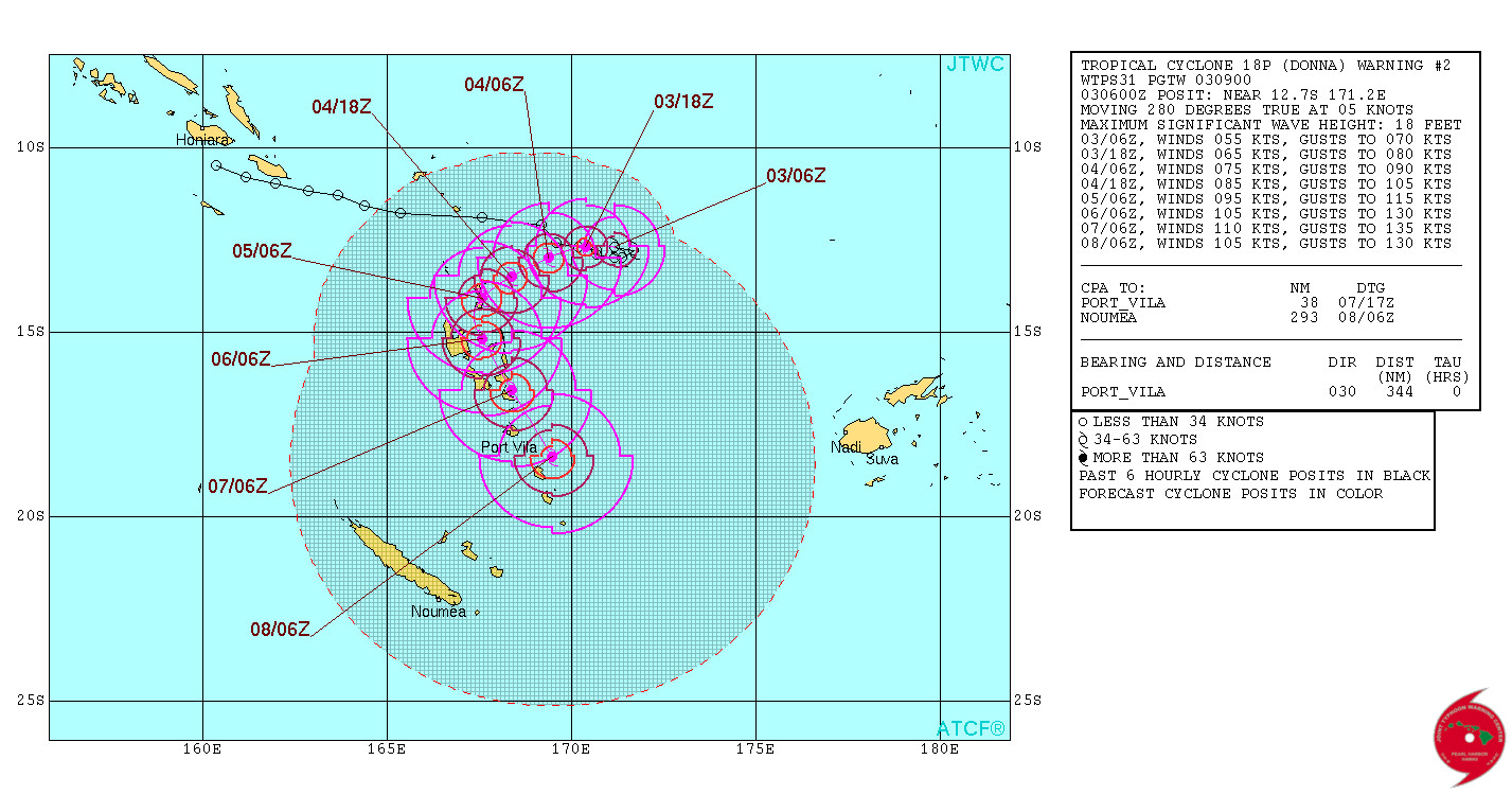
Tropical Cyclone "Donna" JTWC forecast track on May 3, 2017
Over the next 48 hours, Donna is expected to track westward to southwestward under the influence of the subtropical steering ridge. Steady intensification is anticipated as environmental conditions remain favorable, with some guidance suggesting a more rapid intensification rate, JTWC said. By 09:00 UTC on May 5, Donna is expected to turn sharply poleward and move parallel and near to the Vanuatu island chain.
I'm a dedicated researcher, journalist, and editor at The Watchers. With over 20 years of experience in the media industry, I specialize in hard science news, focusing on extreme weather, seismic and volcanic activity, space weather, and astronomy, including near-Earth objects and planetary defense strategies. You can reach me at teo /at/ watchers.news.
Commenting rules and guidelines
We value the thoughts and opinions of our readers and welcome healthy discussions on our website. In order to maintain a respectful and positive community, we ask that all commenters follow these rules.