
Red Alerts issued as Tropical Cyclone “Kevin” moves closer to Vanuatu
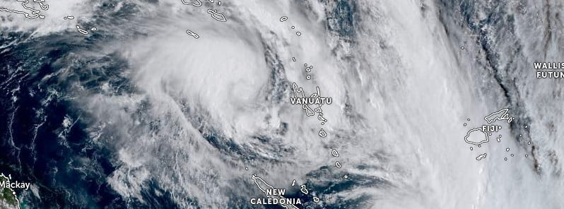
Featured image: Tropical Cyclone "Kevin" at 04:40 UTC on March 2, 2023. Credit: JMA/Himawari-8, Zoom Earth, The Watchers
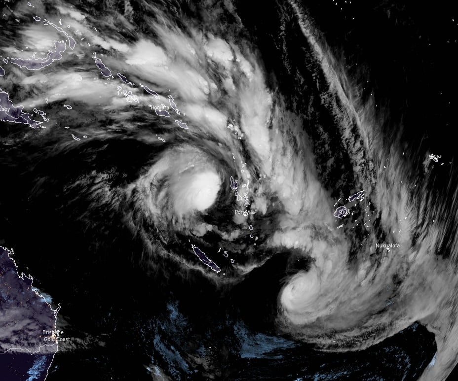
Tropical Cyclone “Kevin” formed on March 1, 2023, between Vanuatu and Caledonia, as the 5th named storm of the 2022/23 South Pacific cyclone season. A Red Alert is in effect for Vanuatu’s provinces of Sanma, Malampa, and Penama. The cyclone comes just a couple of days after Tropical Cyclone “Judy” damaged a number of buildings in Vanuatu, caused power outages, and closed schools.
At 00:00 UTC on March 2, the center of Tropical Cyclone “Kevin” was located about 240 km (149 miles) WSW of Santo and 320 km (199 miles) WNW of Malekula.
Winds close to the center were estimated at 110 km/h (68 mph), and the system was moving SE at 23 km/h (14 mph).
Damaging gale force winds of 75 km/h (47 mph) with gusts up to 105 km/h (65 mph) are expected to affect Sanma, Malampa, and Penama provinces within the next 12 hours as the system approaches the northern provinces.
Destructive storm force winds of 90 km/h (56 mph), gusting to 130 km/h (81 mph), 93 km (58 miles) from the center of the system, are expected to affect northern provinces in the next 12 to 24 hours.
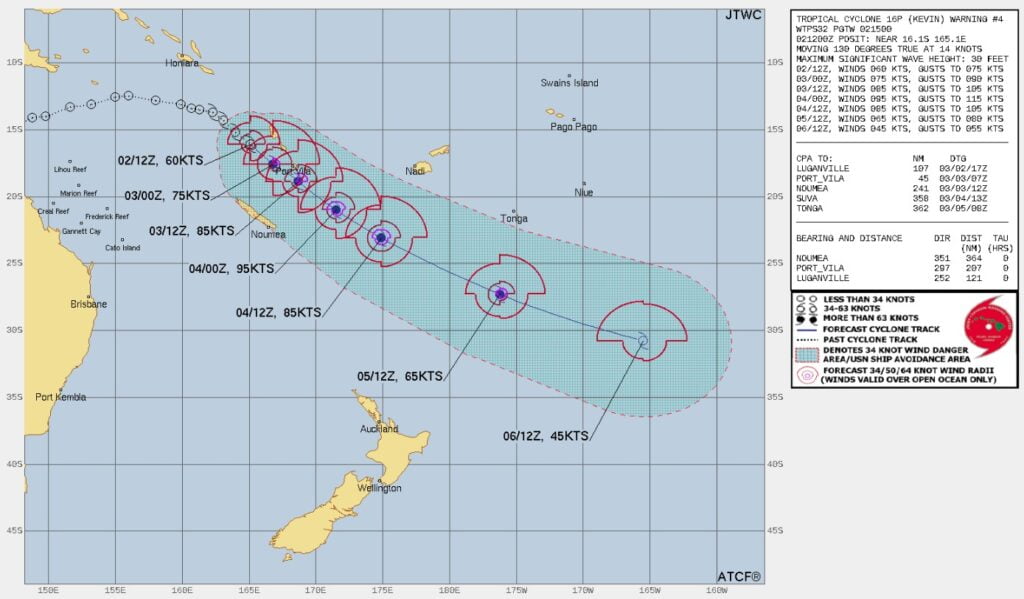
| Date and Time (LT) | Position | Intensity |
|---|---|---|
| +06 hours (05:00, March 3) | 16.2°S, 165.2°E (W of Santo) | 130 km/h (81 mph) |
| +12 hours (11:00, March 3) | 16.7°S, 165.9°E (W of Malekula) | 130 km/h (81 mph) |
| +18 hours (17:00, March 3) | 17.2°S, 166.5°E (W of Ambrym) | 150 km/h (93 mph) |
| +24 hours (23:00, March 3) | 17.9°S, 167.5°E (W of Epi) | 150 km/h (93 mph) |
| +36 hours (11:00, March 4) | 19.7°S, 169.9°E (W of Efate) | 165 km/h (103 mph) |
| +48 hours (23:00, March 4) | 21.8°S, 173.0°E (SW of Tanna) | 150 km/h (93 mph) |
| +60 hours (11:00, March 5) | 23.8°S, 176.9°E (E of Hunter Island) | 130 km/h (81 mph) |
| +72 hours (23:00, March 5) | 25.6°S, 178.7°W (SE of Fiji) | 130 km/h (81 mph) |
Heavy rainfall with thunderstorms is expected over northern Vanuatu, leading to flash flooding in low-lying areas, areas close to the river banks, and coastal flooding.
Seas will become rough to very rough with moderate to heavy swells over the northern and central waters of Vanuatu.
All sea-going vessels, including boats and small fishing rafts, are advised not to go out to sea until the system has moved away from Vanuatu waters.
A Red Alert is now in effect for Sanma, Malampa, and Penama; a Yellow Alert is in effect for Torba and Shefa.
Authorities in Vanuatu are still assessing damage made by Tropical Cyclone “Judy” over the past couple of days. While there are no reports of deaths or serious injuries, Judy’s destructive winds uprooted trees, damaged numerous homes, forced the closure of schools, and caused power outages. Around 500 people were evacuated.
References:
1 Tropical Cyclone Warning Number 5 for SANMA, MALAMPA and PENAMA – VMGD – March 2, 2023
I'm a dedicated researcher, journalist, and editor at The Watchers. With over 20 years of experience in the media industry, I specialize in hard science news, focusing on extreme weather, seismic and volcanic activity, space weather, and astronomy, including near-Earth objects and planetary defense strategies. You can reach me at teo /at/ watchers.news.
Commenting rules and guidelines
We value the thoughts and opinions of our readers and welcome healthy discussions on our website. In order to maintain a respectful and positive community, we ask that all commenters follow these rules.