
Tropical Storm “Kyant” to make landfall over India on October 27

Featured image: NASA's Aqua satellite captured the visible light image of Tropical Cyclone "3B" in the Bay of Bengal. Image credit: NASA Goddard MODIS Rapid Response Team
Tropical Storm "Kyant," formerly known as "03B,"developed from a depression 99B on October 25, 2016. The system was lingering over the Bay of Bengal over the last couple of days, before intensification. Further strengthening is expected over the next 36 hours and the storm will likely make landfall north of Chennai, India on October 27.
Tropical Cyclone "Kyant" was located approximately 642.6 km (399.3 miles) south of Chittagong and moving westward at 11.1 km/h (6.9 mph) on October 25, 15:00 UTC, according to the Joint Typhoon Warning Center (JTWC). The system was packing maximum sustained winds of 83.3 km/h (51.7 mph) with gusts up to 101.8 km/h (63.3 mph) while its minimum central pressure was estimated at 994 hPa.
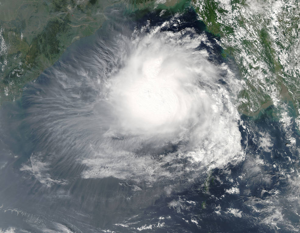
NASA's Aqua satellite captured the visible light image of Tropical Cyclone "Kyant" in the Bay of Bengal. Image credit: NASA Goddard MODIS Rapid Response Team
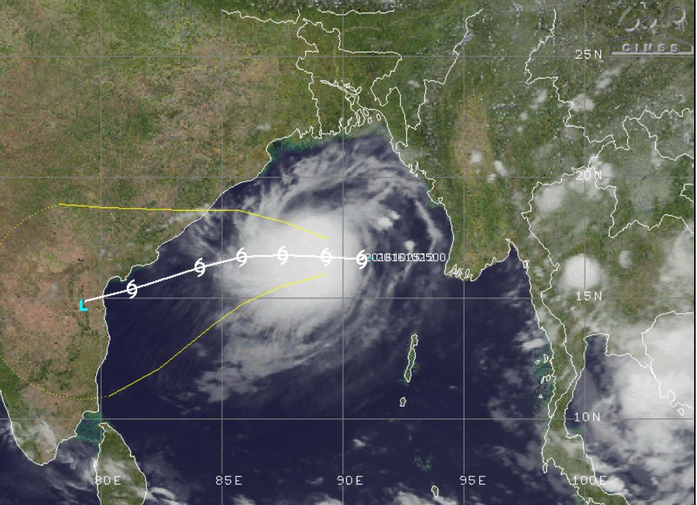
Tropical Storm "Kyant", October 25, 2016, 16:30 UTC. Image credit: UW-CIMSS
The tropical storm will intensify over the next 36 hours, and its maximum sustained winds will reach 111.1 km/h (69 mph) with gusts up to 138.9 km/h (86.3 mph). However, the system will start to weaken rapidly after the next 48 hours, as it begins to entrain dry air, encounters higher vertical wind shear values and interacts with land.

Tropical Storm "Kyant" 4-day forecast track. Image credit: JTWC
The JTWC forecasts the tropical cyclone will move west across the Bay of Bengal over the next few days, and make a landfall north of Chennai, India on October 27.
Update
October 26, 2016
The Cyclonic Storm "Kyant" continues to move west-southwestward over the east-central Bay of Bengal, India Meteorological Department (IMD) reported on October 26, 2016.
The system was located about 450 km (279.6 miles) southeast of Gopalpur, 520 km (323.1 miles) east-southeast of Vishakhapatnam and 730 km (453.6 miles) east-northeast of Machilipatnam, India, on October 26, 06:00 UTC (11:30 IST). It was moving west-southwestward at 18 km/h (11.2 mph) and will is expected to continue the motion over the next 72 hours.
According to the Joint Typhoon Center (JTWC), Kyant was packing maximum sustained winds of 92.6 km/h (57.5 mph) with gusts up to 120.4 km/h (74.8 mph) on October 26, 09:00 UTC, thus already a tropical storm.
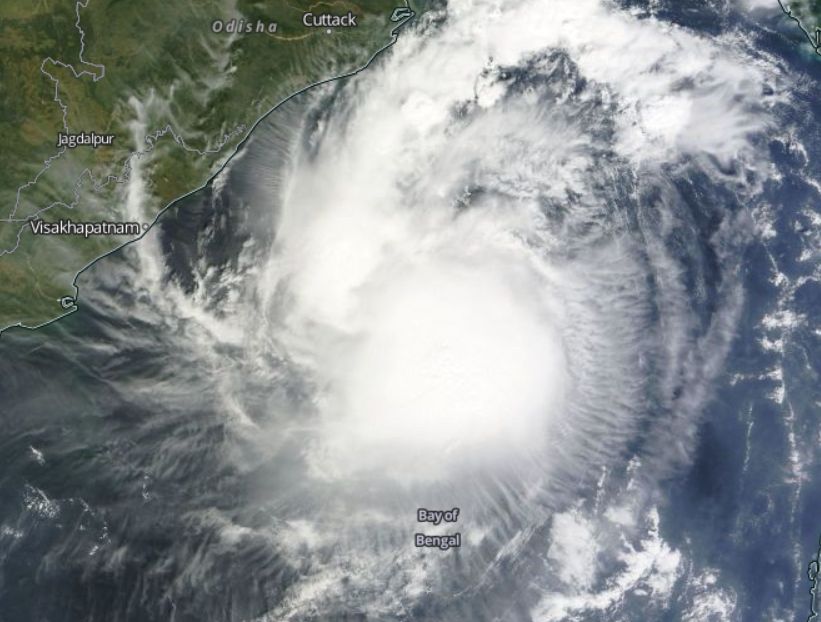
Cyclonic Storm "Kyant", October 26, 2016. Image credit: NASA/Terra MODIS
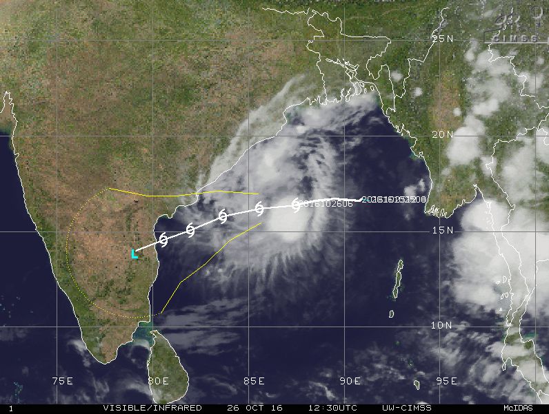
Cylonic Storm "Kyant", October 26, 2016, 12:30 UTC. Image credit: UW-CIMSS
The system will intensify slightly as it approaches land.
IMD issued warnings for wind, sea condition and rainfall associated with the system.
Squally winds reaching 45 to 55 km/h (27.9 to 34.1 mph) are expected to prevail along and south of Odisha on October 27, and along the Andhra Pradesh coast in the period between October 17 and 30.
Sea conditions will be rough to very rough along and off the south Odisha on October 27 and along and off the Andhra Pradesh coasts between October 27 and 30.
Cyclonic Storm "Kyant" 4-day forecast track. Image credit: JTWC
Fishermen have been advised against going into sea along and off Andhra Pradesh coasts, as of October 17. Light to moderate rainfall is likely to affect the south coastal Andhra Pradesh on October 28 to 30 and over north coastal Tamilnadu from October 29 to 31.
Commenting rules and guidelines
We value the thoughts and opinions of our readers and welcome healthy discussions on our website. In order to maintain a respectful and positive community, we ask that all commenters follow these rules.