
Matthew becomes a major hurricane, turn toward Jamaica and Cuba expected
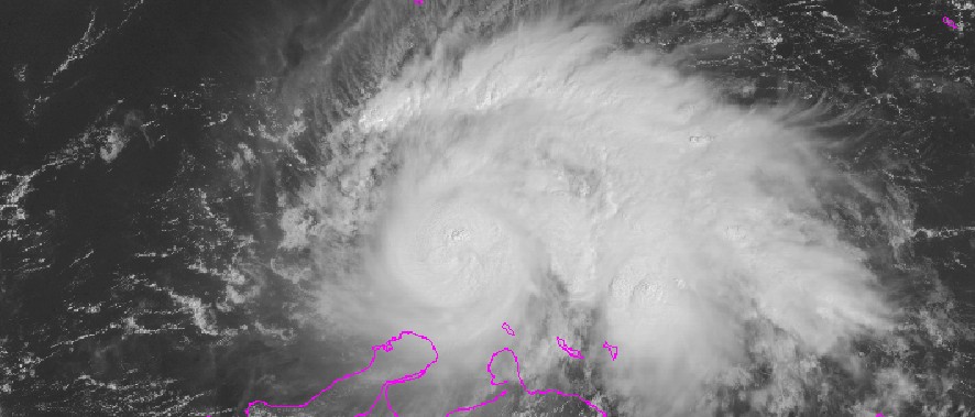
Featured image: Hurricane "Matthew", September 30, 2016, 14:15 UTC. Image credit: NOAA/GOES
Matthew became a major, Category 3 hurricane at 15:00 UTC today while passing over the south-central Carribean Sea. A Tropical Storm Warning is currently in effect from the Colombia/Venezuela border to Riohacha. The path of the system remains uncertain, and the National Hurricane Center (NHC) recommends its progress should be monitored along the coasts of Venezuela and Colombia, in Jamaica, and eastern Cuba. Whether it will impact the US next week remains unclear.
Matthew formed as a tropical storm on September 28, 2016, over the Windward Islands, as the 13th named storm of the 2016 Atlantic hurricane season. It is now the 1st September Caribbean major hurricane since Felix in 2007 and the 1st Carribean in any month since Sandy in 2012, Eric Blake, Hurricane Specialist at the NHC said.
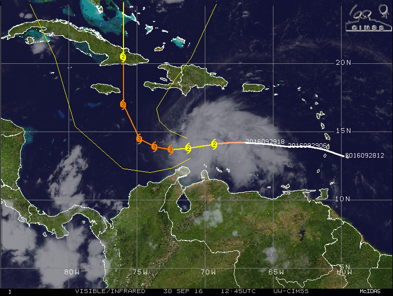
Hurricane "Matthew", September 30, 2016, 12:45 UTC. Image credit: UW-CIMSS
The system was located about 170 km (105 miles) northeast of Putna Gallinas, Colombia, and about 800 km 4950 miles) east-southeast of Kingston, Jamaica on September 30, at 15:00 UTC. Matthew was packing maximum sustained winds of 185 km/h (115 mph), and traveling west-southwestwards at 19 km/h (12 mph) with the minimum central pressure of 968 hPa.
Hurricane Matthew strengthened to a category 1 hurricane Thursday afternoon, with sustained winds of 75-mph. Video: @jeansebfort2/Instagram pic.twitter.com/wKQpryk5cl
— WeatherNation (@WeatherNation) September 30, 2016
Matthew is expected to turn westward, with a decrease in forward speed, later in the day, and the motion should continue through October 1. During the night of October 1 or on Sunday, October 2, Matthew will turn northwestward.
#Matthew is now a major #hurricane– the 1st September Caribbean major hurricane since Felix 2007 & 1st Carib in any month since #Sandy 2012 pic.twitter.com/PJA2cESoiU
— Eric Blake (@EricBlake12) September 30, 2016
On the forecast track, the center of Matthew will pass north of the Guajira Peninsula in the hours ahead and remain over the central Caribbean Sea through early Sunday.
Little change in strength is forecast during the next 48 hours. Hurricane-force winds extend outward up to 55 km (35 miles) from the center and tropical-storm-force winds extend outward up to 315 km (195 miles).
According to the NHC advisory, rainfall totals of 50.8 and 101.6 mm (2 to 4 inches) with isolated higher amounts are expected over Aruba, Bonaire and Curacao through Saturday. The same amounts are expected along the coast of Colombia from the Venezuelan border to Riohacha. Rainfall totals of 25.4 and 50.8 mm (1 and 2 inches) with isolated higher amounts are expected along the coast of Venezuela from Coro to the Colombian border.
Swells from the hurricane will affect parts of the coasts of Puerto Rico, Hispaniola, Aruba, Bonaire, Curacao, Venezuela, and Colombia over the coming days and are likely to cause life-threatening surf and rip current conditions.
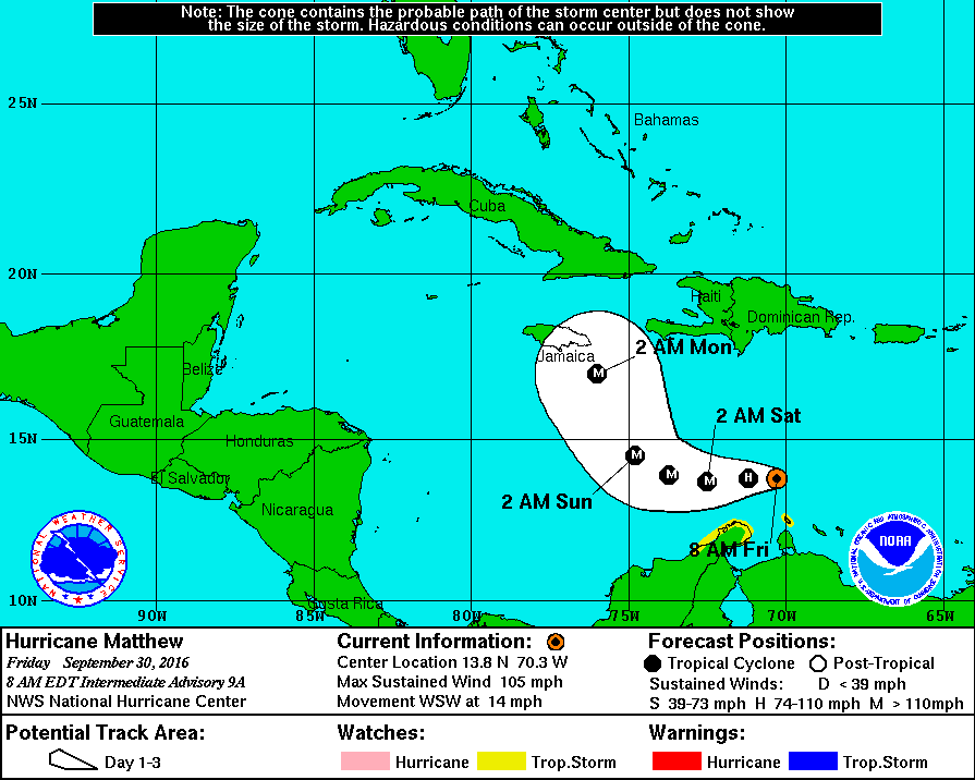
Hurricane "Matthew" 3-day forecast track September 28, 2016. Image credit: NOAA/NWS/NHC
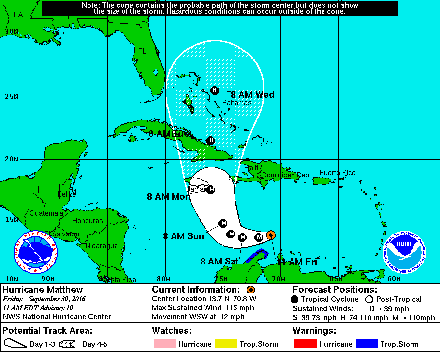
Hurricane Matthew 5-day forecast track – September 30, 2016. Image credit: NOAA/NWS/NHC.
The NHC has warned that the progress of Hurricane "Matthew" should be monitored along the coasts of Venezuela and Colombia, in Jamaica, Hispaniola, and eastern Cuba, and a hurricane watch may be required for Jamaica later in the day.
A significant spread in the model guidance following the coming 3 days is remaining and average NHC track errors for the fourth and fifth day are of the order between 289.7 and 386.2 km (180 and 240 miles).
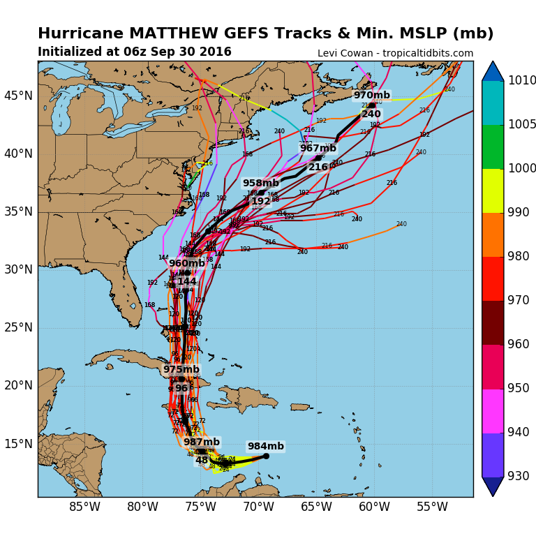
Credit: Levi Covan – tropicaltidbits.com
Read more: Hurricane "Matthew" summary: data, images and videos – September/October 2016
Commenting rules and guidelines
We value the thoughts and opinions of our readers and welcome healthy discussions on our website. In order to maintain a respectful and positive community, we ask that all commenters follow these rules.