
Tropical Storm “Matthew” to become a hurricane before reaching Jamaica, Haiti and Cuba
Featured image: Tropical Storm "Matthew" on September 28, 2016. Credit: UW-CIMSS
Tropical Storm "Matthew" formed over the Windward Islands on September 28, 2016, as the 13th named storm of the 2016 Atlantic hurricane season. Matthew is expected to become a hurricane by Friday, September 30 and turn toward Jamaica, Haiti, and Cuba.
Matthew became a tropical storm at 15:00 UTC today with its center located only 55 km (35 miles) SE of St Lucia. At 21:00 UTC, it was 110 km (65 miles) W of St Lucia producing locally heavy rain and strong winds in parts of the Lesser Antilles.
At the time, Mathew had maximum sustained winds of 95 km/h (60 mph) and was moving west at 30 km/h (18 mph). Its estimated minimum central pressure was 1 008 hPa.
NHC forecasters expect westward motion with some decrease in forward speed to continue over the next couple of days. On the forecast track, the center of Matthew will move away from the Windward Islands within the next 12 hours, and be over the eastern and central Caribbean Sea through Friday.
Matthew is expected to become a hurricane by Friday.
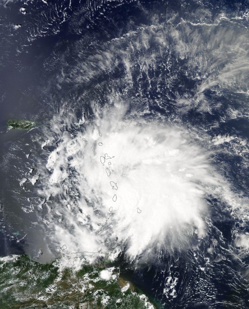
Tropical Storm "Matthew" on September 28, 2016. Credit: NASA Aqua/MODIS
This system is expected to produce total rainfall accumulations of 101.6 mm to 203.2 (4 to 8 inches) across the Windward Islands and southern portions of the Leeward Islands through Thursday. These rains may produce life-threatening flash floods and mud slides, NHC warns.
Rainfall totals of 25.4 to 50.8 mm (1 to 2 inches) are expected farther to the north into the northern Leeward Islands, including the United States and British Virgin Islands and Puerto Rico. Rainfall totals of 25.4 to 76.2 mm (1 to 3 inches) are expected over Aruba, Bonaire, and Curacao through Friday.
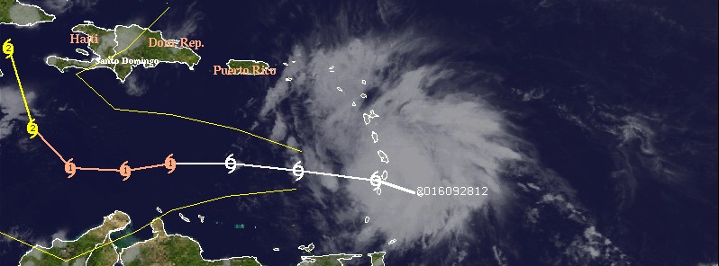
Tropical Storm Matthew forecast track by NWS at 21:00 UTC on September 28, 2016
It is still too early to say what path Matthew will take, but its current track is very similar to that of Hurricane "Hazel" of 1954. Hazel became a major hurricane and stalled over warm Caribbean water. It then passed over Haiti and the Bahamas, killing at least 400 people in Haiti before striking the United States near the border between North and South Carolina, as a Category 4 hurricane.
After causing 95 fatalities in the US, Hazel became extratropical while moving toward Canada and merged with another area of low pressure. The storm then rushed into Canada, killing 81 people, mostly in Toronto.
Read more: Hurricane "Matthew" summary: data, images and videos – September/October 2016
The Watchers team and our contributors bring the latest on extreme weather, earthquakes, volcanic eruptions, space weather, and all things science. We're all about making sense of the natural world and keeping you informed on what’s happening. Got a tip or a question? Hit us up using the form at newstips!
Commenting rules and guidelines
We value the thoughts and opinions of our readers and welcome healthy discussions on our website. In order to maintain a respectful and positive community, we ask that all commenters follow these rules.