
GeoNet response to February 14, 2016 M5.7 Christchurch quake
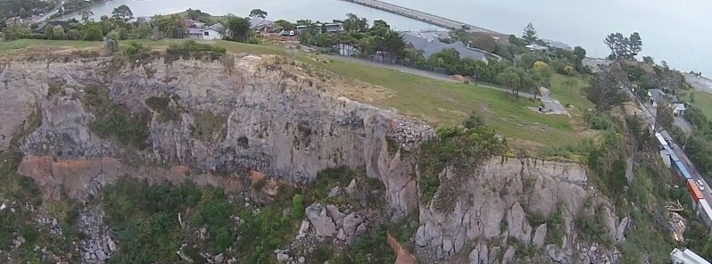
Image credit: GeoNet
In this video, scientists from New Zealand's GeoNet report the results of their monitoring of cliff collapses, liquefaction and tectonic deformation around Christchurch following the M5.7 earthquake of February 14, 2016, also known as the Valentines Day 2016 Quake.
At 00:13 UTC (13:13 local time) on February 14, a large and shallow earthquake registered by New Zealand's GeoNet as M5.7 hit 15 km (9.3 miles) east of Christchurch, New Zealand at a depth of 15 km (9.3 miles). USGS reported it as M5.8 at a depth of 8.2 km (5.1 miles). Numerous aftershocks were registered.
Video courtesy GeoNet
One of the cliff collapses occurred near Taylor's Mistake Bay. Few people narrowly escaped the collapse, but, luckily, no injuries were reported. You can see how the collapse looked like in the videos below:
Video courtesy Breaking Disaster
Video courtesy Louisb nz
Video courtesy YeahNah Productions
The Watchers team and our contributors bring the latest on extreme weather, earthquakes, volcanic eruptions, space weather, and all things science. We're all about making sense of the natural world and keeping you informed on what’s happening. Got a tip or a question? Hit us up using the form at newstips!
Commenting rules and guidelines
We value the thoughts and opinions of our readers and welcome healthy discussions on our website. In order to maintain a respectful and positive community, we ask that all commenters follow these rules.