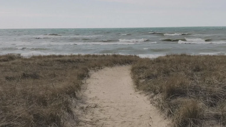
• State of Disaster Emergency declared for Colorado as Sharpe Fire grows to over 11 400 ha (28 000 acres)

    A State of Disaster Emergency has been declared for the state of Colorado due to the rapidly growing Sharpe Fire that has scorched 11 400 ha (28 000 acres). Mandatory evacuations were issued for Campo and surrounding rural areas in southeastern Colorado after the Sharpe Fire crossed from Oklahoma under critical fire weather conditions on Sunday, May 17, 2026. 

  • SPC issues Moderate Risk for strong to intense tornadoes and giant hail across Kansas and Nebraska

    The Storm Prediction Center (SPC) placed portions of central and northeastern Kansas into far southeastern Nebraska under a Moderate Risk for severe thunderstorms on Monday, May 18, 2026. Supercells are forecast to produce all severe hazards, including 5–10+ cm (2–4+ inches) hail and strong to intense tornadoes, mainly from central Kansas into southeastern Nebraska.

  • Southern High Plains under Extremely Critical fire weather outlook

    The Storm Prediction Center (SPC) placed 80 780 km² (31 190 mi²) of the southern High Plains under an Extremely Critical fire-weather outlook for Sunday, May 17, 2026, warning that dangerous wildfire spread conditions are expected across extreme eastern New Mexico, the Texas and Oklahoma Panhandles, extreme southeastern Colorado, and far southwestern Kansas.

  • Exceptional drought returns to Texas Panhandle and western Oklahoma for first time since July 2023

    Exceptional drought (D4) has returned to parts of the Texas Panhandle and western Oklahoma for the first time since July 2023, according to the National Weather Service Arkansas-Red Basin River Forecast Center (ABRFC). Drought conditions continue worsening across large parts of the Southern Plains following one of the driest and warmest starts to spring on record. Extreme Drought (D3) conditions are already affecting 36% of the Arkansas-Red Basin, while forecasters warned that very dry conditions are expected to persist across western portions of the region.

  • SPC forecasts supercells and damaging wind clusters across Iowa late May 15

    The Storm Prediction Center (SPC) placed Iowa under an Enhanced Risk for severe thunderstorms late May 15, 2026, with severe/damaging winds and large to very large hail forecast late this afternoon and evening. Initial supercells may produce hail of 5 cm (2 inches) or larger before storms organize into clusters capable of localized wind gusts above 120 km/h (75 mph).

  • Kīlauea episode 47 ends after 9 hours, fine ash and Pele’s hair fall outside Hawaiʻi Volcanoes National Park

    Episode 47 of the ongoing Halemaʻumaʻu eruption at the summit of Kīlauea ended at 00:27 HST (10:27 UTC) on May 15, 2026, after 9 hours of continuous lava fountaining from the north vent. The U.S. Geological Survey’s Hawaiian Volcano Observatory (HVO) said the eruption is paused and lowered Kīlauea to Volcano Alert Level Advisory and Aviation Color Code Yellow.