• New Mexico seeks federal emergency after record San Juan River flooding, United States

    New Mexico requested a federal emergency declaration on October 24, 2026, after record San Juan River flooding prompted hundreds of water rescues and affected communities around Farmington and Bloomfield. The request covered four counties and five Tribal nations, seeking assistance for debris removal and emergency protective measures. The San Juan River at Farmington reached 4.3 m (14.1 feet) on October 23, breaking its previous record of 3.75 m (12.3 feet) set in September 1909. The gauge subsequently stopped operating, leaving the final crest unconfirmed. Hundreds of water rescues were reported between Farmington and Bloomfield as flooding affected nearby communities.

  • High tides bring coastal flood alerts to California

    A Coastal Flood Warning remains in effect for the San Diego and Orange County coasts through October 29, 2026, as high tides and elevated water levels threaten roads and low-lying property. The National Weather Service (NWS) also has Coastal Flood Advisories for other shoreline areas, including Los Angeles-area beaches, San Francisco Bay, Monterey Bay and Humboldt Bay.

  • Subtropical Storm Josephine forms off U.S. East Coast, forecast to become a hurricane-force extratropical cyclone

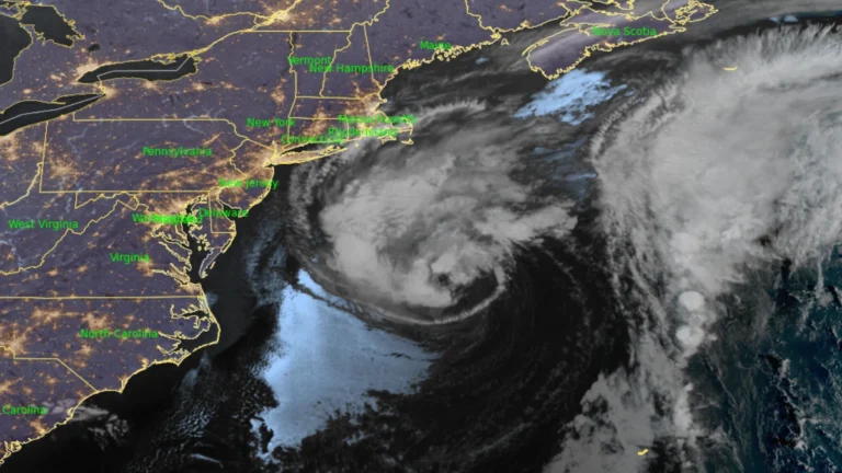
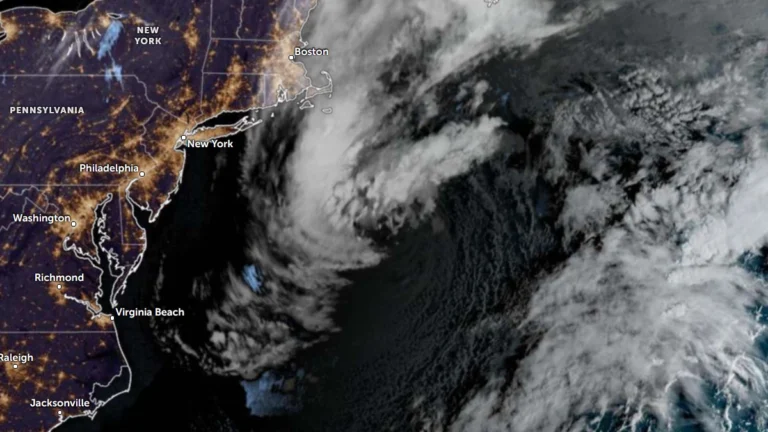
    Subtropical Storm Josephine was accelerating northeastward away from the U.S. East Coast at 05:00 AST (09:00 UTC) on October 22, 2026, with maximum sustained winds of 100 km/h (65 mph). The National Hurricane Center forecast Josephine to lose its subtropical characteristics later October 22 or overnight into October 23 while strengthening through interaction with an approaching upper-level trough, becoming a hurricane-force extratropical cyclone within 24 hours.

  • Nor’easter keeps N.C. 12 closed as coastal flood warnings continue in the Outer Banks, U.S.

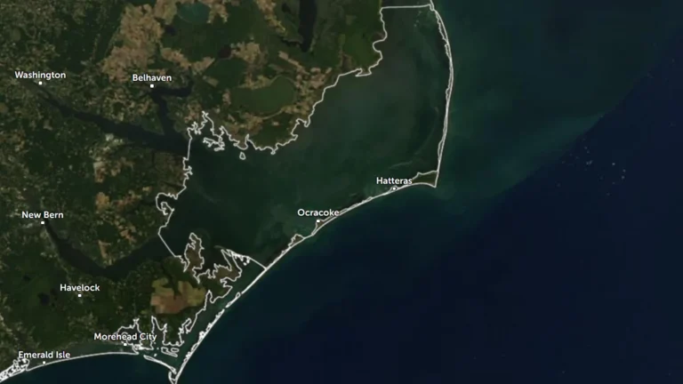
    Coastal Flood Warnings remain in effect for Hatteras and Ocracoke islands on October 21 as a nor’easter continues offshore of the U.S. Mid-Atlantic coast. The National Weather Service forecasts 0.6–1.2 m (2–4 feet) of inundation in vulnerable shoreline areas, while N.C. Highway 12 remains closed between the Marc Basnight Bridge and Rodanthe.

  • Flash-flood risk rises in Southern California, severe storms threaten Arizona

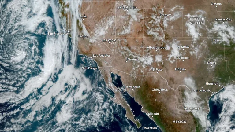
    Heavy rain and severe thunderstorms are forecast across the U.S. Southwest from October 21 into October 23, 2026, as a deep Pacific low draws tropical moisture inland. The Weather Prediction Center (WPC) placed parts of Southern California and the Southwest under a Slight Risk of excessive rainfall for October 21, while the Storm Prediction Center (SPC) placed parts of central and eastern Arizona under a separate Slight Risk of severe thunderstorms.

  • Visitors ordered to evacuate Hatteras Island as coastal storm threatens N.C. Highway 12, U.S.

    Dare County ordered all visitors to evacuate Hatteras Island beginning at 20:00 EDT on October 16 (00:00 UTC on October 17) after declaring a state of emergency ahead of a developing coastal nor’easter. A Coastal Flood Warning is valid from 17:00 EDT (21:00 UTC) on October 17 to 08:00 EDT (12:00 UTC) on October 20, with 0.6–1.2 m (2–4 feet) of inundation above ground level and 2.4–4.3 m (8–14 feet) breaking surf forecast in vulnerable areas.

  • Very strong El Niño favors wetter South and warmer North in NOAA’s 2026–27 winter outlook, U.S.

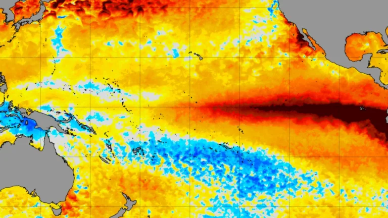
    A strengthening El Niño is shifting the odds toward wetter-than-average conditions across the southern United States and East Coast during winter 2026–27, according to NOAA. The Climate Prediction Center (CPC) reported that the latest weekly Niño-3.4 sea-surface temperature anomaly had reached +2.4°C (+4.3°F), while warmer-than-average conditions are favored across much of the northern United States.

  • Multiple wildfires prompt evacuations during the first Santa Ana event of the season in Southern California

    Multiple wildfires broke out across Southern California on October 15, 2026, prompting evacuation orders and road closures during the season’s first moderate-to-strong Santa Ana wind event. The Henderson Fire at Camp Pendleton reached 568 ha (1 404 acres), while the Los Angeles County Fire Department (LACoFD) listed the Bryson Fire near Malibu at approximately 41 ha (102 acres) with 0% containment in its evening update.

  • Moderate Risk of excessive rainfall issued for parts of West Texas as flooding continues, U.S.

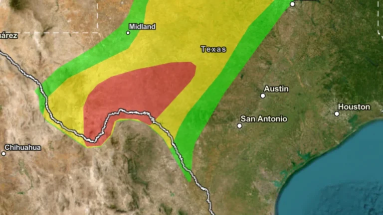
    Heavy rainfall caused flash flooding across parts of West Texas on October 15, 2026, after totals exceeded 127 mm (5 inches) in some areas. The NOAA Weather Prediction Center (WPC) maintained a Moderate Risk of excessive rainfall over portions of West Texas through 12:00 UTC on October 16 as additional thunderstorms and flooding remained possible.

  • Life-threatening flash flooding reported across Oklahoma City, major flooding forecast on Canadian River

    Life-threatening flash flooding was reported across the Oklahoma City metropolitan area on October 14 after thunderstorms produced 76–152 mm (3–6 inches) of rain, while radar indicated 102–279 mm (4–11 inches) farther west, according to the National Weather Service (NWS) in Norman. Major flooding was forecast on the Canadian River near Bridgeport, while the Weather Prediction Center (WPC) maintained a Moderate Risk of excessive rainfall from Oklahoma into the Red River Valley of Texas through 12:00 UTC on October 15.